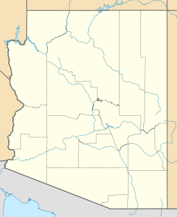
Coyote Mountains Wilderness (Arizona)

Coyote Mountains Wilderness (Arizona)
Protected area
Country United States
State Arizona
Region Sonoran Desert
District Pima County, Arizona
City Robles Junction, AZ
Coordinates 31°59′23″N 111°31′15″W / 31.9898°N 111.5207°W / 31.9898; -111.5207
Area 20.6 km2 (8 sq mi)
Founded 1990's
IUCN category Ib - Wilderness Area

The 5,080-acre (20.6 km2)[1] Coyote Mountains Wilderness of Arizona is part of the Coyote Mountains of southern Arizona in the center of Pima County. The wilderness lies about 40 mi southwest of Tucson,[2] in the northwest of the Altar Valley. Kitt Peak is 4 mi WSW.

Contents

Description

The Coyote Mountains Wilderness makes up much of the center and northeast of the Coyote Mountains. The Coyote's are separated from the Quinlin Mountains abutting southwest; both ranges anchor the northern end of the north-south, massif of the Baboquivari Mountains. The three ranges are located at the northwest of the Altar Valley.

The Coyote Mountains are a small range only about 7 mi long, and merge into lower elevation hills. The north of the wilderness and mountains descend quickly into the south of the Aguirre Valley. The northeast, east, and southeast of the wilderness and the Coyote Mountains descend quickly into the Altar Valley.

Kitt Peak

Kitt Peak and surrounding peaks form a separate landform between the Quinlin Mountains and the Coyotes. The Quinlin's are a linear range, northwest by southeast. From Kitt Peak and northeastwards, the mountains and hills separate into individual units. The Coyote Mountains Wilderness is the largest, and tallest unit in the northeast of the small Coyote Mountains range, which is only about 7 mi long.

Flora and fauna

Some of the common flora in the Coyote Mountains and wilderness are the paloverde tree, and the saguaro cactus. Some oak woodlands are present.

Recreation

See also

References

  1. ^ Coyote Mountains Wilderness Area, blm.gov
  2. ^ Arizona Road & Recreation Atlas, p. 86-87.

External links

BLM


Wikimedia Foundation. 2010.

Игры ⚽ Поможем написать реферат

Look at other dictionaries:

  • Coyote Mountains Wilderness — may refer to: Coyote Mountains Wilderness (Arizona) Coyote Mountains Wilderness (California) This disambiguation page lists articles associated with the same title. If an internal link led you h …   Wikipedia

  • Coyote Hills — may refer to: Coyote Hills (Alameda County), California, USA Coyote Hills Regional Park Coyote Hills (Plumas County), California, USA Coyote Hills, Baker County, Oregon, USA Related names include Coyote Mountains, San Diego County, California,… …   Wikipedia

  • Coyote Buttes — The Magic Crest of South Coyote Buttes. Coyote Buttes is a section of the Paria Canyon Vermilion Cliffs Wilderness managed by the Bureau of Land Management (BLM), spanning extreme South Central Utah and North Central Arizona, just south of US 89… …   Wikipedia

  • List of Arizona Wilderness Areas — This is a List of Arizona Wilderness Areas. A second list contains the geographic landform that is most closely associated with it, or is in its proximity.Note: LCRV = Lower Colorado River Valley List of Arizona wilderness areas*Apache Creek… …   Wikipedia

  • Coyote — For other uses, see Coyote (disambiguation). Coyote Conservation status …   Wikipedia

  • List of mountain ranges of Arizona — There are 194 named mountain ranges in Arizona. The extra items listed may include::Mingus Mountain, the high, NW section of the Black Hills:Shiprock:Sierra Madre Occidental (of W continental Mexico) The list*Agua Caliente Mountains ndash;Yuma… …   Wikipedia

  • Cleghorn Lakes Wilderness — The Cleghorn Lakes Wilderness ia a 33,475 acre (135.47 km2) wilderness area located 16 miles (26 km) northeast of Twentynine Palms, California. Named for the dry lakes found at the center of the wilderness, this area has a variety of… …   Wikipedia

  • Havasu Wilderness — Infobox protected area | name = Havasu Wilderness iucn category = Ib caption = locator x = 42 locator y = 110 location = Arizona California, USA nearest city = Lake Havasu City, AZ lat degrees = 34 lat minutes = 38 lat seconds = 58 lat direction …   Wikipedia

  • Dead Mountains — This article is about the mountain range in California. For the mountain range in Austria, see Totes Gebirge. Coordinates: 35°1′40.002″N 114°44′55.891″W / 35.0277 …   Wikipedia

  • List of mountain ranges of Pima County, Arizona — A list of mountain ranges of Pima County, Arizona.Alphabetical list*Agua Dulce Mountains ndash;Pima County *Ajo Range ndash;Pima County *Alvarez Mountains ndash;Pima County *Artesa Mountains ndash;Pima County *Baboquivari Mountains (Arizona)… …   Wikipedia

Share the article and excerpts

Direct link
Do a right-click on the link above
and select “Copy Link”