- Chuhandanda
-
Chuhandanda — Village development committee — Location in Nepal
 Chuhandanda
Coordinates: 27°11′N 87°42′E / 27.18°N 87.70°ECoordinates: 27°11′N 87°42′E / 27.18°N 87.70°E Country  Nepal
NepalZone Kosi Zone District Terhathum District Population (1991) – Total 3,987 Time zone Nepal Time (UTC+5:45) Chuhandanda is a village development committee in the Himalayas of Terhathum District in the Kosi Zone of eastern Nepal. At the time of the 1991 Nepal census it had a population of 3987 people living in 703 individual households.[1]
References
- ^ "Nepal Census 2001". Nepal's Village Development Committees. Digital Himalaya. http://www.digitalhimalaya.com/collections/nepalcensus/form.php?selection=1. Retrieved 19 November 2008.
External links
Ambung, Angdeem, Basantapur, Chhate Dhunga, Chuhandanda, Dangpa, Eseebu, Hamarjung, Hawaku, Jaljale, Jirikhinti, Khamlalung, Morahang, Okhare, Oyakjung, Panchakanya Pokhari, Phakchamara, Phulek, Piple, Pouthak, Sabla, Samdu, Sankranti Bazar, Shree Jung, Simle, Solma, Sudap, Sungnam, Tamfula, Thoklung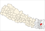 Categories:
- Populated places in Terhathum District
- Kosi Zone geography stubs


Wikimedia Foundation. 2010.