- Chhipagada
-
Chhipagada — Village development committee — Location in Nepal
 Chhipagada
Coordinates: 27°31′N 83°35′E / 27.52°N 83.59°ECoordinates: 27°31′N 83°35′E / 27.52°N 83.59°E Country  Nepal
NepalZone Lumbini Zone District Rupandehi District Population (1991) - Total 3,677 Time zone Nepal Time (UTC+5:45) Chhipagada is a village development committee in Rupandehi District in the Lumbini Zone of southern Nepal. At the time of the 1991 Nepal census it had a population of 3677 people living in 555 individual households.[1]
References
- ^ "Nepal Census 2001". Nepal's Village Development Committees. Digital Himalaya. http://www.digitalhimalaya.com/collections/nepalcensus/form.php?selection=1. Retrieved 8 December 2008.
Aama, Aanandaban, Amari, Amawa Marchawar, Amuwa Paschim, Asurena, Babhani, Bagaha, Bagauli, Bairghat, Balarampur, Bangai, Bangai Marchwar, Baragadewa, Barsauli, Basantapur, Betakuiya, Bhagawanpur, Bisunpura, Bodabar, Bogadi, Butwal, Chhipagada, Chhotaki Ramnaga, Chilhiya, DayaNagar, Devadaha, Dhakadhai, Dhamauli, Dudharakchhe, Ekala, Farena, Gajedi, Gangoliya, Gonaha, Hanaiya, Hati Bangai, Hati Pharsatika, Jogada, Kamahariya, Karaiya, Karauta, Karmahawa, Kataya, Kerbani, Khadawa Bangai, Khudabazar, Lumbini, Madhabaliya, Madhuwani, Mainahiya, Makrahar, Man Materiya, Man Pakadi, Maryadpur, Masina, Motipur, Padsari, Pajarkatli, Pakadi Sakron, Parroha, Parsa, Patekhouli, Pharsatikar, Pharsatikarhati, Piprahawa, Pokharvindi, Rayapur, Roinihawa, Rudrapur, Sadi, Saljhundi, Samera Marchwar, Semalar, Shankar Nagar, Sikatahan, Silautiya, Sipawa, Souraha Pharsatikar, Suryapura, Tama Nagar, Tarkulaha, Tenahawa, Tharki, Thumhawa Piprahawa, Tikuligadh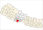 Categories:
- Populated places in Rupandehi District
- Lumbini Zone geography stubs


Wikimedia Foundation. 2010.