- Aruchaur
-
Aruchour — Village development committee — Location in Nepal
 Aruchour
Coordinates: 28°08′N 83°44′E / 28.13°N 83.73°ECoordinates: 28°08′N 83°44′E / 28.13°N 83.73°E Country  Nepal
NepalZone Gandaki Zone District Syangja District Population (1991) – Total 3,283 Time zone Nepal Time (UTC+5:45) Aruchaur is a village development committee in Syangja District in the Gandaki Zone of central Nepal. At the time of the 1991 Nepal census it had a population of 3283 people living in 664 individual households.[1]
References
- ^ "Nepal Census 2001", Nepal's Village Development Committees (Digital Himalaya), http://www.digitalhimalaya.com/collections/nepalcensus/form.php?selection=1, retrieved 15 November 2009.
External links
Almadevi, Arjun Chaupari, Aruchaur, Arukharka, Bagefatake, Bahakot, Banethok Deurali, Bhatkhola, Bichari Chautara, Birgha Archale, Biruwa Archale, Chandi Bhanjyang, Chandikalika, Chapakot, Chhangchhangdi, Chilaunebas, Chimnebas, Chisapani, Chitre Bhanjyang, Darsing Dahathum, Dhanubase, Dhapuk Simal Bhanjyang, Eladi, Faparthum, Fedikhola, Ganeshpur, Jagat Bhanjyang, Jagatradevi, Kalikakot, Karendada, Kaulmabarahachaur, Keware Bhanjyang, Khilung Deurali, Kichnas, Kuwakot, Kyakami, Majhakot Sivalaya, Malengkot, Manakamana, Nibuwakharka, Oraste, Pakbadi, Panchamul, Pauwegaude, Pekhuwa Baghakhor, Pelakot, Pelkachaur, Pindikhola, Rangvang, Rapakot, Ratnapur, Sakhar, Sataudarau, Satupasal, Sekham, Setidobhan, Shreekrishna Gandaki, Sirsekot, Sorek, Taksar, Thuladihi, Thumpokhara, Tindobate, Tulsibhanjyang, Waling, Wangsing Deurali, Yaladi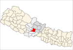 Categories:
- Populated places in Syangja District
- Gandaki Zone geography stubs


Wikimedia Foundation. 2010.