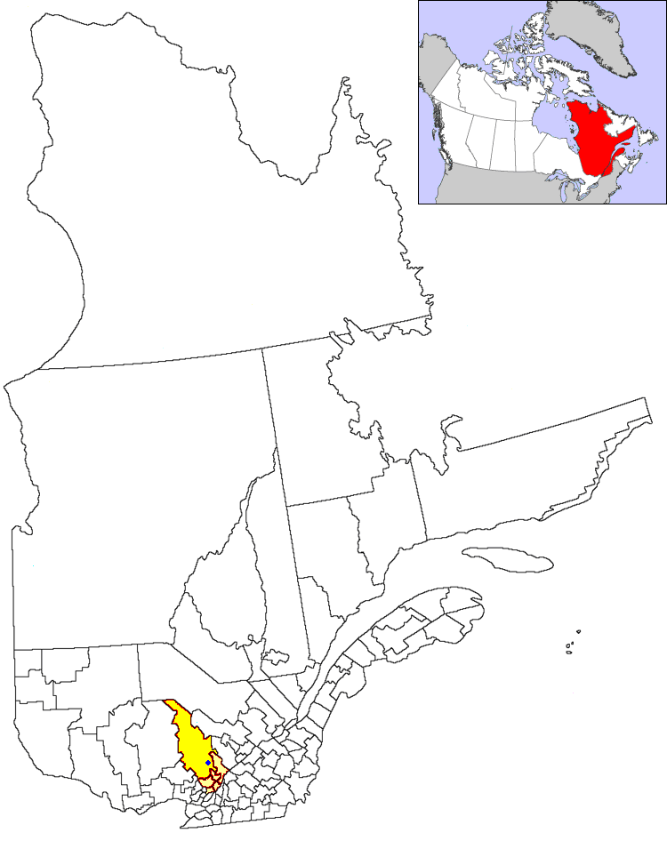
- Saint-Damien, Quebec
Infobox City
official_name = Saint-Damien
native_name =
nickname =
motto =
image_shield = StDamien-Coa.gif
mapsize = 250px
map_caption =
motto = "Per fidem ad Augusta" [For faith in Magnificent Works]
subdivision_type = Country
subdivision_type1 = Province
subdivision_type2 = Region
subdivision_type3 = RCM or TE
subdivision_name = CAN
subdivision_name1 = QC
subdivision_name2 =Lanaudière (14)
subdivision_name3 = Matawinie
leader_title =Mayor
leader_name = Céline Tremblay
(2005 -2009 )
leader_title1 =
leader_name1 =
leader_title2 =
leader_name2 =
established_title = Founded
established_date =1870
established_title2 =
established_date2 =
area_footnotes =
area_magnitude = 1 E8
area_total_km2 = 260.38
area_total_sq_mi =
area_land_km2 =
area_land_sq_mi =
area_water_km2 =
area_water_sq_mi =
area_water_percent =
area_urban_km2 =
area_urban_sq_mi =
area_metro_km2 =
area_metro_sq_mi =
population_as_of = 2006 Census
population_footnotes = [http://www12.statcan.ca/english/census06/data/profiles/community/Details/Page.cfm?Lang=E&Geo1=CSD&Code1=2462075&Geo2=PR&Code2=24&Data=Count&SearchText=Saint-Damien&SearchType=Begins&SearchPR=01&B1=All&Custom= Statistics Canada - Saint-Damien 2006 Community Profile] .]
population_note =
population_total = 2178
population_density_km2 = 8
population_density_sq_mi =
population_metro =
population_density_metro_km2 =
population_density_metro_sq_mi =
population_urban =
timezone = Eastern (EST)
utc_offset = -5
timezone_DST = EDT
utc_offset_DST = -4
latd=46 |latm=20 |lats=9.36 |latNS=N
longd=73 |longm=29 |longs=3.60 |longEW=W
elevation_m =
elevation_ft =
postal_code_type = Postal code span
postal_code = J0K
area_code = 888
website = [http://www.st-damien.com/ Municipality of St.Damien]
footnotes =Saint-Damien (Also named "Saint-Damien-de-Brandon") is a
municipality of 2,178 inhabitants inQuebec ,Canada . It is located in the Regional County Municipality of Matawinie,Lanaudière region.History
The town was founded the
6 September 1870 . Gentilic of the town is, infrench language , "damienois" [fr [http://www.toponymie.gouv.qc.ca/ct/topos/topos.html Commission of toponymy of Quebec] ] .Geography
Saint-Damien is located in the middle of
Lanaudière region nearby Saint-Gabriel-de-Brandon municipality, at circa 100 kms in north ofMontreal , 270 in west ofQuebec City , and 90 km in south ofTaureau reserve . Main street is named "Rue Principale" [Main Street] and it is served byQuebec Route 370 who is connected in south to themotorway Toronto -Montreal-Quebec City.
The bordering municipalities [fr [http://www.mamr.gouv.qc.ca/organisation/orga_cart_regi.asp Municipal afffairs and regions - regional maps] ] of Saint-Damien [fr [http://www.mamr.gouv.qc.ca/repertoire_mun/repertoire/repertoi.asp Repertory of municipalities of Quebec] ] are, starting from north-west and proceding in a clockwise sense, Saint-Zéon (North-West), Mandeville (Nort-East, in RCM of D'Autray), Saint-Gabriel-de-Brandon (South-East, in RCM of D'Autray), Saint-Jean-de-Matha (South) and Sainte-Émélie-de-l'Énergie (West).Famous people
*
Raymond Gravel , canadian politician (1953 )References
ee also
*
List of parish municipalities in Quebec External links
*fr [http://www.st-damien.com/ Official site of Saint-Damien]
*en [http://flagspot.net/flags/ca-qc-sd.html Town flag and informations] at FOTW
Wikimedia Foundation. 2010.
