- Podkoren
Infobox Settlement
official_name = Podkoren
other_name =
native_name =
nickname =
settlement_type =
motto =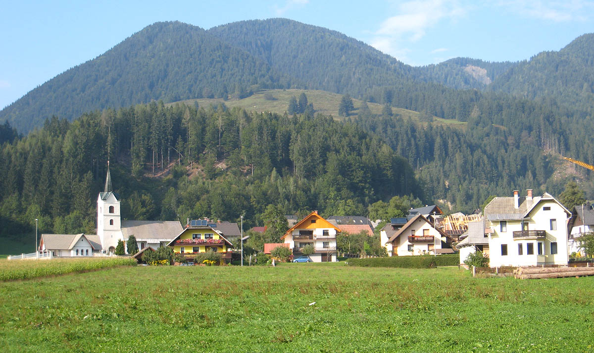
imagesize = 300px
image_caption = Podkoren from the south
flag_size =
image_
seal_size =
image_shield =
shield_size =
image_blank_emblem =
blank_emblem_type =
blank_emblem_size =
mapsize =
map_caption =
mapsize1 =
map_caption1 =
image_dot_
dot_mapsize =
dot_map_caption =
dot_x = |dot_y =
pushpin_
pushpin_label_position =bottom
pushpin_map_caption =Location in Slovenia
subdivision_type = Country
subdivision_name =
subdivision_type1 = Region
subdivision_name1 =Upper Carniola
subdivision_type2 = Municipality
subdivision_name2 =Kranjska Gora
subdivision_type3 =
subdivision_name3 =
subdivision_type4 =
subdivision_name4 =
leader_name =
leader_title1 =
leader_name1 =
leader_title2 =
leader_name2 =
leader_title3 =
leader_name3 =
leader_title4 =
leader_name4 =
established_title =
established_date =
established_title2 =
established_date2 =
established_title3 =
established_date3 =
area_magnitude =
area_footnotes =
area_total_km2 =
area_land_km2 =
area_water_km2 =
area_total_sq_mi =
area_land_sq_mi =
area_water_sq_mi =
area_water_percent =
area_urban_km2 =
area_urban_sq_mi =
area_metro_km2 =
area_metro_sq_mi =
area_blank1_title =
area_blank1_km2 =
area_blank1_sq_mi =
population_as_of =2002
population_footnotes =
population_note =
population_total =388
population_density_km2 =
population_density_sq_mi =
population_metro =
population_density_metro_km2 =
population_density_metro_sq_mi =
population_urban =
population_density_urban_km2 =
population_density_urban_sq_mi =
population_blank1_title =Ethnicities
population_blank1 =
population_blank2_title =Religions
population_blank2 =
population_density_blank1_km2 =
population_density_blank1_sq_mi =
timezone =
utc_offset =
timezone_DST =
utc_offset_DST =
latd= 46|latm= 29|lats=41.8 |latNS=N
longd=13|longm=45|longs=21.67 |longEW=E
elevation_footnotes =
elevation_m = 860.6
elevation_ft =
postal_code_type =
postal_code =
area_code =
blank_name =
blank_info =
blank1_name =
blank1_info =
website =
footnotes = [ [http://www.stat.si/eng/index.asp Statistical Office of the Republic of Slovenia] ]Podkoren is a settlement in the
Kranjska Gora municipality in theUpper Carniola region ofSlovenia . The village church is dedicated toSaint Andrew and is of late Gothic origin as are many houses in the village, but was largely refurbished in the Baroque style. [cite web |url=http://commons.wikimedia.org/wiki/]
Podkoren lies immediately below the
Wurzenpass mountain pass leading intoCarinthia inAustria .One of the village's claims to fame is that Sir Humphry Davy stayed there on a visit to the area.
The
Zelenci nature reserve, at the source of the river Sava, is situated just west of the village. TheSava Dolinka flows east from here, to the south of Podkoren.References
External links
* [http://www.geopedia.si/#L410_F10097924_b4_x405000_y150858_s14 Podkoren at Geopedia]

Wikimedia Foundation. 2010.