- San Pedro Perulapán
Infobox Settlement
name =San Pedro Perulapán
settlement_type = Municipality
other_name =
native_name =
nickname =
motto =
imagesize = 240px
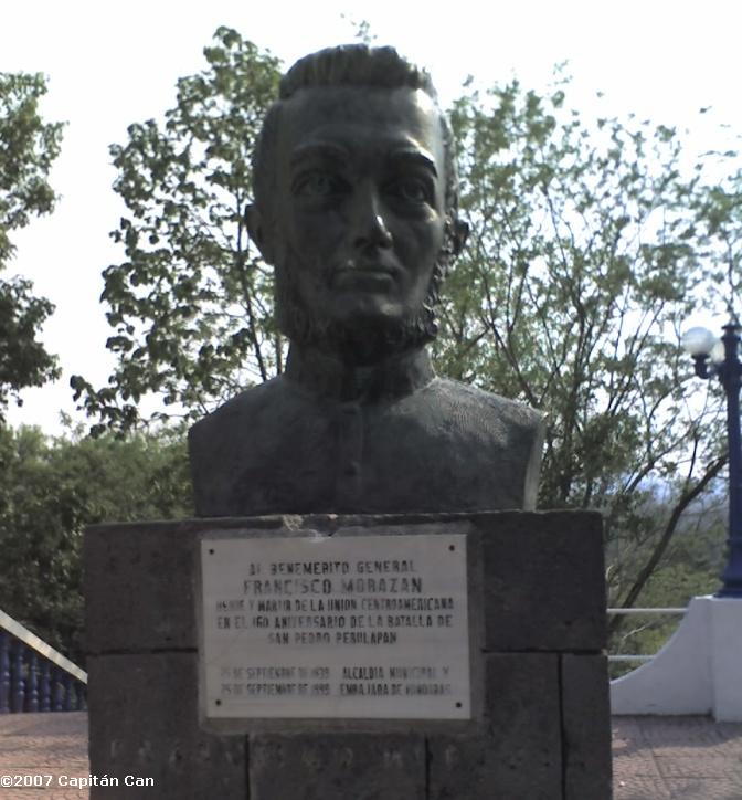
image_caption = Bust of Morazán at San Pedro Perulapán
flag_size =
image_
seal_size =
image_shield =
shield_size =
image_blank_emblem =
blank_emblem_type =
blank_emblem_size =
mapsize =
map_caption =
mapsize1 =
map_caption1 =
image_dot_
dot_mapsize =
dot_map_caption =
dot_x = |dot_y =
pushpin_
pushpin_label_position =bottom
pushpin_mapsize =300
pushpin_map_caption =Location in El Salvador
subdivision_type = Country
subdivision_name = flag|El Salvador
subdivision_type1 = Department
subdivision_name1 =Cuscatlán Department
subdivision_type2 =
subdivision_name2 =
subdivision_type3 =
subdivision_name3 =
subdivision_type4 =
subdivision_name4 =
government_footnotes =
government_type =
leader_title =
leader_name =
leader_title1 =
leader_name1 =
leader_title2 =
leader_name2 =
leader_title3 =
leader_name3 =
leader_title4 =
leader_name4 =
established_title =
established_date =
established_title2 =
established_date2 =
established_title3 =
established_date3 =
area_magnitude =
unit_pref =Imperial
area_footnotes =
area_total_km2 =
area_land_km2 =
area_water_km2 =
area_total_sq_mi =
area_land_sq_mi =
area_water_sq_mi =
area_water_percent =
area_urban_km2 =
area_urban_sq_mi =
area_metro_km2 =
area_metro_sq_mi =
area_blank1_title =
area_blank1_km2 =
area_blank1_sq_mi =
population_as_of =2006
population_footnotes =
population_note =
population_total =
population_density_km2 =
population_density_sq_mi =
population_metro =
population_density_metro_km2 =
population_density_metro_sq_mi =
population_urban =
population_density_urban_km2 =
population_density_urban_sq_mi =
population_blank1_title =Ethnicities
population_blank1 =
population_blank2_title =
population_blank2 =
population_density_blank1_km2 =
population_density_blank1_sq_mi =
timezone =
utc_offset =
timezone_DST =
utc_offset_DST =
latd=13|latm=46|lats=|latNS=N
longd=89 |longm=2|longs= |longEW=W
elevation_footnotes =
elevation_m = 599
elevation_ft =
postal_code_type =
postal_code =
area_code =
blank_name =
blank_info =
blank1_name =
blank1_info =
website =
footnotes =San Pedro Perulapán is a
municipality in the Cuscatlán department ofEl Salvador . San Pedro Perulapán is a town whose origins arepre-Columbian ; it received the title of city on April 28, 1921. [http://www.corsatur.gob.sv/ingles/cuscatlan.htm] TheBattle of San Pedro Perulapán occurred here on September 25, 1839, in whichFrancisco Morazán with 800 Salvadorans defeated 2,000Honduran andNicaraguan forces during the break-up of theFederal Republic of Central America . [http://listas.rds.hn/catrachos/msg08615.html] A belltower in the town still has the bell whose toll announced the victory of the Salvadorans. [http://www.corsatur.gob.sv/ingles/cuscatlan.htm] The parish church contains an image ofSaint Peter that still has the bullet hole it received during this battle. [http://www.corsatur.gob.sv/ingles/cuscatlan.htm] From the peak of the belltower one can see the volcano of Guazapa. [http://www.corsatur.gob.sv/ingles/cuscatlan.htm]Notes
Wikimedia Foundation. 2010.

