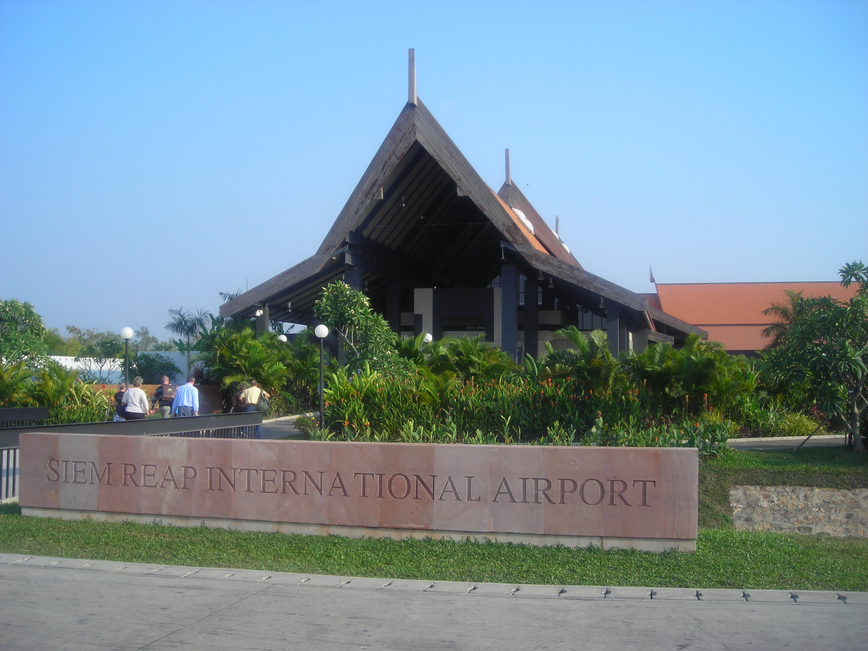
- Angkor International Airport
Infobox Airport
name = Siem Reap-Angkor International Airport
nativename =
nativename-a = អាកាសយានដ្ឋានអន្តរជាតិសៀមរាបអង្គរ
Aéroport International De Siem Reap
nativename-r =

image-width = 200
caption = Angkor Airport seen from the airfield
IATA = REP
ICAO = VDSR
type = Public
owner =
operator =
city-served = Siem Reap
location =
elevation-f = 60
elevation-m = 18
coordinates = Coord|13|24|38.40|N|103|48|46.22|E|type:airport
website = http://www.cambodia-airports.com/siemreap/en
metric-elev =
metric-rwy =
r1-number = 05/23
r1-length-f = 8,366
r1-length-m = 2,550
r1-surface =Concrete
stat-year =
stat1-header =
stat1-data =
stat2-header =
stat2-data =
footnotes =Siem Reap-Angkor International Airport airport codes|REP|VDSR ( _km. អាកាសយានដ្ឋានអន្តរជាតិសៀមរាបអង្គរ _fr. Aéroport International De Siem Reap) is the largest airport in
Cambodia and is located inSiem Reap , home ofAngkor Wat . Official inauguration of Siem Reap-Angkor International Airport's new terminal was inAugust 28 ,2006 . As of 2008, extensions to the airport's apron and parking areas are taking place. Air Traffic Control is provided by CATS (Cambodia Air Traffic Services), with full approach and aerodrome VHF facilities being housed in the control tower, between the fire station and the domestic terminal. Area control is still provided from CATS Centre in Phnom Penh (Pochentong) VHF frequencies used at Siem Reap are: Tower: 118.000 MHz (AM) Approach: 124.300 MHz (AM) ACC (FIR): 127.500 MHz (AM) Ground (apron): 121.750 MHz (AM) ATIS (WX): 129.950 MHz (AM) Tower – fire 3A: 143.750 MHz (FM) CATS are also responsible for clearing takeoffs and landings of tourist helicopters from the "Big Balloon" site, 3km away, near Angkor Wat. Both Helicopters Cambodia http://www.helicopterscambodia.com/ and Sokha Helicopters operate from the airport, with Sokha mainly operating from the Big Yellow Balloon site. The airport itself is located some 6km outside Siem Reap, just off National Route 6 north. Runway alignments are 23 & 05, with only 23 being used for takeoff, due to flight restrictions over Angkor temple.Airlines and destinations
*
AirAsia (Kuala Lumpur)
*Asiana Airlines (Seoul-Incheon)
*Bangkok Airways (Bangkok-Suvarnabhumi, Chiang Mai (Inbound Only))
**Siem Reap Airways (Bangkok-Suvarnabhumi, Hong Kong (Inbound Only), Pakse (Inbound Only), Phnom Penh)
*China Eastern Airlines (Kunming, Nanning)
*China Southern Airlines (Guangzhou)
*Jetstar Asia Airways (Singapore)
*Jetstar Pacific Airlines (Ho Chi Minh City) [begins 3 November 2008]
*Korean Air (Seoul-Incheon)
*Lao Airlines (Luang Prabang (Inbound Only), Pakse (Outbound Only), Vientiane)
*Malaysia Airlines (Kuala Lumpur)
*PMTair (Busan, Hanoi, Seoul-Incheon)
*SilkAir (Da Nang, Singapore)
*Vietnam Airlines (Hanoi, Ho Chi Minh City, Luang Prabang)Airfield
*Length: 2,550 m
*Width: 45 m, with shoulders 2.5 m. wide each
*Perpendicular taxiway: 1 (length: 240 meters, width: 20 meters and 10 meters of shoulders). Under construction: 1 (length: 600 meters, width: 23 meters and 15 meters of shoulders)
*Number of stands: 8
*Navigation aids and visual aids:
**VOR/DME
**NDB
**PAPItatistics
ee also
*
Phnom Penh International Airport
*Sihanoukville International Airport External links
* [http://www.cambodia-airports.com/siemreap/en Siem Reap-Angkor International Airport official website]
Wikimedia Foundation. 2010.
