- Amager
Infobox Islands
name = Amager
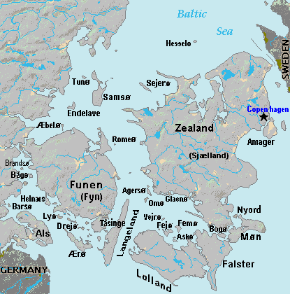
image caption = Amager island (right center) is east ofZealand island, atCopenhagen , west ofSweden
image size =
locator
Location map|Denmark|lat=55.616667|long=12.616667
map_custom = yes
native name =
native name link =
nickname =
location =Øresund
coordinates = coord|55|37|N|12|37|E|display=inline
archipelago =
total islands =
major islands =
area =
length =
width =
highest mount =
elevation =
country = Denmark
country admin divisions title =
country admin divisions =
country admin divisions title 1 =
country admin divisions 1 =
country admin divisions title 2 =
country admin divisions 2 =
country largest city =
country largest city population =
population = 160,030
population as of = 2008
density =
ethnic groups = Danish
additional info =Amager (
IPA : IPA| [ˈɑmɑːˀ] , IPA| [ˈɑmæːˀ(j)ɐ] , IPA| [ˈɑmɑːˀʀ] ) is a Danishisland in theØresund . The Danish capital,Copenhagen , is partly situated on Amager, which is connected toZealand by severalbridge s.During the Second World War, high unemployment in Copenhagen led authorities to drain a large part of the sea west of the island, and build a dam to hold out the water, effectively adding one half of Amager's previous area to the island.
The reclaimed area is currently known as
Kalvebod Fælled , and was originally amilitary area, but today it is part of a major construction area called theØrestad , being thought of as an extension tocentral Copenhagen . The area houses such major facilities as Bella Center, a convention and exposition center, andField's , the second-largestshopping center inScandinavia . This project was initiated by the Danish government.Large parts of Kalvebod Fælled have rich nature and grazing cows. This area allows citizens of Copenhagen to experience nature without travelling far from the city.
The beach area to the East of the island, known as
Amager Strandpark (Amager Beach Park), which had fallen into disrepair since its inception in the 1930s, was extensively redeveloped between May 2004 and August 2005. A 2km long artificial island was constructed just off the mainland which narrows to the southeast, creating a small lagoon. The seaward facing side of the island comprises a wide sandy bathing beach, while the lagoon facing side is mainly made up of low dunes. There is another beach on the mainland side of the lagoon, which runs alongside the beach road. Ice cream kiosks, coffee shops, a marina and two small recreational parks can also be found in the Strandpark area. The lagoon is popular, and is used regularly, for water sports, such as kayaking or wind-surfing.Amager is also home to the
Amager Bio , a cinema, concert and cultural venue. Top bands from the last 40 years often play there, both those of international origin (Uriah Heep, King Crimson, Cradle of Filth, John Mayall and the Bluesbreakers, Jethro Tull, The Moody Blues) and from Denmark (Dodo and the Dodos, Sussi and Leo, Big Fat Snake).Amager has long been populated and well used thanks to its rich soil and proximity to Copenhagen. It was only in the late 19th century that Copenhagen began to expand onto the island (Sundbyerne), and in 1902 these built up areas were incorporated into Copenhagen.
Various communities are located on Amager, including
Islands Brygge , and the towns ofDragør ,Kastrup , andTårnby .The Øresund Bridge connects
Sweden to Denmark on Amager. The construction of the bridge has had a large impact on the physical geography of the island, largely due to the construction of newhighway s.The
Copenhagen Metro connects Amager to central Copenhagen.Copenhagen Airport is located on the eastern part of Amager.External links
* [http://www.amager-strand.dk/ServiceMenu/English Amager Beach Park]
* [http://www.amagerbio.dk/?30/Forside Amager Bio]
Wikimedia Foundation. 2010.