- Dodge, Texas
-
Dodge — Unincorporated community — Location within the state of Texas
 Dodge
DodgeCoordinates: 30°44′44″N 95°23′53″W / 30.74556°N 95.39806°WCoordinates: 30°44′44″N 95°23′53″W / 30.74556°N 95.39806°W Country United States State Texas County Walker Elevation 400 ft (122 m) Time zone Central (CST) (UTC-6) – Summer (DST) CDT (UTC-5) ZIP codes 77334 FIPS code GNIS feature ID 1381774 Dodge is an unincorporated community in eastern Walker County, Texas, United States, on the northern edge of the Sam Houston National Forest. It lies along FM 405 east of the city of Huntsville, the county seat of Walker County.[1] Its elevation is 400 feet (122 m).[2] Although Dodge is unincorporated, it has a post office, with the ZIP code of 77334;[3] the ZCTA for ZIP Code 77334 had a population of 184 at the 2000 census.[4]
Although settlers first arrived in the Dodge area in the 1820s, the community was founded in 1872 by William H. Parmer, the son of Martin Parmer. Dodge grew up around the Dodge Station of the Houston and Great Northern Railroad; it was named for Phelps Dodge, the company that constructed the community. Dodge's post office was established in 1881. Although the community flourished for several decades, it declined with the coming of the Great Depression.[5]
References
- ^ Rand McNally. The Road Atlas '08. Chicago: Rand McNally, 2008, p. 100.
- ^ U.S. Geological Survey Geographic Names Information System: Dodge, Texas
- ^ Zip Code Lookup
- ^ "American FactFinder". United States Census Bureau. http://factfinder.census.gov. Retrieved 2008-01-31.
- ^ Dodge, Texas (Walker County), Handbook of Texas Online, 2008-01-17. Accessed 2008-08-26.
External links
- Profile of Dodge from the Handbook of Texas Online
Municipalities and communities of Walker County, Texas Cities 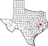
Unincorporated
communityDodge
Categories:- West Texas geography stubs
- Populated places in Walker County, Texas
- Unincorporated communities in Texas


Wikimedia Foundation. 2010.