Mount Cass Wind Farm

Mount Cass Wind Farm
Mount Cass Wind Farm is located in New Zealand
{{{alt}}}
Location of Mount Cass Wind Farm
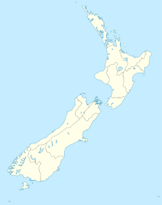
Country New Zealand
Location Canterbury
Coordinates 43°4′30″S 172°50′15″E / 43.075°S 172.8375°E / -43.075; 172.8375Coordinates: 43°4′30″S 172°50′15″E / 43.075°S 172.8375°E / -43.075; 172.8375
Owner(s) MainPower
Power station information
Primary fuel Wind
Power generation information
Maximum capacity up to 69 MW

The Mount Cass Wind Farm is/was a proposed wind farm to be located east of Waipara on Mount Cass in the Canterbury region of New Zealand.

Contents

Timeline

  • 23 November 2007 - application for resource consents lodged
  • 1 August 2008 - submissions close
  • 2 April 2009 - consents declined[1][2]
  • April 2009 - decision appealed to the Environment Court[3]

See also

References

  1. ^ Paul Rogers (2 April 2009). Resource Consent Application - Report and Determination by Hearing Commissioners. 
  2. ^ Williams, David (6 April 2009). "Wind farm plan rejected". Stuff.co.nz. http://www.stuff.co.nz/business/industries/2316073/Wind-farm-plan-rejected. Retrieved 26 October 2011. 
  3. ^ MainPower appeals Mt Cass wind farm decision, MainPower media release, 27 April 2009.

External links


Wikimedia Foundation. 2010.

Игры ⚽ Поможем решить контрольную работу

Look at other dictionaries:

  • Wind power in New Zealand — As of early 2008, wind power in New Zealand has an installed capacity of 321 MW, nearly double the 2006 capacity. Wind power now provides enough electricity to meet the needs of 145,000 New Zealand households,cite web last = first = authorlink =… …   Wikipedia

  • MainPower — Industry Electricity distribution Predecessor North Canterbury Electric Power Board Founded 1928 Headquarters Rangiora, New Zealand Key people Gill Cox ( …   Wikipedia

  • Indiana — This article is about the U.S. state of Indiana. For other uses, see Indiana (disambiguation). Hoosier State redirects here. For the passenger train, see Hoosier State (train). State of Indiana …   Wikipedia

  • Evanston, Illinois — Fountain Square County: Cook Township: Evanston Incorporated: C …   Wikipedia

  • Illinois — This article is about the U.S. state of Illinois. For other uses, see Illinois (disambiguation). State of Illinois …   Wikipedia

  • Lee County, Illinois — Location in the state of Illinois …   Wikipedia

  • Iowa — This article is about the U.S. state of Iowa. For other uses, see Iowa (disambiguation). State of Iowa …   Wikipedia

  • March 2006 tornado outbreak sequence — Tornado damage in Springfield, Illinois Date of tornado outbreak: March 9 13, 2006 Duration1: 4 days, 14 hours, 45 minutes Maximum rated tornado …   Wikipedia

  • May 21–26, 2011 tornado outbreak sequence — May 21–26, 2011 tornado outbreak EF4 tornado that struck Chickasha, Oklahoma. Date of tornado outbreak: May 21 – May 26, 2011 Duration1 …   Wikipedia

  • Dolly Sods Wilderness — Coordinates: 38°59′45″N 79°22′05″W / 38.99583°N 79.36806°W / 38.99583; 79.36806 …   Wikipedia

Share the article and excerpts

Direct link
Do a right-click on the link above
and select “Copy Link”