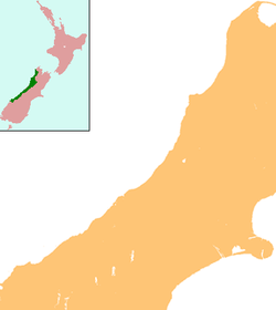
Maruia

Maruia
Maruia
Maruia is located in West Coast
Maruia
Coordinates: 42°11′20″S 172°13′13″E / 42.18889°S 172.22028°E / -42.18889; 172.22028Coordinates: 42°11′20″S 172°13′13″E / 42.18889°S 172.22028°E / -42.18889; 172.22028
Country New Zealand
Region West Coast
District Buller District
Population (2006)
 - Total 174

Maruia is a locality in the West Coast region of New Zealand. The Shenandoah Highway (State Highway 65) passes through it. Murchison is 65 km north, the Lewis Pass is 39 km to the south-east, and Reefton is 63 km west by road. The Maruia River flows past to the west.[1][2]

The population of Maruia and its surrounds was 174 in the 2006 Census, an increase of 12 from 2001.[3]

The principal activity is dairy farming. The community celebrated 100 years of settlement in the Maruia Valley in 2005.[4] The Maruia Valley inspired the environmental lobby group, the Maruia Society (later changing its name to the Ecologic Foundation) and the Maruia Mail Order Catalogue, organised by the New Zealand Nature Company.

Education

Maruia School is a coeducational full primary (years 1-8) school with a decile rating of 9 and a roll of 14.[5] The school was founded in 1926.[4]

Notes

  1. ^ Peter Dowling (editor) (2004). Reed New Zealand Atlas. Reed Books. pp. map 64. ISBN 0-7900-0952-8. 
  2. ^ Roger Smith, GeographX (2005). The Geographic Atlas of New Zealand. Robbie Burton. pp. map 150. ISBN 1-877333-20-4. 
  3. ^ Quickstats about Maruia
  4. ^ a b "Education Review Report: Maruia School". Education Review Office. June 2005. http://www.ero.govt.nz/ERO\reppub.nsf/Institution/896788798976CB18CC2570300013F927/$File/3204.htm. 
  5. ^ "Te Kete Ipurangi - Maruia School". Ministry of Education. http://www.tki.org.nz/e/schools/display_school_info.php?school_id=3204. 

Wikimedia Foundation. 2010.

Игры ⚽ Поможем решить контрольную работу

Look at other dictionaries:

  • Maruia — bezeichnet im Buller Distrikt der Region West Coast in Neuseeland Maruia (Neuseeland), Siedlung Maruia Springs, Siedlung Maruia River, Fluss Diese Seite ist eine Begriffsklärung zur Unterschei …   Deutsch Wikipedia

  • Maruia River — Maruia FallsVorlage:Infobox Fluss/KARTE fehlt DatenVorlage:Infobox Fluss/GKZ fehlt …   Deutsch Wikipedia

  • Maruia (Neuseeland) — Maruia …   Deutsch Wikipedia

  • Maruia River — The Maruia River (dark) showing the Buller River (light). The Maruia River is located in the northwestern South Island of New Zealand. It is a major tributary of the Buller River, flowing for 80 kilometres before joining the larger river eight… …   Wikipedia

  • Maruia Springs — p1 Maruia Springs …   Deutsch Wikipedia

  • Maruia Society — The Maruia Society was an environmental organisation in New Zealand. Maruia means sheltered valley in the Maori language. (There is also a valley of that name in New Zealand s South Island.) The Society had its origins in the Beech Forest Action… …   Wikipedia

  • Maruia Declaration — The Maruia Declaration was a public petition calling for the immediate phasing out of the logging of virgin native forest in New Zealand. In 1977 environmental groups presented the petition to Parliament carrying 341,160 signatures. It repeated… …   Wikipedia

  • Fleuve Maruia — Maruia Maruia Falls Caractéristiques Longueur  ? Bassin  ? Débit moyen  ? …   Wikipédia en Français

  • New Zealand State Highway 7 — State Highway 7 Route information Maintained by …   Wikipedia

  • Ecologic Foundation — The Ecologic Foundation (Ecologic Foundation Incorporated, also referred to as Ecologic) is an independent not for profit Think Tank based in Nelson, New Zealand focused on environmental policy research and analysis, consultancy and advocacy. Its …   Wikipedia

Share the article and excerpts

Direct link
Do a right-click on the link above
and select “Copy Link”