Queen Avenue Bridge

Queen Avenue Bridge

Infobox_nrhp | name =Queen Avenue Bridge
nrhp_type =


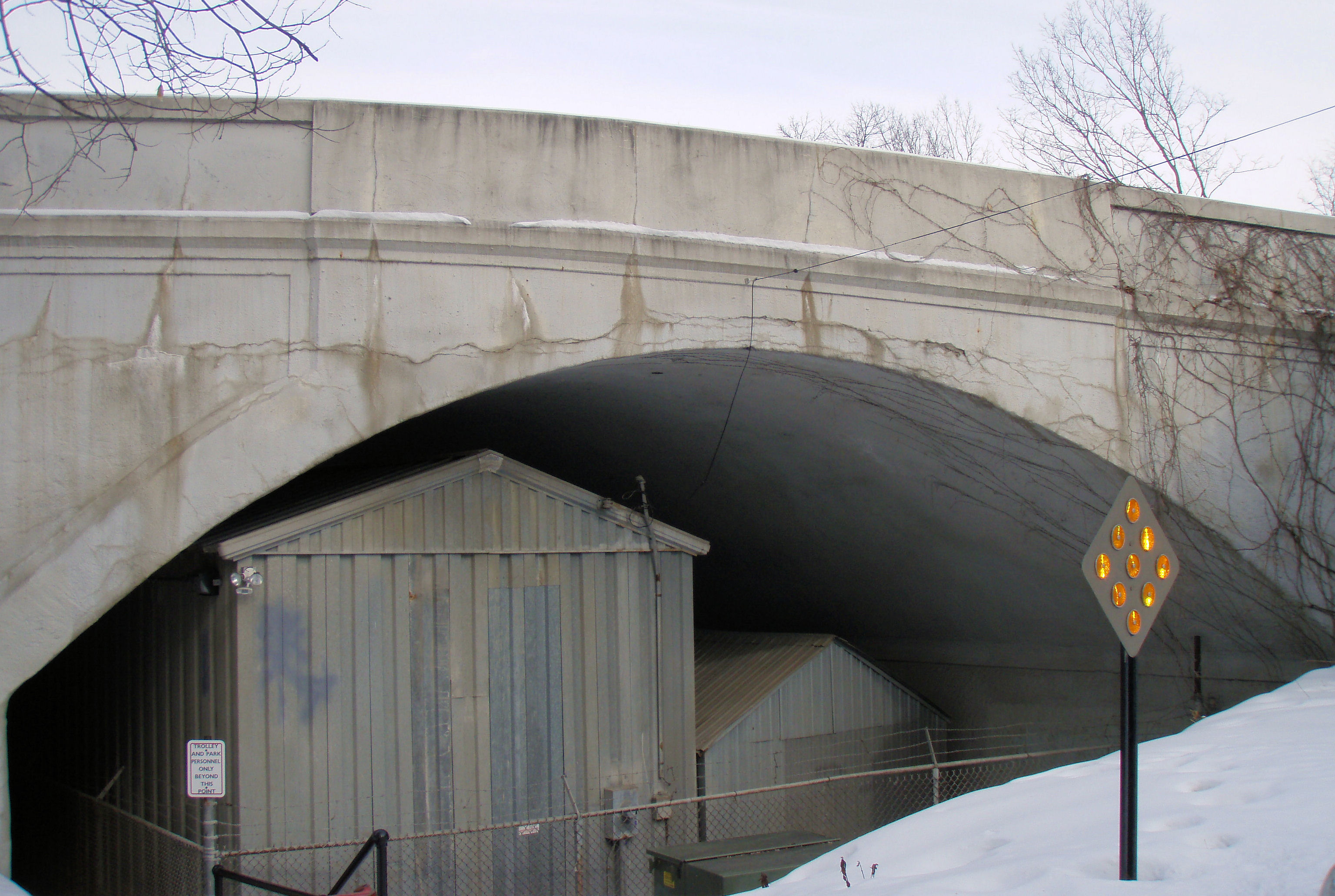
caption = The southwest side of the bridge with the sheds underneath used for the Minnesota Streetcar Museum cars
location= Minneapolis, Minnesota
lat_degrees = 44
lat_minutes = 55
lat_seconds = 28
lat_direction = N
long_degrees = 93
long_minutes = 18
long_seconds = 40
long_direction = W
locmapin = Minnesota
area =
built =1905
architect= Shepley,Charles R.; Minneapolis Street Railway Co.
architecture= Other
added = November 06, 1989
governing_body = Local
mpsub=Reinforced-Concrete Highway Bridges in Minnesota MPS
refnum=89001847cite web|url=http://www.nr.nps.gov/|title=National Register Information System|date=2008-04-15|work=National Register of Historic Places|publisher=National Park Service]

The Queen Avenue Bridge is a reinforced concrete single-span barrel arch bridge in Minneapolis, Minnesota that spans the tracks used by the Minnesota Streetcar Museum. The bridge was built in 1905 and is listed on the National Register of Historic Places.cite book|title=The National Register of Historic Places in Minnesota|last=Nord|first=Mary Ann|publisher=Minnesota Historical Society|date=2003|isbn=0-87351-448-3]

Much of the significance of the bridge is due to it being the third-oldest reinforced concrete arch bridge in Minnesota. It also retains most of the integrity of the design from its original plans. [cite web|url=http://www.mnhs.org/places/nationalregister/bridges/nrheqab/sign.html|title=Queen Avenue Bridge - Historic Significance|publisher=Minnesota Historical Society|accessdate=2008-07-20]

References


Wikimedia Foundation. 2010.

Игры ⚽ Поможем написать курсовую

Look at other dictionaries:

  • Laurier Avenue Bridge — The Laurier Avenue Bridge is a bridge in Ottawa, Canada. It carries Laurier Avenue over the Rideau Canal and also Colonel By Drive and Queen Elizabeth Driveway. It is the southern most of three bridges that cross the canal in downtown Ottawa. The …   Wikipedia

  • Old Eastern Avenue Bridge — The southern side of the bridge Carries Unused Crosses Don River Total length …   Wikipedia

  • Queen Elizabeth Way — Route information …   Wikipedia

  • Queen Street West — describes both the western branch of Queen Street, a major east west thoroughfare, and a series of neighbourhoods or commercial districts, situated west of Yonge Street in downtown Toronto, Ontario, Canada. Queen Street begins in the west at the… …   Wikipedia

  • Avenue Road — is a major north south street in Toronto, Ontario. The road is a continuation of University Avenue, linked to it via Queen s Park and Queen s Park Circle East and West to form a single through route Toronto Pocket Street Atlas , MapArt Publishing …   Wikipedia

  • Avenue McGill College —  Pour l’article homonyme, voir Rue McGill.  45° 30′ 12″ N 73° 34′ 25″ W / …   Wikipédia en Français

  • Avenue du Mont-Royal — 45° 31′ 27″ N 73° 34′ 57″ W / 45.524303, 73.582606 …   Wikipédia en Français

  • Avenue du Parc — 45° 30′ 46″ N 73° 34′ 50″ W / 45.512743, 73.580603 …   Wikipédia en Français

  • Avenue Atwater — 45° 29′ 02″ N 73° 34′ 47″ W / 45.483777, 73.579609 …   Wikipédia en Français

  • Avenue Christophe-Colomb — Pour les articles homonymes, voir Christophe Colomb (homonymie). 45° 32′ 43″ N 73° 36′ 57″ W …   Wikipédia en Français

Share the article and excerpts

Direct link
Do a right-click on the link above
and select “Copy Link”