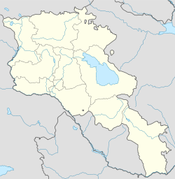
Zovuni, Aragatsotn

Zovuni, Aragatsotn

Coordinates: 40°30′39″N 44°25′44″E / 40.51083°N 44.42889°E / 40.51083; 44.42889

Zovuni
Zovuni is located in Armenia
Zovuni
Coordinates: 40°30′39″N 44°25′44″E / 40.51083°N 44.42889°E / 40.51083; 44.42889
Country Armenia
Marz (Province) Aragatsotn
Time zone   (UTC+4)
 – Summer (DST)   (UTC+5)

Zovuni (also, Molla Kasum) is a former town in the Aragatsotn Province of Armenia. Its ruins now lie beneath the Aparan Reservoir. The town was famous for the mausoleum of Vartan Mamikonian; the mausoleum and adjoining church were moved to higher ground before the town was flooded.

References


Wikimedia Foundation. 2010.

Игры ⚽ Нужно решить контрольную?

Look at other dictionaries:

  • Zovuni — For the town in Aragatsotn province, see Zovuni, Aragatsotn. Infobox Settlement official name = Zovuni Զովունի native name = pushpin mapsize =200px subdivision type = Country subdivision name = ARM subdivision type1 = Province subdivision name1 …   Wikipedia

  • List of municipalities of Armenia — Map of Armenia The Municipalities of Armenia are referred to as communities (համայնքներ hamaynkner, singular համայնք hamaynk ). Each community is self governing and consists of one or more settlements (bnakavayrer, singular bnakavayr).… …   Wikipedia

  • Yerevan — For other uses, see Yerevan (disambiguation). Coordinates: 40°11′00″N 44°31′00″E …   Wikipedia

  • Kotayk — 40° 25′ 00″ N 44° 45′ 00″ E / 40.4167, 44.75 …   Wikipédia en Français

  • Kotayk' —  Pour l’article homonyme, voir Kotayk (Kotayk).  Kotayk Կոտայք …   Wikipédia en Français

  • Abovian — Abovyan  Pour l’article homonyme, voir Abovyan (Ararat).  Abovyan Աբովյան Administration …   Wikipédia en Français

  • Abovyan —  Pour l’article homonyme, voir Abovyan (Ararat).  40° 16′ 03″ N 44° 37′ 17″ E / …   Wikipédia en Français

  • Apovian — Abovyan  Pour l’article homonyme, voir Abovyan (Ararat).  Abovyan Աբովյան Administration …   Wikipédia en Français

  • Byureghavan — 40° 18′ 53″ N 44° 35′ 37″ E / 40.314722, 44.593611 …   Wikipédia en Français

  • Charentsavan — 40° 21′ N 44° 36′ E / 40.35, 44.60 …   Wikipédia en Français

Share the article and excerpts

Direct link
Do a right-click on the link above
and select “Copy Link”