Vilsandi National Park

Vilsandi National Park

Infobox_protected_area | name = Vilsandi National Park
iucn_category =


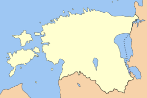
caption = Location of Vilsandi National Park
locator_x = 12
locator_y = 110
location = Estonia
lat_degrees = 58
lat_minutes = 22
lat_seconds = 43
lat_direction = N
long_degrees = 21
long_minutes = 52
long_seconds = 38
long_direction = E
area = convert|238|km2|mi2|0|abbr=on
established = 1957
visitation_num =
visitation_year =
governing_body =

Vilsandi National Park is a national park in Saare County, Estonia. It includes part of the island of Vilsandi, a number of smaller islands, adjacent parts of western Saaremaa and the Harilaid peninsula on Saaremaa, all in Kihelkonna Parish.

The park grew from a bird reserve founded in 1910. It is a highly sensitive ecosystem due to the use of the area by many migratory birds as a breeding and nesting ground. Hunting is absolutely prohibited. This park is a popular tourist destination for both Estonians and foreign vistors, particularly from Finland.

External links

* [http://www.vilsandi.ee/ Vilsandi National Park] (in Estonian)


Wikimedia Foundation. 2010.

Игры ⚽ Нужен реферат?

Look at other dictionaries:

  • Loona Manor Vilsandi National Park — (Кихельконна,Эстония) Категория отеля: Адрес: Loona küla, Kihelkonna vald …   Каталог отелей

  • Matsalu National Park — Matsalu rahvuspark IUCN Category II (National Park) …   Wikipedia

  • Vilsandi — The island of Vilsandi, Kihelkonna Commune, Estonia is located in the Baltic Sea. It covers an area of some 9 square kilometres, and is the westernmost populated island in Estonia.The island can be reached on foot by wading from Saaremaa, or by… …   Wikipedia

  • List of national parks of Estonia — There are 5 national parks in Estonia. *Karula National Park *Lahemaa National Park *Matsalu National Park *Soomaa National Park *Vilsandi National Park …   Wikipedia

  • Protected areas in Estonia — are regulated by the Nature Conservation Act (Lang et|Looduskaitseseadus), which was passed by the Estonian parliament on April 21 2004 and entered into force May 10 2004.cite web |url=http://www.legaltext.ee/en/andmebaas/tekst.asp?loc=text… …   Wikipedia

  • Vesiloo — is a small, uninhabited Estonian island in the Baltic Sea. [ [http://www.saaremaa.ee/index.php?option=com content view=article id=635 Itemid=313 Saaremaa Island: The Vilsandi nature preserve] ] Its coordinates are coord|58|23|45|N|21|50|35|E|. [… …   Wikipedia

  • Национальный парк Вильсанди — Вильсанди эст. Vilsandi rahvuspark …   Википедия

  • Nootamaa — is a small island in the Baltic Sea belonging to the country of Estonia. It marks the westernmost part of Estonia s territorial boundary. Its coordinates are 58°19′12″N 21°46′50″E / 58.32°N 21.78056°E / 58.32; 21.78056 …   Wikipedia

  • Loonalaid — (Swedish: Letenholm ) is a small island in the Baltic Sea belonging to the country of Estonia. Its coordinates are coord|58|19|42|N|21|48|19|E|. [ [http://www.tageo.com/index e en v 14 d m3616278.htm Tageo.com] ] Loonalaid lies just off the… …   Wikipedia

  • Harilaid — The Harilaid peninsula is a peninsula on the north west coast of the island of Saaremaa in Estonia.Harilaid covers an area of 4.5 km² and is low lying (the highest elevation is 4.6m). It is connected to the mainland by a 300 metre wide neck of… …   Wikipedia

Share the article and excerpts

Direct link
Do a right-click on the link above
and select “Copy Link”