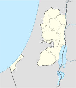
- Deir Sharaf
-
Deir Sharaf Other transcription(s) - Arabic دير شرف - Also spelled Dayr Sharaf (official) Location of Deir Sharaf within the Palestinian territories Coordinates: 32°15′15.10″N 35°11′17.45″E / 32.254194°N 35.1881806°ECoordinates: 32°15′15.10″N 35°11′17.45″E / 32.254194°N 35.1881806°E Governorate Nablus Government - Type Village Council Population (2006) - Jurisdiction 2,759 Deir Sharaf (Arabic: دير شرف) is a Palestinian town in the Nablus Governorate in northern West Bank, located 9 kilometers northwest of Nablus. According to the Palestinian Central Bureau of Statistics (PCBS), the town had a population of 2,759 inhabitants in mid-year 2006.[1]
References
Cities 

Municipalities Aqraba · Asira al-Shamaliya · Awarta · Beita · Beit Furik · Huwara · Jamma'in · Qabalan · Sebastia · TellVillages Ammuriya · al-Aqrabaniya · Asira al-Qibliya · Azmut · al-Badhan · Balata al-Balad · Beit Dajan · Beit Hasan · Beit Iba · Beit Imrin · Beit Wazan · Bizziriya · Burin · Burqa · Deir al-Hatab · Deir Sharaf · Duma · Einabus · Ein Shibli · Furush Beit Dajan · Ijnisinya · Jalud · Jurish · Kafr Qallil · al-Lubban ash-Sharqiya · Madama · Majdal Bani Fadil · an-Naqura · an-Naseriya · Odala · Osarin · Qaryut · Qusin · Qusra · Rujeib · Salim · Sarra · as-Sawiya · Talfit · Talluza · Urif · Yanun · Yasid · Yatma · Zawata · Zeita Jamma'inRefugee camps Categories:- Nablus Governorate
- Palestine geography stubs
- Villages in the West Bank
Wikimedia Foundation. 2010.

