- Anjoman
Infobox Settlement
official_name = Anjoman
other_name =
native_name =
nickname =
settlement_type =
motto =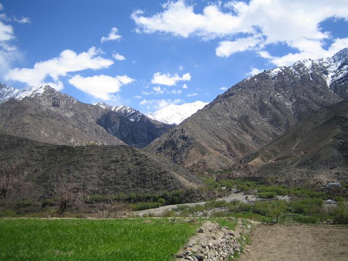
imagesize = 300px
image_caption = Scenery of the Panjshir Valley
flag_size =
image_
seal_size =
image_shield =
shield_size =
image_blank_emblem =
blank_emblem_type =
blank_emblem_size =
mapsize =
map_caption =
mapsize1 =
map_caption1 =
image_dot_
dot_mapsize =
dot_map_caption =
dot_x =
dot_y =
pushpin_
pushpin_mapsize=300
pushpin_label_position =bottom
pushpin_map_caption = Location in Afghanistan
subdivision_type = Country
subdivision_name = flag|Afghanistan
subdivision_type1 = Province
subdivision_name1 =Badakhshan Province
subdivision_type2 =
subdivision_name2 =
subdivision_type3 =
subdivision_name3 =
subdivision_type4 =
subdivision_name4 =
government_footnotes =
government_type =
leader_title =
leader_name =
leader_title1 =
leader_name1 =
leader_title2 =
leader_name2 =
leader_title3 =
leader_name3 =
leader_title4 =
leader_name4 =
established_title =
established_date =
established_title2 =
established_date2 =
established_title3 =
established_date3 =
area_magnitude =
unit_pref =Imperial
area_footnotes =
area_total_km2 =
area_land_km2 =
area_water_km2 =
area_total_sq_mi =
area_land_sq_mi =
area_water_sq_mi =
area_water_percent =
area_urban_km2 =
area_urban_sq_mi =
area_metro_km2 =
area_metro_sq_mi =
area_blank1_title =
area_blank1_km2 =
area_blank1_sq_mi =
population_as_of =
population_footnotes =
population_note =
population_total =
population_density_km2 =
population_density_sq_mi =
population_metro =
population_density_metro_km2 =
population_density_metro_sq_mi =
population_urban =
population_density_urban_km2 =
population_density_urban_sq_mi =
population_blank1_title =Ethnicities
population_blank1 =
population_blank2_title =Religions
population_blank2 =
population_density_blank1_km2 =
population_density_blank1_sq_mi =
timezone = + 4.30
utc_offset =
timezone_DST =
utc_offset_DST =
latd= 35
latm= 53
lats= 0
latNS=N
longd= 70
longm= 24
longs= 0
longEW=E
elevation_footnotes =
elevation_m =
elevation_ft =
postal_code_type =
postal_code =
area_code =
blank_name =
blank_info =
blank1_name =
blank1_info =
website =
footnotes =Anjoman is a
village inBadakhshan Province in north-easternAfghanistan . [cite web| url=http://geonames.nga.mil/ggmagaz/geonames4.asp |title=NGA GeoName Database |publisher=National Geospatial Intelligence Agency |accessdate=2008-05-27]It is located on the scenic Anjoman Pass which is situated in a 100 mile
Panjshir Valley . Each year cattle is herded through Anjoman from the high plains of Badakhshan Province down to the south [ [http://www.britannica.com/eb/article-9001467/Feyzabad Encyclopedia Britannica] , RetrievedJune 12 2008 ] .References
External links
* [http://www.maplandia.com/afghanistan/badakhshan/anjoman Satellite map at Maplandia.com]
* [http://encarta.msn.com/encnet/features/mapcenter/map.aspx Search for Anjoman in the MSN Encarta atlas]

Wikimedia Foundation. 2010.