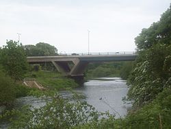
- Chartershaugh Bridge
-
Chartershaugh Bridge 
Chartershaugh Bridge, 2008.Carries Motor vehicles
(A182 road)Crosses River Wear Locale Washington, England Opened 1975 Chartershaugh Bridge is a road traffic bridge spanning the River Wear in North East England, linking Shiney Row with Washington as part of the A182 road. The bridge was opened in 1975 and is named after the former settlement of Chartershaugh, which once stood on a site near the bridge.
Categories:- United Kingdom bridge (structure) stubs
- Tyne and Wear building and structure stubs
- Bridges across the River Wear
- Bridges completed in 1974
- Bridges in Tyne and Wear
- Transport in the City of Sunderland
Wikimedia Foundation. 2010.
