- Maribojoc, Bohol
-
Maribojoc — Municipality — 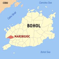
Country  Philippines
Region Central Visayas Province  Bohol
BoholDistrict 1st district of Bohol Organized October 15, 1860. Barangays 22 Population (2007) – Total 18,113 Time zone PST (UTC+8) ZIP code Income class 4th class
Maribojoc is a 4th class municipality in the province of Bohol, Philippines. According to the 2007 census, it has a population of 18,113 people.The town has a land area of 53.31 square kilometres (20.58 sq mi). The primary language spoken is Boholano, though English and Tagalog are also spoken and understood. Fishing and agriculture are the two main sources of livelihood.
Contents
History
Maribojoc was a fishing village when the Jesuit priests Juan de Torres and Gabriel Sanchez landed in Baclayon in 1595 bringing the cross for the first time in Maribojoc. Fr. Francisco Colin, an early Jesuit historian, listed the town's name as Malabooch and later changed it to Malabohoc. How it became Maribojoc is not known. During the pre-Spanish era, the town's name was "Dunggoan", derived from the old port located at the shore of the famous bay where sailors used to land and engage business with the early settlers.
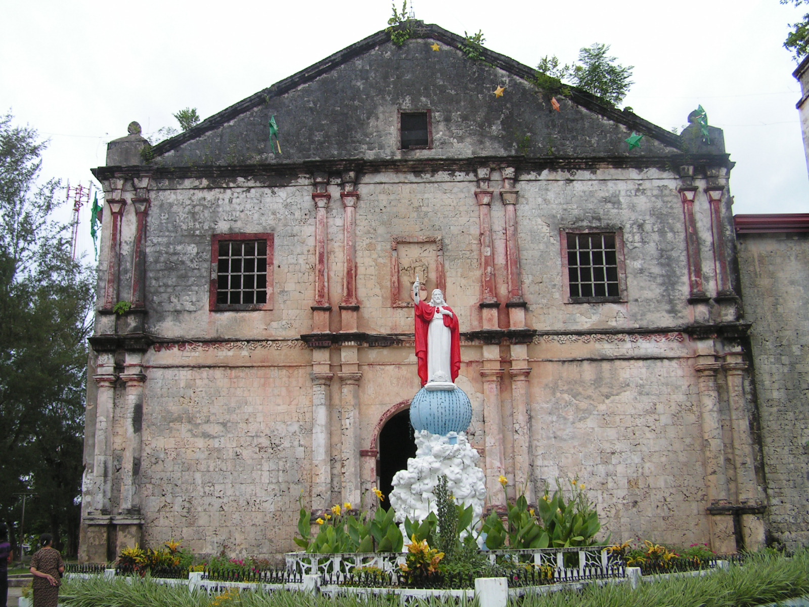
The Maribojoc parish, officially known as "Parroquía de Santa Cruz", was founded in 1767 when the Jesuits left Maribojoc. Maribojoc was one of the nine big villages founded by the Augustinian Recollect friars when they took over in 1768. It was during the time of the Recollects that the foundation of the Maribojoc church was laid in 1798 on what was once a swampy land and was finished in 1816, after 18 years of work. At the back of the church is a flight of stone stairs built in 1864. Earlier, in 1796, the Punta Cruz watchtower was built as a lookout against marauding pirates. The town of Maribojoc was officially organized on October 15, 1860.
Barangays
Maribojoc is politically subdivided into 22 barangays. Punsod was elevated into a barrio in 1956.[1]
- San Roque (Aghao)
- Agahay
- Aliguay
- Anislag
- Bayacabac
- Bood
- Busao
- Cabawan
- Candavid
- Dipatlong
- Guiwanon
- Jandig
- Lagtangon
- Lincod
- Pagnitoan
- Poblacion
- Punsod
- Punta Cruz
- San Isidro
- San Vicente
- Tinibgan
- Toril
Gallery
-
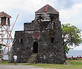
Punta Cruz watchtower
-
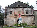
Roman Catholic Church
-
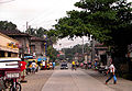
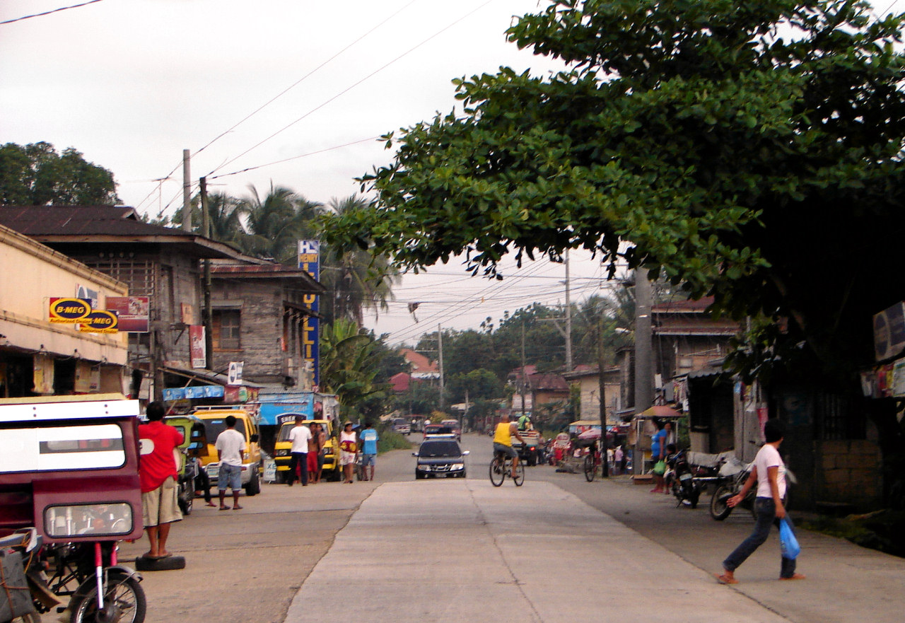
Poblacion, Maribojoc
References
External links
- Philippine Standard Geographic Code
- 2000 Philippine Census Information
- Municipality of Maribojoc
- 2007 Philippine Census Information

Loon, Antequera Loon 
Antequera  Maribojoc

Maribojoc Bay (Cebu Strait) Cortes Municipalities Alburquerque • Alicia • Anda • Antequera • Baclayon • Balilihan • Batuan • Bien Unido • Bilar • Buenavista • Calape • Candijay • Carmen • Catigbian • Clarin • Corella • Cortes • Dagohoy • Danao • Dauis • Dimiao • Duero • Garcia Hernandez • Getafe • Guindulman • Inabanga • Jagna • Lila • Loay • Loboc • Loon • Mabini • Maribojoc • Panglao • Pilar • President Carlos P. Garcia • Sagbayan • San Isidro • San Miguel • Sevilla • Sierra Bullones • Sikatuna • Talibon • Trinidad • Tubigon • Ubay • ValenciaComponent city Categories:- Municipalities of Bohol


Wikimedia Foundation. 2010.