- Titoki, New Zealand
-
Titoki 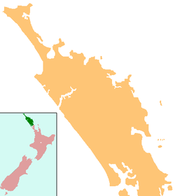
 Titoki
Coordinates: 35°44′02″S 174°03′26″E / 35.73389°S 174.05722°ECoordinates: 35°44′02″S 174°03′26″E / 35.73389°S 174.05722°E Country New Zealand Region Northland Region District Whangarei District Titoki is a locality in the Mangakahia Valley of Northland, New Zealand. Whangarei is 26 km to the east. The Wairua River passes to the east of Titoki and the Mangakahia River to the west.[1][2] A hydroelectric plant has been operating at Wairua Falls since 1916[3]. It was upgraded to produce 5.4 Gwh per year in 2007.[4]
Contents
Education
Mangakahia Area School is a coeducational composite (years 1-15) school with a decile rating of 3 and a roll of 157.[5] The school, previously called Titoki District High School, celebrated its centennial in 2007.[6]
Notable people
- Tania Roxborogh, writer
Notes
- ^ Peter Dowling (editor) (2004). Reed New Zealand Atlas. Reed Books. Map 7. ISBN 0-7900-0952-8.
- ^ Roger Smith, GeographX (2005). The Geographic Atlas of New Zealand. Robbie Burton. Map 24. ISBN 1-877333-20-4.
- ^ "Annual Report" (PDF). Northpower. 2005. p. 9. http://www.northpower.co.nz/pdf/Annual-Report-2005.pdf.
- ^ "Power to Northland as hydro scheme expands". New Zealand Government. 7 November 2007. http://www.beehive.govt.nz/release/power+northland+hydro+scheme+expands. Retrieved 2008-04-17.
- ^ "Te Kete Ipurangi - Mangakahia Area School". Ministry of Education. http://www.tki.org.nz/e/schools/display_school_info.php?school_id=18.
- ^ "Mangakahia Area School Centennial Celebrations" ([dead link]). Education Gazette New Zealand 84 (15). 22 August 2005. http://www.edgazette.govt.nz/notices.php/?id=61179.
External links
Categories:- Populated places in New Zealand
- Whangarei District
- Northland Region geography stubs

Wikimedia Foundation. 2010.