- Dammeron Valley, Utah
-
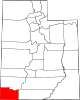
Dammeron Valley — CDP — Location within the state of Utah
 Dammeron Valley
Coordinates: 37°18′13″N 113°39′46″W / 37.30361°N 113.66278°WCoordinates: 37°18′13″N 113°39′46″W / 37.30361°N 113.66278°W Country United States State Utah County Washington Elevation[1] 4,675 ft (1,425 m) Population (2010)[2] – Total 803 Time zone Mountain (MST) (UTC-7) – Summer (DST) MDT (UTC-6) ZIP codes 84783 Area code(s) 435 FIPS code GNIS feature ID 2629948[1] Dammeron Valley is a census-designated place in Washington County, Utah, United States. The population was 803 at the 2010 census. Although Dammeron Valley is unincorporated, it has its own ZIP code of 84783.[3]
Demographics
As of the census[2] of 2010, there were 803 people residing in the CDP. There were 317 housing units. The racial makeup of the town was 98.6% White, 0.5% American Indian and Alaska Native, 0.7% Asian, 0.2% Native Hawaiian and Other Pacific Islander, 0.4% from some other race, and 1.5% from two or more races. Hispanic or Latino of any race were 1.5% of the population.
References
- ^ a b U.S. Geological Survey Geographic Names Information System: Dammeron Valley, Utah. Retrieved on May 18, 2011.
- ^ a b "American FactFinder". United States Census Bureau. http://factfinder2.census.gov/main.html. Retrieved May 18, 2011.
- ^ Zip Code Lookup
External links
Municipalities and communities of Washington County, Utah Cities Enterprise | Hildale | Hurricane | Ivins | La Verkin | Santa Clara | St. George | Toquerville | Washington
Towns Apple Valley | Leeds | New Harmony | Rockville | Springdale | Virgin
CDPs Central | Dammeron Valley | Pine Valley | Veyo
Unincorporated
communityGhost towns Adventure | Duncan's Retreat | Grafton | Harrisburg | Hebron | Silver Reef
Categories:- Populated places in Washington County, Utah
- Census-designated places in Utah
- Utah geography stubs


Wikimedia Foundation. 2010.