- Omak, Washington
-
Omak, Washington — City — Location of Omak, Washington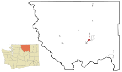
Coordinates: 48°24′38″N 119°31′29″W / 48.41056°N 119.52472°WCoordinates: 48°24′38″N 119°31′29″W / 48.41056°N 119.52472°W Country United States State Washington County Okanogan Area - Total 2.9 sq mi (7.6 km2) - Land 2.9 sq mi (7.4 km2) - Water 0.1 sq mi (0.2 km2) Elevation 843 ft (257 m) Population (2010) - Total 4,845 - Density 1,670.7/sq mi (654.7/km2) Time zone Pacific (PST) (UTC-8) - Summer (DST) PDT (UTC-7) ZIP code 98841 Area code(s) 509 FIPS code 53-51340[1] GNIS feature ID 1524048[2] Omak is the largest city in Okanogan County, Washington, United States. The population was 4,721 at the 2010 census. It is just south of the Canadian border where more populated cities are located (Kelowna, Penticton, and Kamloops).
It has a small commuter airport (KOMK) with one paved runway of 4,667 ft (1,423 m) in length.[3]
Contents
History
The town of Omak was platted in 1907, and officially incorporated on February 11, 1911.[4] Shortly after being formed, the city of Omak waged a battle trying to get the county seat to be located there, but it lost to the nearby community of Okanogan.
Since 1933, Omak has hosted the World Famous Omak Stampede, with the Suicide Race added in 1935.
Geography
Omak is located at 48°24′38″N 119°31′29″W / 48.410554°N 119.524649°W (48.410554, -119.524649).[5]
According to the United States Census Bureau, the city has a total area of 2.9 square miles (7.6 km2), of which, 2.9 square miles (7.4 km2) of it is land and 0.1 square miles (0.2 km2) of it (2.38%) is water.
Omak is located in the Mid-Valley area of the Okanogan Valley at the foot of the Okanogan Highlands. Approximately a quarter of the incorporated part of Omak lies in the Colville Indian Reservation. The Okanogan River meanders through the city of Omak on its way to the Columbia River.
Demographics
 A bridge over the Okanogan River, seen from Pioneer Park.
As of the census[1] of 2000, there were 4,721 people, 1,861 households, and 1,220 families residing in the city. The population density was 1,646.0 people per square mile (635.1/km2). There were 2,016 housing units at an average density of 702.9 per square mile (271.2/km2). The racial makeup of the city was 69.52% White, 0.17% African American, 15.21% Native American, 0.91% Asian, 0.15% Pacific Islander, 10.02% from other races, and 4.02% from two or more races. Hispanic or Latino of any race were 13.01% of the population.
There were 1,861 households out of which 32.8% had children under the age of 18 living with them, 44.8% were married couples living together, 15.7% had a female householder with no husband present, and 34.4% were non-families. 29.8% of all households were made up of individuals and 13.3% had someone living alone who was 65 years of age or older. The average household size was 2.46 and the average family size was 2.99.
In the city the population was spread out with 27.7% under the age of 18, 9.0% from 18 to 24, 26.9% from 25 to 44, 20.9% from 45 to 64, and 15.4% who were 65 years of age or older. The median age was 35 years. For every 100 females there were 93.5 males. For every 100 females age 18 and over, there were 90.0 males.
The median income for a household in the city was $24,089, and the median income for a family was $31,052. Males had a median income of $26,228 versus $23,674 for females. The per capita income for the city was $13,472. About 20.0% of families and 25.3% of the population were below the poverty line, including 34.0% of those under age 18 and 10.1% of those age 65 or over.
Sister city
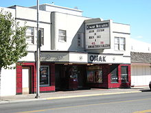 Omak Theater
Omak has one Sister City, according to the Washington State Lt. Governor's list of Washington Sister Cities:
Notable residents
- Joe Feddersen, artist
References
- ^ a b "American FactFinder". United States Census Bureau. http://factfinder.census.gov. Retrieved 2008-01-31.
- ^ "US Board on Geographic Names". United States Geological Survey. 2007-10-25. http://geonames.usgs.gov. Retrieved 2008-01-31.
- ^ AirNav
- ^ Steigmeyer, Rick (2008-03-20). "Omak — Stampede town". The Wenatchee World. http://wenatcheeworld.com/apps/pbcs.dll/article?AID=/20080320/ARTS01/534917803. Retrieved 2009-04-08.
- ^ "US Gazetteer files: 2010, 2000, and 1990". United States Census Bureau. 2011-02-12. http://www.census.gov/geo/www/gazetteer/gazette.html. Retrieved 2011-04-23.
External links
- Official Omak Stampede and Suicide Race website
- City of Omak official website
- Omak Chamber of Commerce official website
Municipalities and communities of Okanogan County, Washington County seat: Okanogan Cities 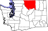
Towns Conconully | Coulee Dam ‡ | Elmer City | Nespelem | Riverside | Twisp | Winthrop
CDPs Unincorporated
communitiesIndian reservation Ghost towns Footnotes ‡This populated place also has portions in an adjacent county or counties
Categories:- Cities in Washington (state)
- Populated places in Okanogan County, Washington


Wikimedia Foundation. 2010.