- Connell, Washington
-
Connell, Washington — City — Location of Connell, Washington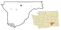
Coordinates: 46°39′30″N 118°51′39″W / 46.65833°N 118.86083°WCoordinates: 46°39′30″N 118°51′39″W / 46.65833°N 118.86083°W Country United States State Washington County Franklin Area – Total 2.9 sq mi (7.4 km2) – Land 2.9 sq mi (7.4 km2) – Water 0.0 sq mi (0.0 km2) Elevation 846 ft (258 m) Population (2010) – Total 4,209 – Density 1,034.8/sq mi (399.5/km2) Time zone Pacific (PST) (UTC-8) – Summer (DST) PDT (UTC-7) ZIP code 99326 Area code 509 FIPS code 53-14485[1] GNIS feature ID 1504104[2] Connell is a city in Franklin County, Washington, United States. The population was 4,209 at the 2010 census. The Washington State Office of Financial Management's 2011 estimate placed the population at 5,150.
Contents
History
Prior to 1883 the area now known as Connell was used by ranchers as open range for cattle and horses. The community was established in 1883 as a junction between the Northern Pacific Railroad and the Oregon Railroad and Navigation Company. The new town was called Palouse Junction by Jacob Cornelius Connell, a railroad official and resident. Palouse Junction was unique on the Ainsworth to Spokane run, in that it was not on a river. It was also the gateway to the Palouse via the OR&N's line to Washtucna. Water for trains and for the town was from public wells dug by the railroad. At some time between 1886 and 1900, the town was renamed to Connell.[3]
The Northern Pacific Railroad ceased service to the station in 1890,[4] but the Union Pacific Railroad took over the station in 1901, and the town began to grow again. A school district was formed sometime between 1900 and 1904. In 1902 the Franklin County Bank was Incorporated in Connell, and the Connell Land and Improvement Company was established. Also in that year, the county allowed a franchisee to begin piping in water for the town (Although this was never very successful, and the following year a good well hit water at 268 feet).[5] In 1903, lots on the west side of the tracks were sold, and a new commercial district began to grow, and a number of existing buildings were even moved to these new lots.
By this time the town rivaled Pasco in importance in Franklin County. Unfortunately, much of the business district was destroyed by fire in July, 1905. The destroyed sections were quickly rebuilt using brick.[6] Connell was officially incorporated on November 28, 1910. Dryland wheat farming was the lifeblood of Connell through most of the twentieth century.
Connell Today
The primary industrial base is food processing, agricultural chemicals and a minimum and medium security correctional facility that is capable of holding 2600 offenders. The community is also home to the North Franklin School District where there is a high school, junior high, grade school and administration offices. Both the state and county have transportation facilities in the community. The community has many well maintained parks. The City also has a pool which was recently remodeled. City athletic fields range from general purpose open space, to soccer and baseball fields. The City has recently purchased additional water rights and has water for future growth in residential, commercial and industrial activities. A new wastewater treatment facility is under construction and is near completion. New waterlines are also being installed to replace aging pipes.
During the last ten years the City has rebuilt Columbia Avenue, the main thoroughfare, reconstructed its industrial streets, and has recently received a grant award to reconstruct a portion of Clark Street. This roadway connects the downtown to Highway 260 on the west side of town, and serves the junior and senior high schools and administration buildings for the school district. Connell has grown 28% in the last ten years. This growth might add upon the opening of the medium-security facility at Coyote Ridge Correctional Facility, which is being built near the city.
Connell continues to struggle to find it's "niche". Local businesses struggle to compete against the major business of the Tri-Cities and Othello. Several businesses have left(Akins Food, B&H clothing, Tru-Value Hardware and Les Schwab Tire) and very few new businesses have been established.
Former Spokane Valley, Washington City Councilman Steve Taylor was selected as Connell's new city Administrator.[7] Connell has a strong-mayor form of city government with the Administrator reporting to the Mayor.
As of 2010 the town seems to be turning a corner to better days. Coyote Ridge Correctional Facility is actively hiring hundreds of employees, Oasis Custom Homes purchased land across from the High School and is building many new homes in a master planned community called the Oasis Village Connell, and the School District is just starting the construction of a new elementary school on Clark Street, next to the Oasis Village. Even commercial lots near HWY 395 are being purchased and developed.
Geography
Connell is located at 46°39′30″N 118°51′39″W / 46.65833°N 118.86083°W (46.658300, -118.860842).[8]
According to the United States Census Bureau, the city has a total area of 2.9 square miles (7.4 km²).
Demographics
As of the census[1] of 2000, there were 2,956 people, 766 households, and 602 families residing in the city. The population density was 1,034.8 people per square mile (399.1/km²). There were 891 housing units at an average density of 311.9 per square mile (120.3/km²). The racial makeup of the city was 63.19% White, 3.92% African American, 1.12% Native American, 4.36% Asian, 0.03% Pacific Islander, 21.52% from other races, and 5.85% from two or more races. Hispanic or Latino of any race were 41.47% of the population.
There were 766 households out of which 48.8% had children under the age of 18 living with them, 61.1% were married couples living together, 11.4% had a female householder with no husband present, and 21.3% were non-families. 17.4% of all households were made up of individuals and 7.6% had someone living alone who was 65 years of age or older. The average household size was 3.17 and the average family size was 3.59.
In the city the age distribution of the population shows 31.4% under the age of 18, 12.2% from 18 to 24, 32.4% from 25 to 44, 18.3% from 45 to 64, and 5.7% who were 65 years of age or older. The median age was 29 years. For every 100 females there were 142.9 males. For every 100 females age 18 and over, there were 160.3 males.
The median income for a household in the city was $33,992, and the median income for a family was $38,309. Males had a median income of $30,129 versus $24,444 for females. The per capita income for the city was $12,600. About 15.9% of families and 19.5% of the population were below the poverty line, including 26.7% of those under age 18 and 9.6% of those age 65 or over.
References
- ^ a b "American FactFinder". United States Census Bureau. http://factfinder.census.gov. Retrieved 2008-01-31.
- ^ "US Board on Geographic Names". United States Geological Survey. 2007-10-25. http://geonames.usgs.gov. Retrieved 2008-01-31.
- ^ http://www.cityofconnell.com/history_palousejunction.html
- ^ http://historylink.org/index.cfm?DisplayPage=output.cfm&file_id=7452
- ^ http://www.cityofconnell.com/history_townsitewater.html
- ^ http://www.cityofconnell.com/history_fireandflood.html
- ^ http://www.tri-cityherald.com/kennewick_pasco_richland/story/619405.html
- ^ "US Gazetteer files: 2010, 2000, and 1990". United States Census Bureau. 2011-02-12. http://www.census.gov/geo/www/gazetteer/gazette.html. Retrieved 2011-04-23.
External links
Municipalities and communities of Franklin County, Washington Cities 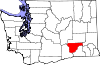
CDPs Unincorporated
communityEltopia
Categories:- Cities in Washington (state)
- Populated places in Franklin County, Washington


Wikimedia Foundation. 2010.