- Brighton, Vermont
Infobox Settlement
official_name = Pagename
other_name =
native_name =
nickname =
settlement_type = Town
motto =
imagesize =
image_caption =
flag_size =
image_
seal_size =
image_shield =
shield_size =
image_blank_emblem =
blank_emblem_size =
mapsize = 250px
map_caption = Located in Essex County, Vermont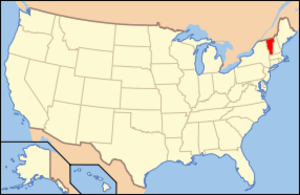
mapsize1 = 195px
map_caption1 = Location of Vermont with the U.S.A.
subdivision_type = Country
subdivision_name =United States
subdivision_type1 = State
subdivision_name1 =Vermont
subdivision_type2 = County
subdivision_name2 = Essex
subdivision_type3 =
subdivision_name3 =
subdivision_type4 =
subdivision_name4 =
government_footnotes =
government_type =New England town
leader_title =
leader_name =
leader_title1 =
leader_name1 =
leader_title2 =
leader_name2 =
leader_title3 =
leader_name3 =
leader_title4 =
leader_name4 =
established_title = Chartered
established_date = 1781
established_title2 = Settled
established_date2 = 1824
established_title3 = Organized
established_date3 = 1832
area_magnitude =
unit_pref = Imperial
area_footnotes =
area_total_km2 = 138.3
area_land_km2 = 135.2
area_water_km2 = 3.2
area_total_sq_mi = 53.4
area_land_sq_mi = 52.2
area_water_sq_mi = 1.2
area_water_percent =
population_as_of = 2000
population_footnotes =
population_note =
population_total = 1260
population_density_km2 = 9.3
population_density_sq_mi = 24.1
population_blank1_title = Households
population_blank1 = 529
population_blank2_title = Families
population_blank2 = 356
timezone = EST
utc_offset = -5
timezone_DST = EDT
utc_offset_DST = -4
latd = 44 |latm = 48 |lats = 32 |latNS = N
longd = 71 |longm = 52 |longs = 10 |longEW = W
elevation_footnotes =
elevation_m = 365
elevation_ft = 1280
postal_code_type =ZIP code
postal_code = 05846
area_code = 802
blank_name = FIPS code
blank_info = 50-08725GR|2
blank1_name = GNIS feature ID
blank1_info = 1462052GR|3
website =
footnotes =Brighton is a town in Essex County,
Vermont ,United States . The population was 1,260 at the 2000 census. The town was named Gilead in its original grant in 1780. The town was sold to a group comprised primarily of soldiers commanded by Colonel Joseph Nightingale and subsequently named Random. The town's name was finally changed by the legislature to Brighton in 1932. The Brighton village ofIsland Pond gets its name from theAbenaki word "Menanbawk" which literally means island pond.Brighton is part of the Berlin, NH–VT Micropolitan Statistical Area.
Geography
According to the
United States Census Bureau , the town has a total area of 53.4square mile s (138.4km² ), of which, 52.2 square miles (135.2 km²) of it is land and 1.2 square miles (3.2 km²) of it (2.28%) is water.The Clyde River originates in Spectacle Pond, Brighton. It flows from there to Island Pond [After which the town of Island Pond is named] [The pond was originally called "Knowles Pond" in th 19th century] from the north end of Island Pond to the west. It proceeds towards Charleston, in a northwesterly direction.
Demographics
As of the
census GR|2 of 2000, there were 1,260 people, 529 households, and 356 families residing in the town. Thepopulation density was 24.1 people per square mile (9.3/km²). There were 891 housing units at an average density of 17.1/sq mi (6.6/km²). The racial makeup of the town was 95.16% White, 0.16% African American, 1.03% Native American, 0.48% Asian, 0.08% from other races, and 3.10% from two or more races. Hispanic or Latino of any race were 0.32% of the population.There were 529 households out of which 30.2% had children under the age of 18 living with them, 51.8% were couples living together and joined in either
marriage or civil union, 11.7% had a female householder with no husband present, and 32.7% were non-families. 27.6% of all households were made up of individuals and 15.5% had someone living alone who was 65 years of age or older. The average household size was 2.38 and the average family size was 2.88.In the town the population was spread out with 25.0% under the age of 18, 7.8% from 18 to 24, 23.8% from 25 to 44, 25.2% from 45 to 64, and 18.2% who were 65 years of age or older. The median age was 41 years. For every 100 females there were 94.7 males. For every 100 females age 18 and over, there were 91.3 males.
The median income for a household in the town was $26,932, and the median income for a family was $31,316. Males had a median income of $26,413 versus $23,125 for females. The
per capita income for the town was $12,999. About 14.9% of families and 19.2% of the population were below thepoverty line , including 28.7% of those under age 18 and 15.3% of those age 65 or over.References
External links
* [http://www.islandpond.com/ Island Pond Official Web Site]
*

Wikimedia Foundation. 2010.