- Lometa, Texas
Infobox Settlement
official_name = Lometa, Texas
settlement_type =City
nickname =
motto =
imagesize =
image_caption =
image_
mapsize = 250px
map_caption = Location of Lometa, Texas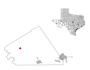
mapsize1 = 250px
map_caption1 =subdivision_type = Country
subdivision_name =United States
subdivision_type1 = State
subdivision_name1 =Texas
subdivision_type2 = County
subdivision_name2 = Lampasasgovernment_footnotes =
government_type =
leader_title =
leader_name =
leader_title1 =
leader_name1 =
established_title =
established_date =unit_pref = Imperial
area_footnotes =
area_magnitude =
area_total_km2 = 2.3
area_land_km2 = 2.3
area_water_km2 = 0.0
area_total_sq_mi = 0.9
area_land_sq_mi = 0.9
area_water_sq_mi = 0.0population_as_of = 2000
population_footnotes =
population_total = 782
population_density_km2 = 334.6
population_density_sq_mi = 866.6timezone = Central (CST)
utc_offset = -6
timezone_DST = CDT
utc_offset_DST = -5
elevation_footnotes =
elevation_m = 455
elevation_ft = 1493
latd = 31 |latm = 13 |lats = 5 |latNS = N
longd = 98 |longm = 23 |longs = 34 |longEW = Wpostal_code_type =
ZIP code
postal_code = 76853
area_code = 512
blank_name = FIPS code
blank_info = 48-43516GR|2
blank1_name = GNIS feature ID
blank1_info = 1361632GR|3
website =
footnotes =Lometa is a city in Lampasas County,
Texas ,United States . The population was 782 at the 2000 census. It is part of the Killeen–Temple–Fort Hood Metropolitan Statistical Area.Geography
Lometa is located at coor dms|31|13|5|N|98|23|34|W|city (31.218129, -98.392916)GR|1.
According to the
United States Census Bureau , the city has a total area of 0.9 square miles (2.3 km²), all of it land.Events
The annual festivals in Lometa are a spring Diamond Back Jubilee, an annual livestock show, and a summer junior rodeo.
Lometa has a lone stoplight, a recent improvement as of 2003 from the original four-way stop, in the middle of town. On the edge of town there is a nice municipal park with camping sites and a rodeo arena and grounds.
Lometa was a convert|200|acre|km2|sing=on site platted May 17, 1886, as a railroad stop. The town was rapidly transplanted out of the nearby stagecoach stop of Senterfitt. The town had originally been called Montvale, but a change was made in 1886 when a post office was applied for.
By 1890 there were 150 Lometans and four years later the town got its first newspaper. Another weekly paper was published in 1896 and a third by 1900.
Demographics
As of the
census GR|2 of 2000, there were 782 people, 291 households, and 190 families residing in the city. Thepopulation density was 866.6 people per square mile (335.5/km²). There were 339 housing units at an average density of 375.7/sq mi (145.4/km²). The racial makeup of the city was 83.12% White, 2.30% African American, 1.02% Native American, 0.13% Asian, 11.51% from other races, and 1.92% from two or more races. Hispanic or Latino of any race were 29.80% of the population.There were 291 households out of which 28.2% had children under the age of 18 living with them, 46.7% were married couples living together, 10.7% had a female householder with no husband present, and 34.7% were non-families. 31.3% of all households were made up of individuals and 21.0% had someone living alone who was 65 years of age or older. The average household size was 2.52 and the average family size was 3.14.
In the city the population was spread out with 33.5% under the age of 18, 7.5% from 18 to 24, 19.7% from 25 to 44, 23.4% from 45 to 64, and 15.9% who were 65 years of age or older. The median age was 34 years. For every 100 females there were 102.1 males. For every 100 females age 18 and over, there were 94.0 males.
The median income for a household in the city was $21,923, and the median income for a family was $28,125. Males had a median income of $27,917 versus $16,538 for females. The
per capita income for the city was $10,428. About 19.3% of families and 29.1% of the population were below thepoverty line , including 38.3% of those under age 18 and 18.8% of those age 65 or over.Transportation
Lometa is served by two major highways, U.S. Routes 183 and 190. Two railroads are located in Lometa,
BNSF Railway (previously the Santa Fe Railway) and theGulf, Colorado and San Saba Railroad (previously the Santa Fe Railway's) branch toBrady, Texas . Until July 1968, Lometa was a night flag stop on the Santa Fe passenger train the "California Special" that ran fromClovis, New Mexico to Houston.Education
Lometa has one primary education facility covering grades pre-k through 12th. The school is a part of the
Lometa Independent School District (LISD), and the mascot is the fighting hornet, whose colors are maroon and gold.References
*Jonnie Ross Elzner, Relighting Lamplights of Lampasas County, Texas (Lampasas: Hill Country, 1974)
*Scott Hightower: Tin Can Tourist, Natural Trouble, Part of the BargainExternal links
* [http://www.chrishamiltonphotography.com/stories/RRlometa-01.html Photojournalism essay]

Wikimedia Foundation. 2010.