- Ohio State Route 732
-
State Route 732
Route information Maintained by ODOT Length: 30.94 mi[1] (49.79 km) Major junctions South end:  OH 129 near Millville
 US 27 in Oxford
 SR 177 in Morning Sun
 US 127 in Eaton
North end: 
 US 35/US 127/OH 122 in Eaton
Location Counties: Butler, Preble Highway system Ohio highways
Interstates • U.S. Routes • State Routes←  SR 730
SR 734  →
→State Route 732 or OH 732 is a state highway in the U.S. state of Ohio. This two-lane state route begins at OH 129 (Hamilton-Scipio Road) in Butler County, and extends northward to end at the junction of US 127 and US 35/OH 122 in Eaton in Preble County, Ohio, traveling 30.94 miles (49.79 km).[1]
This route gives access from northern and western Ohio via I-70 or US 127 to Miami University in Oxford and Hueston Woods State Park. It also is a route for students leaving Oxford and a way for travelers in Oxford to visit Hueston Woods State Park and its lodge. The traveler to Eaton may be interested in Fort St. Clair built pursuant to orders from President Washington in 1791-2. The forerunner of the Poland China Hog was developed within a stone's throw of the road.
Contents
Route description
The south end of OH 732 is at OH 129 (Hamilton-Scipio Road) west of Millville, and 3 miles (4.8 km) east of the Indiana-Ohio border at Scipio. The route follows Sample Road going north from this intersection in Butler County for 3 miles (5 km) to Reily. In Reily, it turns east for a block and then continues north crossing Indian Creek as it leaves Reily as Oxford-Reily Road. Oxford is about 6 miles (10 km) north. OH 732 ascends a steep hill near Indian Creek Park. OH 732 continues north past a sharp bend as it leaves the creek and ascends to the flashing caution light as it crosses Stillwell-Becket Road with the water tower at the southwest corner of this intersection. OH 732 continues north through farm fields on a straight road passing Talawanda Middle School on the east side of the road.[2]
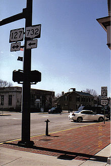 North end of OH 732 at the Eaton Post Office in Eaton, Ohio
OH 732 reaches the southwest corner of Oxford at the intersection of Oxford-Reily Road with West Chestnut Street. Chestnut Street is also known as Brookville Road. OH 732 turns eastbound on Chestnut Street and passes a traffic signal at South Locust Street, continuing east to the north end of Kehr Road. When OH 732 meets College Street, it passes the Talawanda Board of Education and Talawanda High School. OH 732 turns left on Main Street proceeding north and uphill to the traffic light on US 27 (High Street). Miami University is a few blocks east on High Street. OH 732 continues on Main Street northbound past the Presbyterian Church and McCullough-Hyde Hospital leaving Oxford and passing the historic Black Covered Bridge over Talawanda Creek. It is about 20 miles (32 km) to Eaton before reaching the Butler-Preble County line.[2]
Just north of the county line is the east entrance to Hueston Woods State Park. A bit north of the park entrance is Oxford-Eaton Road (Preble County Road 29) which runs past the ODOT facility to join OH 177 northwestward to Morning Sun. OH 732 continues concurrent with OH 177 until a bit north of Morning Sun, where OH 732 continues due north crossing OH 725. OH 732 continues to jog east and north past Lakengren to meet US 127 at a traffic light in the south side of Eaton. Eaton is the county seat of Preble County. One mile before the US 127 intersection is Eaton High School. The northern terminus of OH 732 is .5 miles (0.8 km) north at the US 35/OH 122 intersection with US 127 northwest of the Eaton County Court House in downtown Eaton.[3]
According to ODOT District 8, the number of vehicles carried is between 660 and 5,270 vehicles a day, depending on the section.[citation needed]
History
We begin by reviewing late eighteenth century military roads in Butler County. The first was built in 1791 by General Arthur St. Clair from Cincinnati to Hamilton and continuing north to the fortifications at Eaton. This road was about 7 miles (11 km) east of Oxford and OH 732 and followed Seven Mile Creek This was done in his unsuccessful campaign. In 1794 General Anthony Wayne constructed a road north from Fort Hamilton a few miles east of St. Clair's road, giving rise to the long multi-county road "Wayne Trace". In 1804 the Ohio Legislature passed an act requiring roads to be 20 feet (6.1 m) wide with stumps not to exceed one foot.[4]
Eaton Road (future OH 732) is clearly marked on McBride's Map of Oxford Township of 1836.[5] The land and overshot mill of the Austins is also marked where Eaton Road crosses Talawanda Creek. Aaron Austin whose 1816 homestead is still near the Black Covered Bridge operated the Mill here on Talawanda Creek. The mill eventually passed into the hands of Pugh and the Austin land passed into the hands of a successful swine breeder,David Magie, a contributor to the Poland China Hog. The covered bridge was called Black by local people to distinguish it from the white painted bridge one mile (1.6 km) downstream which carried the traffic of the future OH 73.
The enumeration of Ohio State Routes began in 1924, but was adjusted by the 1926–27 effort of the Federal Government to do the same. Added to the system in 1938, OH 732 was the longest of four Butler County routes to be designated by number that yearThe Butler County Engineers Office indicates that SR732 was rerouted in 1951 to use the current bridge crossing Talawanda Creek a few hundred feet east of the Black Bridge. There being no other bridge piers in evidence shows that the Black Bridge carried OH 732 until 1951..[4]
The precursor to OH 732 between Oxford and Eaton was laid out in March 1811. The road began on the Great Miami River at Derrough's Ford, proceeding north to Oxford and then on to Eaton.[6]
The Black Covered Bridge spanning Talawanda Creek just north of the Oxford City limits was constructed in 1868. The bridge was renovated in 1998 and can be viewed by the passerby from the current OH 732 bridge by looking upstream (west).[7] This bridge spans Talawanda Creek which is 209 feet (64 m) wide at this point. It is exceeded in length by only a few Ohio covered bridges. Built by Bandin, Butin and Bowman in 1868 and 1869, it incorporates both the truss style of Childs and that of Long in one bridge. The first version was an arched structure with a roadway width of 18 feet (5.5 m). In 1869 a stone pier was added as a support beneath the center of the bridge. The bow in the bridge was removed by replacing some wooden cross members with threaded iron rods. The nuts at the ends of these were loosened so that the bow was straightened and the middle of the bridge was lowered onto the pier. The bridge is so named to distinguish it from the white bridge east of Oxford and was useful in servicing Pugh's Mill at the time of construction.The Butler County Engineers Office-BCEO indicates that SR732 was rerouted in 1951 to use the current bridge crossing Talawanda Creek a few hundred feet east of the Black Bridge. There being no other bridge piers in evidence shows that the Black Bridge carried SR732 until 1951.[8]
Major intersections
County Location Mile Destinations Notes Butler Reily Township 0.00 [1] SR 129Southern Terminus. Oxford 9.37 US 27Preble Israel Township 14.64 SR 177SR 177 joins from the southeast. 17.17 SR 177SR 177 departs to the northwest. 18.97  SR 725
Eaton 30.56 US 127US 127 joins from the south. 30.94 US 35
US 127
SR 122Northern terminus. US 127 continues to north as a solo route. 1.000 mi = 1.609 km; 1.000 km = 0.621 mi Sources
- ^ a b c "Technical Services Straight Line Diagrams". Ohio Department of Transportation. 2007-01-01. Archived from the original on 2008-03-07. http://web.archive.org/web/20080307023822/http://www.dot.state.oh.us/techservsite/availpro/Road_+Infor/SLD/default.htm. Retrieved 2008-03-23.
- ^ a b Butler County Engineer's Office (2007). Official Butler County Transportation Map (Map). http://bceo.org/butlermap.html. Retrieved 2008-03-22.
- ^ Dan Garnell (2007). Map (Map). http://www.state-ends.com/ohio/oh732/. Retrieved 2008-08-11.
- ^ a b Blount, Jim. "Butler County Place Names". The Lane Libraries. http://www.lanepl.org/blount/jbplaces/index.html. Retrieved 2008-09-06.
- ^ Whipperwill Publications (1983). Oxford Township (Map). Evansville, IN.
- ^ "A History and Biographical Cyclopaedia of Butler County, Ohio". US GenWeb Project. Rootsweb. http://www.rootsweb.ancestry.com/~ohbutler/cyc/502.htm. Retrieved 2008-09-06.
- ^ Ohio Department of Transportation District 8
- ^ Bridge plaque, Black Covered Bridge
External links
Categories:- State highways in Ohio
- Transportation in Butler County, Ohio
- Transportation in Preble County, Ohio


Wikimedia Foundation. 2010.