- Muttom
-
Muttom
Mum Mudi Chola Nallur
— village — Coordinates Country India State Tamil Nadu District(s) Kanya kumari Time zone IST (UTC+05:30) Muttom (Tamil:முட்டம்) is a village in Kanyakumari District of the Tamil Nadu State, India.
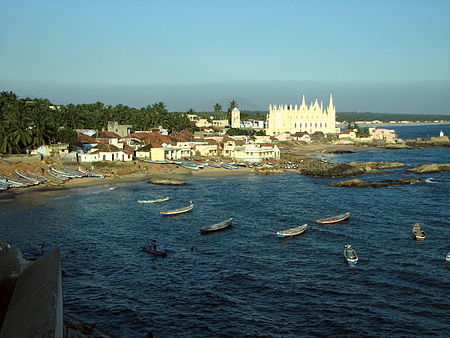 Muttom Fishing Village
Contents
Geography
Muttom is a fishing village, located 16 kilometers from the capital town Nagercoil. Muttom is located at 8°08′N 77°19′E / 8.13°N 77.32°E.[1] It is well connected by road to the Nagercoil town. It is approximately 75 km from the Trivandrum International Airport. It is reachable from Kanyakumari by road with a distance of about 34 km.
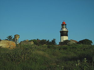 Muttom Lighthouse
==Places of
Demographics
More than 90 percent of the village are Christians and they do a variety of jobs. Majority of the people are fishermen who do fishing related works. Most of the people are educated at least to the school level. As most of the residents are Catholics, it has a catholic administration committee which is elected democratically and headed by the parish priest of the All Saints Church.
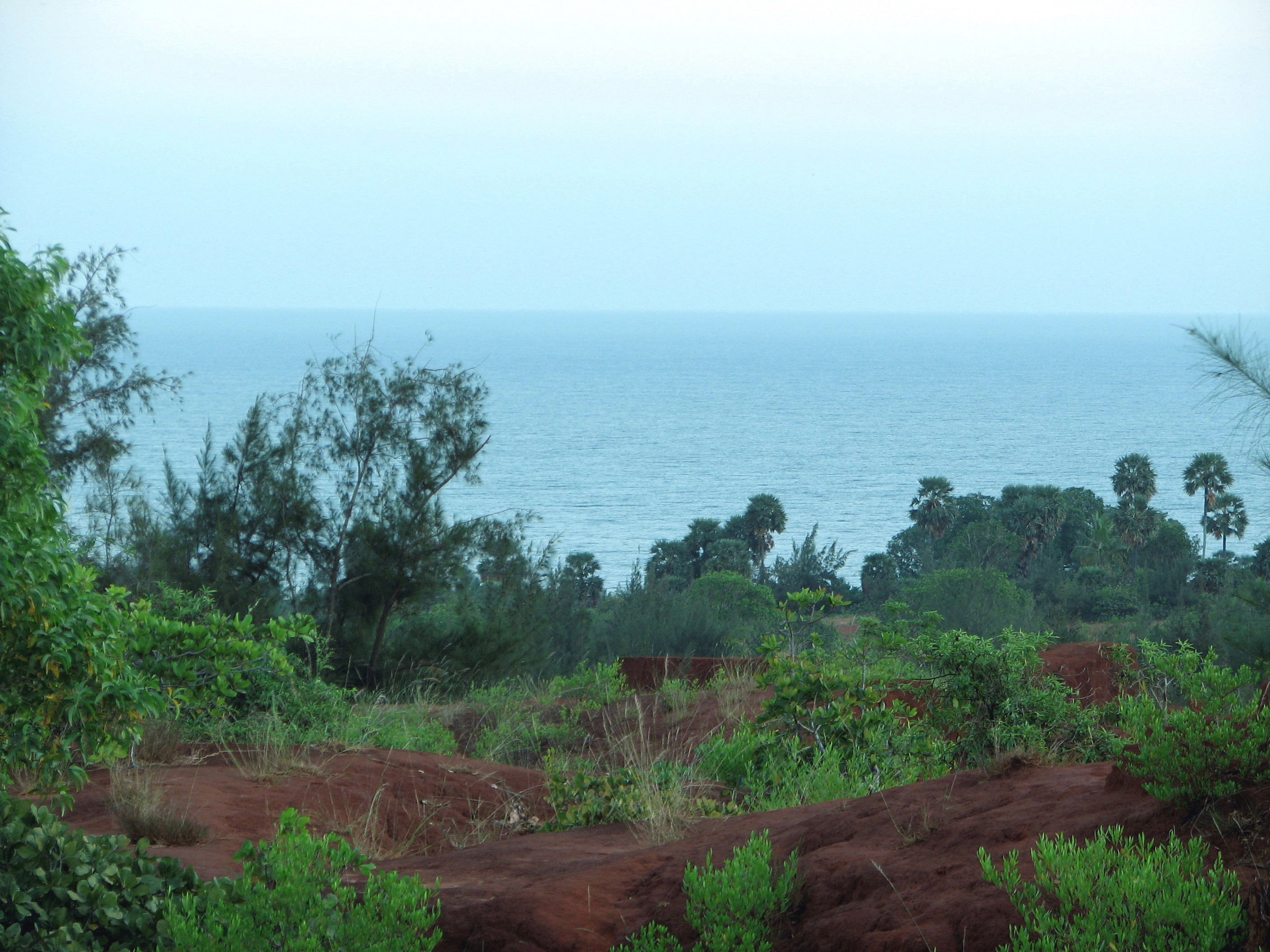
 Muttom Coast
Education
Muttom has a primary school (St. John's primary school), managed by the catholic parish priest of MUTTOM and headed by the senior most teacher as Headmaster. There also is a higher secondary school by the name of All Saints Higher Secondary School and is managed by the Monfort Brothers. This school has long standing records in both sports and academics. There is a B.Ed college named after Bishop Agneswamy is also established recently and more educational institutions are expected in the coming years. English medium school namely the Model English School, provides a quality education to the children of Muttom as well as neighbouring villages, which is really a benefit to the small fishing villages.
==2004
Reaching Muttom
Buses serving this village :
- From Nagercoil 5C, 14A, 14C, 14DV,14EV
- From Thuckalay & Monday Market (alias Thingalchanthai or Thingalnagar) 47,47C,12G
- From James Nager 14DV
- From kanyakumari SSS
- From Marthandam 46C
Nearest Rail Head- Eraniel - 10 km a small crossing station
- Nagercoil - 18 km Junction Station for trains to all parts of India.
Nearest Airport- Trivandrum (Thiruvananthapuram) 80 km by road
Nearest Seaport
- Muttom - fishing harbour
- Tuticorin (Thoothukudi) - 120 km Cargo Ship international/domestic, plans to ply passenger ships between Srilanka and India
Main town : Nagercoil for all kinds of accommodation and shopping
References
External references
- Web Portal of Muttom by Bede Griffiths Charitable Trusts
- Rowlett, Russ. "Lighthouses of India: West Bengal, Orissa, and Andhra Pradesh". The Lighthouse Directory. University of North Carolina at Chapel Hill. http://www.unc.edu/~rowlett/lighthouse/inde.htm.
Categories:- Villages in Kanniyakumari district


Wikimedia Foundation. 2010.