- Church Hill, Tennessee
-
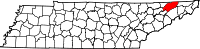
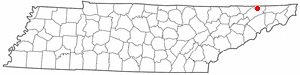
Church Hill, Tennessee — City — Location of Church Hill, Tennessee
Coordinates: 36°31′15″N 82°43′32″W / 36.52083°N 82.72556°W Country United States State Tennessee County Hawkins Area – Total 9.4 sq mi (24.3 km2) – Land 8.9 sq mi (23.0 km2) – Water 0.5 sq mi (1.3 km2) Elevation 1,217 ft (371 m) Population (2000) – Total 5,916 – Density 665.8/sq mi (257.1/km2) Time zone Eastern (EST) (UTC-5) – Summer (DST) EDT (UTC-4) ZIP codes 37642, 37645 Area code(s) 423 FIPS code 47-14980[1] GNIS feature ID 1305931[2] Church Hill is a city in Hawkins County, Tennessee, United States. The population was 5,916 at the 2000 census. It is part of the Kingsport–Bristol (TN)–Bristol (VA) Metropolitan Statistical Area, which is a component of the Johnson City–Kingsport–Bristol, TN-VA Combined Statistical Area – commonly known as the "Tri-Cities" region.
The City of Church Hill was incorporated in 1958, though the community was established as a trading post and stagecoach stop called "Spencer's Mill" in the late 18th century. The name Church Hill came later, following the establishment of a Methodist Church "on the hill" overlooking the Holston River Valley. The church still stands today on Grandview Street downtown.
One of Church Hill's most notable landmarks is Canton Hall an Antebellum Mansion built by slave hands and owned by the Hoard family. Other landmarks include Smith Place, built in the early 20th century and the site of Carter's Store, home to the first settlers west of the Appalachians.
Church Hill continues to grow annually and is the largest town in Hawkins County with a more recent estimate of nearly 7,000 residents.
Contents
Geography
Church Hill is located at 36°31′15″N 82°43′32″W / 36.52083°N 82.72556°W (36.520845, -82.725472)[3].
According to the United States Census Bureau, the city has a total area of 9.4 square miles (24 km2), of which, 8.9 square miles (23 km2) of it is land and 0.5 square miles (1.3 km2) of it (5.23%) is water.
Demographics
As of the census[1] of 2000, there were 5,916 people, 2,482 households, and 1,772 families residing in the city. The population density was 665.8 people per square mile (256.9/km²). There were 2,709 housing units at an average density of 304.9 per square mile (117.7/km²). The racial makeup of the city was 97.95% White, 1.30% African American, 0.12% Native American, 0.22% Asian, 0.07% from other races, and 0.34% from two or more races. Hispanic or Latino of any race were 0.41% of the population.
There were 2,482 households out of which 29.2% had children under the age of 18 living with them, 59.5% were married couples living together, 9.9% had a female householder with no husband present, and 28.6% were non-families. 25.5% of all households were made up of individuals and 9.1% had someone living alone who was 65 years of age or older. The average household size was 2.34 and the average family size was 2.78.
In the city the population was spread out with 21.4% under the age of 18, 6.5% from 18 to 24, 30.2% from 25 to 44, 26.9% from 45 to 64, and 15.0% who were 65 years of age or older. The median age was 39 years. For every 100 females there were 89.4 males. For every 100 females age 18 and over, there were 85.7 males.
The median income for a household in the city was $36,563, and the median income for a family was $43,423. Males had a median income of $32,305 versus $25,010 for females. The per capita income for the city was $19,656. About 10.0% of families and 12.0% of the population were below the poverty line, including 16.2% of those under age 18 and 10.5% of those age 65 or over.
Education
Elementary schools
- Church Hill Elementary School (Hawkins County Schools), grades K-4
- Mascot: Panthers School Colors: Blue An Gold
- Carters Valley Elementary School (Hawkins County Schools), grades K-4
- Mascot: Jets School Colors: Blue And White
- McPheeters Bend Elementary School (Hawkins County Schools), grades K-4
- Mount. Carmel Elementary School (Hawkins County Schools) , grades Pre-K-4
Intermediate and Middle Schools
- Church Hill Intermediate School (Hawkins County Schools), grades 5-6
- Church Hill Middle School (Hawkins County Schools), grades 7-8
Mascot: Panthers School Colors: Blue and Gold
High schools
- Volunteer High School (Hawkins County Schools), grades 9-12
Mascot: Falcons School Colors: Blue and Orange
The Volunteer High School Marching Band has gone to many places such as the 2007 Allstate Sugar Bowl and performed with other bands from the U.S. at pregame and halftime. In the spring of 2009, they marched in the Epcot park at Disney World in Orlando, Florida. The band will also be attending the 2011 Outback Bowl in Tampa Bay, Florida. They were the only marching band in Tennessee invited.
Notable residents
- Lloyd Carr, the former head coach of the University of Michigan Wolverines football team, spent the first 10 years of his life in Church Hill before his family moved to Michigan.
- [4]James Alan Shelton, guitarist for Dr.Ralph Stanley and his Clinch Mountain Boys.
Notable nearby cities and towns
- Kingsport -- many Church Hill residents work and shop in Kingsport.
- Rogersville -- the county seat of Hawkins County is also Tennessee's second-oldest town
References
- ^ a b "American FactFinder". United States Census Bureau. http://factfinder.census.gov. Retrieved 2008-01-31.
- ^ "US Board on Geographic Names". United States Geological Survey. 2007-10-25. http://geonames.usgs.gov. Retrieved 2008-01-31.
- ^ "US Gazetteer files: 2010, 2000, and 1990". United States Census Bureau. 2011-02-12. http://www.census.gov/geo/www/gazetteer/gazette.html. Retrieved 2011-04-23.
- ^ Shelton, Jame. "biography". WordPress. http://jamesalanshelton.com/biography/. Retrieved 25 September 2011.
External links
- Hawkins County, Tennessee official website
Coordinates: 36°31′15″N 82°43′32″W / 36.520845°N 82.725472°W
Municipalities and communities of Hawkins County, Tennessee Cities Church Hill | Kingsport‡
Towns Unincorporated
communitiesEidson | Mooresburg
Footnotes ‡This populated place also has portions in an adjacent county or counties
Categories:- Cities in Tennessee
- Populated places in Hawkins County, Tennessee
- Kingsport–Bristol metropolitan area
Wikimedia Foundation. 2010.