- Crump, Tennessee
-
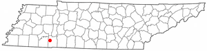
Crump, Tennessee — City — 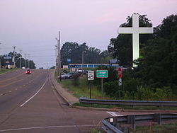 Location of Crump, Tennessee
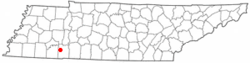
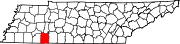
Coordinates: 35°13′57″N 88°20′10″W / 35.2325°N 88.33611°WCoordinates: 35°13′57″N 88°20′10″W / 35.2325°N 88.33611°W Country United States State Tennessee County Hardin Area – Total 14.1 sq mi (36.5 km2) – Land 14.1 sq mi (36.5 km2) – Water 0.0 sq mi (0.0 km2) Elevation 456 ft (139 m) Population (2010) – Total 1,428 – Density 101.3/sq mi (39.1/km2) Time zone Central (CST) (UTC-6) – Summer (DST) CDT (UTC-5) ZIP code 38327 Area code(s) 731 FIPS code 47-18620[1] GNIS feature ID 1281766[2] Crump is a city in Hardin County, Tennessee, United States. The population was 1,428 at the 2010 census.
Contents
Geography
Crump is located at 35°13′57″N 88°20′10″W / 35.2325°N 88.33611°W (35.232480, -88.336037)[3].
According to the United States Census Bureau, the city has a total area of 14.1 square miles (37 km2), of which, 14.1 square miles (37 km2) of it is land and 0.07% is water.
Demographics
As of the census[1] of 2000, there were 1,521 people, 639 households, and 460 families residing in the city. The population density was 107.9 people per square mile (41.7/km²). There were 751 housing units at an average density of 53.3 per square mile (20.6/km²). The racial makeup of the city was 97.96% White, 0.20% African American, 0.53% Native American, 0.20% Asian, 0.13% from other races, and 0.99% from two or more races. Hispanic or Latino of any race were 0.92% of the population.
There were 639 households out of which 27.2% had children under the age of 18 living with them, 60.1% were married couples living together, 8.0% had a female householder with no husband present, and 27.9% were non-families. 25.0% of all households were made up of individuals and 11.4% had someone living alone who was 65 years of age or older. The average household size was 2.38 and the average family size was 2.83.
In the city the population was spread out with 22.5% under the age of 18, 6.7% from 18 to 24, 28.3% from 25 to 44, 26.2% from 45 to 64, and 16.4% who were 65 years of age or older. The median age was 41 years. For every 100 females there were 98.0 males. For every 100 females age 18 and over, there were 93.3 males.
The median income for a household in the city was $29,333, and the median income for a family was $33,179. Males had a median income of $29,897 versus $19,023 for females. The per capita income for the city was $14,700. About 13.4% of families and 15.8% of the population were below the poverty line, including 20.5% of those under age 18 and 21.7% of those age 65 or over.
Education
The Tennessee Technology Center has a location at Crump.[4]
References
- ^ a b "American FactFinder". United States Census Bureau. http://factfinder.census.gov. Retrieved 2008-01-31.
- ^ "US Board on Geographic Names". United States Geological Survey. 2007-10-25. http://geonames.usgs.gov. Retrieved 2008-01-31.
- ^ "US Gazetteer files: 2010, 2000, and 1990". United States Census Bureau. 2011-02-12. http://www.census.gov/geo/www/gazetteer/gazette.html. Retrieved 2011-04-23.
- ^ "Tennessee Technology Center at Crump". Cappex. 2011. http://www.cappex.com/colleges/Tennessee-Technology-Center-at-Crump-221430#quickFacts. Retrieved 19 November 2011.
Municipalities and communities of Hardin County, Tennessee Cities Crump | Savannah
Towns Adamsville‡ | Milledgeville‡ | Saltillo
Unincorporated
communitiesAustin | Belle Meade | Bethlehem | Box Elder | Bruton Branch | Big Ivy | Bucktown | Caney Hollow | Cerro Gordo | Center Star | Centerview | Childers Hill | Counce | Crossroads | Crowtexas | Damon | Five Forks | Gillises Mills | Grandview | Hamburg | Havana | Hinkle | Holiday Hills | Holtsville | Hookers Bend | Hurley | Lebanon | Lowreyville | Maddox | Morris Chapel | New Harmony | New Hope | New Town | Nixon | Oak Grove | Olive Hill | Olivet | Phillips | Pittsburg Landing | Pollards Mill | Pyburn | Red Sulphur Springs | River Heights | Shady Grove | Shiloh | Southside | Stout | Swift | Thompson Crossroads | Walkertown | Walnut Grove | West Hima | Winn Springs
Footnotes ‡This populated place also has portions in an adjacent county or counties
Categories:- Cities in Tennessee
- Populated places in Hardin County, Tennessee

Wikimedia Foundation. 2010.