- Mellette, South Dakota
-
Mellette, South Dakota — City — Location in Spink County and the state of South Dakota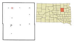
Coordinates: 45°9′14″N 98°29′54″W / 45.15389°N 98.49833°WCoordinates: 45°9′14″N 98°29′54″W / 45.15389°N 98.49833°W Country United States State South Dakota County Spink Incorporated 1908[1] Area – Total 0.3 sq mi (0.7 km2) – Land 0.3 sq mi (0.7 km2) – Water 0 sq mi (0 km2) Elevation 1,296 ft (395 m) Population (2010) – Total 210 – Density 700/sq mi (300/km2) Time zone Central (CST) (UTC-6) – Summer (DST) CDT (UTC-5) ZIP code 57461 Area code(s) 605 FIPS code 46-41860[2] GNIS feature ID 1256431[3] Mellette is a city in Spink County, South Dakota, United States. The population was 210 at the 2010 census.
Geography
Mellette is located at 45°9′14″N 98°29′54″W / 45.15389°N 98.49833°W (45.153970, -98.498336).[4]
According to the United States Census Bureau, the city has a total area of 0.3 square miles (0.78 km2), all of it land.
Mellette has been assigned the ZIP code 57461 and the FIPS place code 41860.
Demographics
As of the census[2] of 2000, there were 248 people, 90 households, and 63 families residing in the city. The population density was 948.7 people per square mile (368.3/km²). There were 99 housing units at an average density of 378.7 per square mile (147.0/km²). The racial makeup of the city was 98.79% White, 0.40% from other races, and 0.81% from two or more races. Hispanic or Latino of any race were 0.40% of the population.
There were 90 households out of which 43.3% had children under the age of 18 living with them, 58.9% were married couples living together, 4.4% had a female householder with no husband present, and 30.0% were non-families. 27.8% of all households were made up of individuals and 15.6% had someone living alone who was 65 years of age or older. The average household size was 2.76 and the average family size was 3.44.
In the city the population was spread out with 35.5% under the age of 18, 5.6% from 18 to 24, 26.2% from 25 to 44, 18.1% from 45 to 64, and 14.5% who were 65 years of age or older. The median age was 34 years. For every 100 females there were 100.0 males. For every 100 females age 18 and over, there were 107.8 males.
The median income for a household in the city was $34,107, and the median income for a family was $34,500. Males had a median income of $30,521 versus $19,375 for females. The per capita income for the city was $11,467. About 10.9% of families and 12.6% of the population were below the poverty line, including 9.9% of those under the age of eighteen and 28.6% of those sixty five or over.
References
- ^ "SD Towns". South Dakota State Historical Society. http://history.sd.gov/Archives/forms/exhibits/SD%20Towns.pdf. Retrieved 2010-02-14.
- ^ a b "American FactFinder". United States Census Bureau. http://factfinder.census.gov. Retrieved 2008-01-31.
- ^ "US Board on Geographic Names". United States Geological Survey. 2007-10-25. http://geonames.usgs.gov. Retrieved 2008-01-31.
- ^ "US Gazetteer files: 2010, 2000, and 1990". United States Census Bureau. 2011-02-12. http://www.census.gov/geo/www/gazetteer/gazette.html. Retrieved 2011-04-23.
Municipalities and communities of Spink County, South Dakota Cities 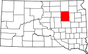
Towns Brentford | Northville | Tulare | Turton
Townships Antelope | Athol | Belle Plaine | Belmont | Benton | Beotia | Buffalo | Capitola | Clifton | Conde | Cornwall | Crandon | Exline | Frankfort | Garfield | Great Bend | Groveland | Harmony | Harrison | Jefferson | Lake | La Prairie | Lincoln | Lodi | Mellette | Northville | Olean | Prairie Center | Redfield | Richfield | Spring | Summer | Tetonka | Three Rivers | Tulare | Turton | Union
Categories:- Cities in South Dakota
- Populated places in Spink County, South Dakota


Wikimedia Foundation. 2010.