- Marvin, South Dakota
-
Marvin, South Dakota — Town — Location in Grant County and the state of South Dakota
Coordinates: 45°15′37″N 96°54′45″W / 45.26028°N 96.9125°WCoordinates: 45°15′37″N 96°54′45″W / 45.26028°N 96.9125°W Country United States State South Dakota County Grant Incorporated 1917[1] Area – Total 0.5 sq mi (1.4 km2) – Land 0.5 sq mi (1.4 km2) – Water 0 sq mi (0 km2) Elevation 1,644 ft (501 m) Population (2010) – Total 34 – Density 68/sq mi (24.3/km2) Time zone Central (CST) (UTC-6) – Summer (DST) CDT (UTC-5) ZIP code 57251 Area code(s) 605 FIPS code 46-41220[2] GNIS feature ID 1256341[3] Marvin is a town in Grant County, South Dakota, United States. The population was 34 at the 2010 census.
Contents
Geography
Marvin is located at 45°15′37″N 96°54′45″W / 45.26028°N 96.9125°W (45.260146, -96.912613),[4] in the headwaters region of the Whetstone River.
According to the United States Census Bureau, the town has a total area of 0.5 square miles (1.3 km2), all of it land.
Marvin has been assigned the ZIP code 57251 and the FIPS place code 41220.
Demographics
As of the census[2] of 2000, there were 66 people, 19 households, and 9 families residing in the town. The population density was 121.6 people per square mile (47.2/km²). There were 28 housing units at an average density of 51.6 per square mile (20.0/km²). The racial makeup of the town was 84.85% White, 13.64% Native American, and 1.52% from two or more races.
There were 19 households out of which 21.1% had children under the age of 18 living with them, 26.3% were married couples living together, 10.5% had a female householder with no husband present, and 52.6% were non-families. 47.4% of all households were made up of individuals and 10.5% had someone living alone who was 65 years of age or older. The average household size was 2.21 and the average family size was 3.22.
In the town the population was spread out with 19.7% under the age of 18, 3.0% from 18 to 24, 22.7% from 25 to 44, 28.8% from 45 to 64, and 25.8% who were 65 years of age or older. The median age was 47 years. For every 100 females there were 407.7 males. For every 100 females age 18 and over, there were 430.0 males.
The median income for a household in the town was $17,250, and the median income for a family was $34,375. Males had a median income of $36,250 versus $11,250 for females. The per capita income for the town was $11,405. There were 23.1% of families and 40.2% of the population living below the poverty line, including 52.2% of under eighteens and 57.9% of those over 64.
Religion
Blue Cloud Abbey is a Benedictine monastery located near Marvin.
References
- ^ "SD Towns". South Dakota State Historical Society. http://history.sd.gov/Archives/forms/exhibits/SD%20Towns.pdf. Retrieved 2010-02-14.
- ^ a b "American FactFinder". United States Census Bureau. http://factfinder.census.gov. Retrieved 2008-01-31.
- ^ "US Board on Geographic Names". United States Geological Survey. 2007-10-25. http://geonames.usgs.gov. Retrieved 2008-01-31.
- ^ "US Gazetteer files: 2010, 2000, and 1990". United States Census Bureau. 2011-02-12. http://www.census.gov/geo/www/gazetteer/gazette.html. Retrieved 2011-04-23.
Municipalities and communities of Grant County, South Dakota Cities 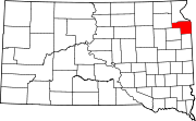
Towns Albee | La Bolt | Marvin | Revillo | Stockholm | Strandburg | Twin Brooks
Townships Indian reservation Footnotes ‡This populated place also has portions in an adjacent county or counties
Categories:- Populated places in Grant County, South Dakota
- Towns in South Dakota


Wikimedia Foundation. 2010.