Dotanang

Dotanang
Dotanang
Dotanang is located in Bhutan
Dotanang
Location in Bhutan
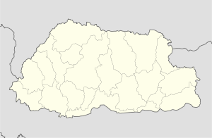
Coordinates: 27°35′N 89°38′E / 27.583°N 89.633°E / 27.583; 89.633Coordinates: 27°35′N 89°38′E / 27.583°N 89.633°E / 27.583; 89.633
Country Flag of Bhutan.svg Bhutan
District Thimphu District
Elevation 2,594 m (8,510 ft)
Time zone GMT +5:30

Dotanang is a village in central-western Bhutan. It is located 6.3 miles (10.1 km) north-west of the capital Thimphu in Thimphu District. It lies at an altitude of 2594 metres (8510 ft).

Nearby settlements include Atsho Chhubar (13.8 miles), Barshong (8.3 miles), Kencho (10.9 miles), Yuwak (13 miles), Punakha (12.6 miles) Thimphu (6.3 miles), Tashi Chho Dzong (6.1 miles), Tshalunang (9 miles).


See also

External links


Wikimedia Foundation. 2010.

Игры ⚽ Поможем решить контрольную работу

Look at other dictionaries:

  • List of cities, towns and villages in Bhutan — An A Z list of settlements in Bhutan. For a list of the main cities and towns see List of cities in Bhutan*Alla *Ama *Bachāp *Balfai *Bali, Bhutan *Barshong *Beteni *Bhangbārai *Bhurgaon *Bioka *Bitana *Bumtang Tang *Buri Chu *Byakar Dzong… …   Wikipedia

  • Yuwak — Infobox Settlement official name = PAGENAME native name = imagesize = image caption = image map caption = pushpin pushpin label position =bottom pushpin mapsize = 300 pushpin map caption =Location in Bhutan subdivision type = Country subdivision… …   Wikipedia

  • Tshalunang — Infobox Settlement official name = PAGENAME native name = imagesize = image caption = image map caption = pushpin pushpin label position =bottom pushpin mapsize = 300 pushpin map caption =Location in Bhutan subdivision type = Country subdivision… …   Wikipedia

Share the article and excerpts

Direct link
Do a right-click on the link above
and select “Copy Link”