- Muzaffargarh
-
Muzaffargarh Location in Pakistan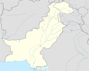
 Muzaffargarh
Coordinates: 30°12′0″N 71°25′0″E / 30.2°N 71.416667°ECoordinates: 30°12′0″N 71°25′0″E / 30.2°N 71.416667°E Country  Pakistan
Region Punjab District Muzaffargarh District Number of Tehsil 4 Union councils 5 Government[1][2] – Nazim --------------- – Naib nazim Area – Total 8,435 km2 (3,256.8 sq mi) Elevation 122 m (400 ft) Population (2010)[citation needed] – Total 3,504,000 Time zone PST (UTC+5) – Summer (DST) PDT (UTC+6) Area code(s) 066 Website www.mugarh.com/ Muzaffargarh (Punjabi, Urdu: مظفر گڑھ) is a city in southwestern Punjab, Pakistan, located on the bank of the Chenab River. The Town of Muzaffargarh was founded in 1794 by the Governor of Mulran Nawab Muzaffar Khan.The Meaning of Muzaffargarh is "Fort of Muzaffar" because the old town lies inside the walls of a fort built by Nawab Muzaffar Khan of Multan.Prior to that the place was known by a shop called "Musan Hatti",on the road leading from Multan to Dera Ghazi Khan.In 1859 the headquarters were moved to Muzaffargarh. It is the chief city of Muzaffargarh District.[3] The city was founded in the sixteenth century. In 1864 it became the headquarters of Muzaffargarh District.[4] Muzaffargarh spreads over an area of 8,435 km² and it forms a strip between the river Chenab on its east and Indus river on its West. Muzaffargarh is one of oldest districts of Punjab. The city is famous for sweet mangoes and nuts. Wheat, Cotton and Sugarcane are major crops of this area.
Muzaffargarh was especially hard hit by the 2010 Pakistan floods, given its position between the Chenab and Indus rivers.[5]
Contents
Geography and climate
Muzaffargarh Climate chart (explanation) J F M A M J J A S O N D 7.22159.52382029141336209.840241242296139293338281137251.735182.329116.9236Average max. and min. temperatures in °C Precipitation totals in mm Source: World Meteorological Organization Imperial conversion J F M A M J J A S O N D 0.370400.474460.883560.596670.4105760.5108832.4103841.3100820.499770.194650.183520.37342Average max. and min. temperatures in °F Precipitation totals in inches The city of Muzaffargarh is located in southern Punjab province at almost the exact centre of Pakistan. The closest major city is Multan. The area around the city is a flat, alluvial plain and is ideal for agriculture, with many citrus and mango farms. There are many canals that cut across the Muzaffargarh District, providing water from nearby farms. This makes the land very fertile. However usually land close to the Chenab are usually flooded in the monsoon season.
Muzaffargarh features an arid climate with very hot summers and mild winters. The city witnesses some of the most extreme weather in the country. The highest recorded temperature is approximately 54 °C (129 °F), and the lowest recorded temperature is approximately −1 °C (30 °F). The average rainfall is roughly 127 millimetres (5.0 in). Dust storms are a common occurrence within the city.
Demographics
The majority of Muzaffargarh's residents speak Saraiki, while Haryanvi is the second most spoken language. A good portion of the people are conversant in Urdu. English is understood by the educated. The majority of the people are Muslims. However, the city does have significant Sikh and Hindu communities within the district.
Muzaffargarh has traditionally been a melting pot of several distinct ethnic groups due to its location at the intersection of all four of Pakistan's main provinces and due to its historical significance as a centre of learning and culture. As a result, Multan today consists of Saraiki, Haryanvi, Punjabi, Baloch, Pashtun, Sindhi, and Urdu-speaking Muhajirs who arrived at the time of independence in 1947.
As per the 1998 census of Pakistan, the following are the demographics of the district, by spoken language:
- Saraiki: 70.58 (54.23% in the city)
- Haryanvi: 14.59% (11.01% in the city)
- Punjabi: 7.14% (25.13% in the city)
- Urdu: 5.86% (6.64% in the city)
- Pashto: 0.62%
- Balochi: 0.10%
- Sindhi: 0.07%
- Other: 1.04%
Transportation
Muzaffargarh has connections with other cities by a variety of means of transportation. The district has concrete road reaching up to 983.69 km. The district is linked with DG Khan, Layyah and Multan districts through concrete roads. Buses to Multan leave frequently, since it is located closely to the city. There are a variety of buses travelling farther from the city. Many of them are now air-conditioned with a fairly good safety record. The N-5 National Highway connects the city to connect to all parts of Pakistan. The road otherwise, known as GT Road, allows connections to Rawalpindi, Islamabad, Faisalabad, Karachi, Lahore as well as Bahawalpur. Coach services such as Faisal Movers Express, Niazi Express,Khan brothers transport, Nadir flying coach, Punjab Tourism Department, Skyways and New Khan Bus Service are some of the most reliable coach companies operating out of Multan.
Muzaffargarh is connected by rail with all parts of the country and lies on the Branch track between Rawalpindi, Multan, Mainwali and Attock. The main Peshawar-Karachi railway line passes through Multan district.
The people of Muzaffargarh use Multan International Airport because it is nearer to Muzaffargarh and a 25 minute drive. Multan International Airport is an airport situated 10 km away from the city centre of Multan. It is not as large as the other airports in Pakistan, as it operates to cater mainly to the population of Multan, Vehari, Khanewal, Rajanpur, Sahiwal, and Pakpattan to mainly to other points within Pakistan as well as the Middle East. Flight are currently operated by the national flag carrier, Pakistan International Airlines. However, since the growth of air travel within the region, there has been speculated interest from other private carriers. The rise in air-travel has also led to the expansion of the current airport with a new runway and terminal.
Tehsil No. of Unions Alipur 14 Jatoi 16 Kot Addu 27 Muzaffargarh 35 Total 93 Main towns
The district's towns include Khangarh, Rohillanwali, Shaher Sultan, Rangpur, Gujrat, Mehmood Kot, Sinawan, Thatta Gurmani, Daira Din Panah, Chowk Sarwar Shaheed, Shah Jamal, Mahr pur, Baseera, Wasandaywali, Jalwala Pir Amir, Binda Ishaq, Ehsan Pur, Bakaini, Seet Pur Murad Abad, Ghazi Ghaat and Karam Dad Quresh & Douna, Basti Mohany Wala, Basti Daood Shah Wala (Shaher Sultan), Alipur and Jatoi.ada rind wala.
Educational Institutions
Although Muzaffargarh is one of the oldest and largest districts of Pakistan by area and population, it still has only a single campus of Virtual University of Pakistan. The literacy rate is one of the lowest in the country. However, regardless of this hapless scenario, the beacons of light still spread throughout the country from this region through its well-known academic educational institutions at the secondary level. There are many schools and colleges like Govt. College for Boys, Govt. College for Girls, Sardar Kuarey Khan Public Higher Secondary School, The Country School, Dar-e-Arqam, Beacon House School and College, Punjab Group of Colleges, Rise College, The Nelson School, Alla Public School, TEVTA, Govt. Comprehensive Higher Secondary School, Govt. High School, Govt. Normal higher Secondary School for Girls and many more schools and institutions. The famous academies include Superior Science Secondary School, Misali Zikriya Higher Secondary School, Misali Middle School, Rashid Minhas Higher Secondary School, Al-Hasnain Public School Khangarh and Ahsan Public School Basira.
Agriculture
Major Crops
Wheat, sugarcane and cotton are the main crops grown in the district. Rice, jawar, bajra, moong, mash, masoor, ground nuts, maize and oil seeds such as rape / mustard and sunflower are also grown in minor quantities in the district.
Fruits
Mangoes, dates, citrus and pomegranate are the main fruits grown in the district. Dates, jaman, pears, phalsa and bananas are also grown in minor quantities in the district.
Vegetables
Onions, carrots, cauliflower and peas are the main vegetables grown in the district. Ladyfinger, turnips, tomatoes, potatoes, garlic and chillies are also grown in the district in minor quantities.
Forests
An area of 100,864 acres is forested in the district. There is also linear plantation of 1250 A.V. mile the roads/rails/canals in the district. Trees grown in the area are kikar, shisham, millbury, eucalyptus, bamboo and coconut.
Major industries
The district's major industries include cotton ginning and pressing, flour mills, jute textile, oil mills, paper/paperboard articles, petroleum products, polypropylene bags, power generation, readymade garments, solvent extraction, sugar, textile composite and textile spinning.
PARCO
PARCO's Mid-Country Refinery is the country's latest, largest and most complex refinery and employs critical processes involved in refining. Commissioned in the year 2000, PARCO’s 100,000 barrels per day, state-of-the-art Mid-Country Refinery (MCR) at Mahmood Kot in Muzaffargarh, represents about 35% of Pakistan’s refining capacity. It helps substitute import of refined, value-added oil products to the tune of US$ 100 million per year. The MCR mainly processes crude oil of Upper Zakum from Abu Dhabi and light Arabian crude from Saudi Arabia.
KAPCO
Kot Addu Power Company Limited (KAPCO) was incorporated in 1996 with the purpose of contributing economic power to the national grid. KAPCO has shown exceptional results in the area of plant maintenance, availability, quality standards and financial performance. In April 2005 KAPCO was formally listed on all the three Stock Exchanges of Pakistan.
AES Lalpir
Lal Pir (Pvt.) Limited owns and operates Lal Pir Thermal Power station, the most efficient power plant in Pakistan. It is located in Muzaffargarh.
TPS Muzaffargarh
The Thermal Power Station Muzaffargarh consists of 3 oil fired steam operated units of 210 MW, each with provision of adding another 3 units of same or more capacity.
Notable Persons
- Prof. Dr. Shoaib Attique
- Dr. Sjaad Haider Parvaiz (writer)
- Tauqeer nasir (actor)
- Mohammad Sohail Karim Hashmi, Secretary PM&DC.
- Prof. Khalil-ur-rehman Farooqi
- Dr. Amjad Farooq (PhD nuclear physics)
- Khalid Qureshi, Commander Special Investigation Group, Current DIG FIA.
Mr.Chaudhary Pervez Akhter(Asian Construction Company)
Administration
The district is administratively divided into the following four tehsils (subdivisions), which contain a total of 93 Union Councils:[6]
Tehsil No. of Unions Alipur 14 Jatoi 16 Kot Addu 27 Muzaffargarh 35 Total 93 Main towns
The district's towns include Khangarh,Rohillanwali, Shaher Sultan, Rangpur, Gujrat,Budh, Mehmood Kot, Sinawan, Thatta Gurmani, Daira Din Panah, Chowk Sarwar Shaheed, Shah Jamal,Mahr pur, Baseera, Wasandaywali, Jalwala Pir Amir,Binda Ishaq, Ehsan Pur, Bakaini, Seet Pur Murad Abad, Ghazi Ghaat and Karam Dad Quresh & Douna alipur and jatoi
Educational Institutions
Although Muzaffar Garh is one of the oldest and largest districts of Pakistan by area and population but still it does not have even a single university. The literacy rate is one of the lowest in the country. However regardless of this hapless scenario, the beacons of light still spread throughout the country from this region through its well-known academic educational institutions at the secondary level. The famous academies include Superior Science Secondary School, Misali Zikriya Higher Secondary School, Misali Middle School,Abdalian Higher Secondary Scool,Shakir Science Academy,Sir Syed Inter Science college,Alipur www.facebook.com/SSISCAliPur, Rashid Minhas Higher Seconadry School, Al-Hasnain Public School Khangarh and The Educators Iqbal campus.
References
- ^ [1]
- ^ Area reference
Density reference - ^ Tehsils & Unions in the District of Muzaffargarh - Government of Pakistan
- ^ District Profile: Southern Punjab- Muzaffargarh
- ^ http://blogs.oxfam.org/en/blog/10-08-16-muzaffargarh-pakistan-caught-between-two-rivers
- ^ Tehsils & Unions in the District of Muzaffargarh - Government of Pakistan
External links
Divisions of Pakistan Balochistan KP Punjab Bahawalpur · Dera Ghazi Khan · Faisalabad · Gujranwala · Lahore · Multan · Rawalpindi · Sahiwal · SargodhaSindh Categories:- Muzaffargarh District
- Punjab, Pakistan geography stubs

Wikimedia Foundation. 2010.