- Maptitude
-
Maptitude 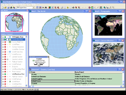
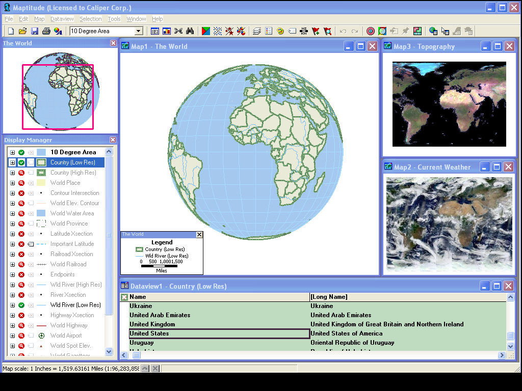
Developer(s) Caliper Corporation Stable release 5.0 / January 29, 2008 Operating system Microsoft Windows Type Mapping Software, GIS, GIS software Website Caliper Mapping Software Home Maptitude is a mapping software program created by Caliper Corporation that allows users to view, edit and integrate maps. The software and technology are designed to facilitate the geographical visualization and analysis of either included data or custom external data.
Maptitude is intended for business users but competes at all levels of the GIS market in many different sectors. It encapsulates the core GIS functionality of the Caliper mapping software suite of products, and integrates with Microsoft Office, data mapping from various sources including Microsoft Excel, and includes a proprietary BASIC-like programming language (Caliper Script) within a development interface (GISDK) that allows automation of the Maptitude environment.
The Caliper technology is used in the following end-user desktop software:
- Maptitude (for international users, with a primary market in the USA, but with tailored add-ons for the U.K., Canada, Australia, and New Zealand)
- Maptitude for Redistricting (for redistricting professionals)
- Maptitude for Precinct and Election Management (for county and state election offices)
- Political Maptitude (for political campaign strategists) [Discontinued in 2008]
- TransCAD (for transportation professionals)
- TransModeler (for traffic simulation)
The Caliper technology is also used in the following web-based software:
- Maptitude for the Web
- TransCAD for the Web
The Web development platform uses application source code that can be edited using Javascript, HTML and ASP.NET. Application templates (Mapplications) are used to create a web application or service. The default templates include Ajax applications and mashups that use Google Maps via the Google Map API.
Contents
Product history
The standard Maptitude product is typically released every year as both an upgrade and as a full packaged product; the current version is 6.0. Maptitude, which was first released as Maptitude 3.0 in 1995,[1] and numbered to agree with TransCAD 3.0, the first Microsoft Windows version of that software. The Community 2020 edition was released in 1997[2][3][4], a product developed for the U.S. Dept. of Housing and Urban Development (HUD). Maptitude 4.0 was released later that same year (1997)[5] and subsequent versions included 2000 U.S. Census data and additional capabilities.[6] Version 5.0, was released on January 29, 2008.[7] The MAF/TIGER Partnership Software (MTPS) edition was released in 2008[8][9], a product developed for the U.S. Census Bureau. Version 6.0, the current version, was released in late 2010 as a beta. A final release of Maptitude 6.0 will include the 2010 US Census Data as well as ACS demographics.
- Maptitude 3.0, initial release as a commercial product
- Community 2020, for the U.S. Department of Housing and Urban Development
- Maptitude 4.0, significantly updated features
- Maptitude 4.1, first version with 2000 US Census Data
- Maptitude 4.2, first version to include the GISDK rather than offer it as an option
- Maptitude 4.5, significantly updated features
- Maptitude 4.6, very similar to 4.5; more of a Census data update
- Maptitude 4.7, new features and data
- Maptitude 4.8, first version to support aerial photo downloads
- Maptitude 5.0, major release
- MTPS, for the U.S. Census Bureau[10]
- Maptitude 6.0, Early Release (Beta)
New versions have sometimes been released before the equivalent TransCAD releases, and have been identically numbered, but recent versions have always followed the release date of the TransCAD software. The program's icon and toolbars were updated in version 5.0 to be consistent with modern software applications.
Version 6.0 is planned for final release in mid-2011, although no additional information is available at this time.
The software is available for Microsoft Windows.
See also
- TransModeler Traffic simulation mapping software
- Caliper Corporation
References
- ^ Maptitude offers unbeatable mapping value for Windows (InfoWorld)
- ^ http://spatialnews.geocomm.com/reviews/comm2020.html
- ^ http://www.hud.gov/nofa/suprnofa/sprprt3b.cfm
- ^ http://findarticles.com/p/articles/mi_m0EIN/is_1996_Oct_14/ai_18763378
- ^ Mapping the world with GIS wares
- ^ http://www.caliper.com/PDFs/Online-Mapping%20Solutions.pdf
- ^ GISCafe Weekly : GIS Aptitude with Maptitude 5.0 - February 11, 2008
- ^ http://www.census.gov/geo/www/luca2010/maf_tgr_sftware.html
- ^ http://www.caliper.com/Press/pr092506.htm
- ^ http://www.census.gov/rdo/pdf/MTPS_INSTRUCTIONS.pdf
External links
- Caliper Mapping Software - official website
- New features of Maptitude 5.0 - A user review of new features of Maptitude 5.0
- Maptitude Discussion Group
- Maptitude News - News & Press
Categories:- GIS software
Wikimedia Foundation. 2010.