- Muggins Mountains
-
For the wilderness area, see Muggins Mountains Wilderness.
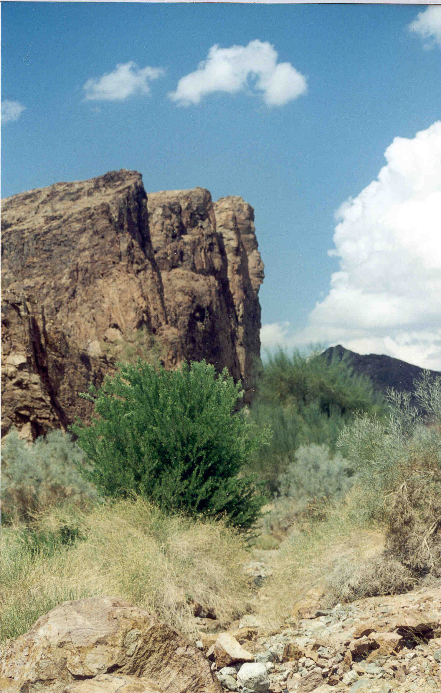
Muggins Mountains Mountain Range  Morgan Peak in the Muggins Mountains
(peak in the distant background)
Foreground-base of mountains-adjacent cliffs of wash; in view: gray-green Psorothamnus, deep-green Acacia greggii-(Catclaw), Blue Palo Verdes, and straw-colored Bebbia junceasCountry United States State Arizona Highest point unnamed - elevation 1,908 ft (582 m) The Muggins Mountains is a mountain range in southwest Arizona east of Yuma, Arizona, northeast of the Gila Mountains (Yuma County), and east of the Laguna Mountains. It contains a wilderness area with the same name.
Contents
Description of Dome Valley and the range
The Muggins Range is part of a three range mountain complex at the confluence of the Colorado and Gila Rivers, bordering the Gila River Valley. A small circular range-(7 mi diameter), the Laguna Mountains (Arizona) abuts the Colorado River and southeastern California's Chocolate Mountains-(containing the Little Picacho Wilderness on the Colorado River across from the Gila Mountains). The north end of the Gila mountains forces the Gila River to run, northwest-west-southwest to meet the Colorado River.
The Muggins Mountains are a triangular block of peaks, with a trending northwest-southeast flank on the southwest that abuts the Gila River as it drains northwest through Dome Valley. The opposite side of the valley is the same ridgeline block faulting, but on the northeast corner of the Gila Mountains.
Muggins Mountains
The Muggins Mountains is a triangular block about 13 miles (21 km) per side. The northern half of the mountain range has the two high peaks of the range: the unnamed northwest at 1,908 feet (582 m)-(the highest point of the range, by 3 feet (1 m)), and the northeast, Red Bluff Mountain at 1,905 feet (581 m); this northern half is part of the southern border of the US Army Yuma Proving Ground.
The southern portion of the Muggins Mountains completes this triangular mountain block, (and is itself a separate triangular block pointing south), and is bordered on the southeast by the agricultural Mohawk Valley (Arizona) and the Gila River Valley; to the southwest is Dome Valley and the northwest-flowing Gila River agricultural valley. The Muggins Mountains Wilderness is in the southwest and borders Dome Valley; two peaks are located in the wilderness, Muggins Peak at 1,424 feet (434 m) in the southeast, and the Klothos Temple in center, center west, at 1,666 feet (508 m). Morgan Wash flows east on the north of Muggins Peak, then turns southwest towards Dome Valley, and is the southeastern border of the wilderness area. The West Wash-(and actually east) of the Twin Tanks Wash separates Klothos to the northeast from Muggins Peak by a ridgeline; Muggins Wash is southeast and on the northwest side of Muggins Peak.
With the arid southwest Sonoran Desert climate and rocky, rugged terrain, the mountains are formidable climbing areas. There is a flatland, mesas, and hills between the two northern peaks, but are on the Yuma Proving Ground, and over the mountain from southern hiking access routes. Small alluvial fans drain this northern east-west perimeter. The unnamed northwest mountain is separated by the entire southern mountain polygonal block, by a west flowing wash: Vinegaroon Wash. The large visible alluvial fan that drains the central Muggins Mountains by way of Vinegaroon Wash sits on the northwest of the range and can be seen from US 95 4 mi west. The fan spreads north, northwest, and west.
Three washes drain the southwest and the Muggins Mountains Wilderness: Twin Tanks Wash in the northwest, Muggins Wash, and Morgan Wash the southeast wilderness border; all drain southwest into the northeast Dome Valley foothills. Muggins Wash is the access route to the wilderness, by way of road, County 7th Street.
Ephemeral water sources only persist in winter-spring and should be considered nonexistent, except during rains, or winter, and standing water only lasts the longest in wetter and cooler years. The elevation of the mountains is such that there are no standing forests, only desert communities of vegetation. This section of the western Sonoran Desert, and local Yuma Desert is in the "Creosote Bush scrub community". Desert Ironwood, palo verde, catclaw acacia, saguaros, ocotillo, Anderson thornbush, Smoketree (Psorothamnus), and creosote are some locally adapted tree/bush species. Brittlebush, saltbush, and Bebbia are some common shrub forms.
Communities near Muggins Mountains
The nearest communities to the Muggins Mountains are Dome, Ligurta, and Wellton in the Dome and Mohawk Valleys. Yuma, and the Fortuna Foothills are west and beyond the Gila Mountains.
See also
- List of mountain ranges of Yuma County, Arizona
- List of mountain ranges of Arizona
- List of LCRV Wilderness Areas (Colorado River)
- Muggins Mountains Wilderness
- Muggins Mountains Wilderness flora
External links
- BLM Muggins Mountains Wilderness site
- Public Lands Muggins Mountains Wilderness site Muggins Mountains map and region: [1]
- Wilderness Preservation System: Muggins "Mountain" Wilderness site
Coordinates: 32°44′42″N 114°12′12″W / 32.7450461°N 114.2032728°W
Categories:- Arizona geography stubs
- Mountain ranges of the Lower Colorado River Valley
- Mountain ranges of the Sonoran Desert
- Mountain ranges of Yuma County, Arizona
- Mountain ranges of Arizona
Wikimedia Foundation. 2010.