Mayals (electoral ward)

Mayals (electoral ward)
Mayals Ward
Wm swansea mayals.jpg
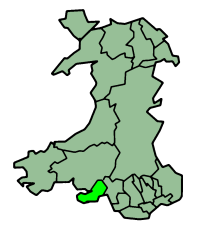
Ordnance Survey
OS grid reference: Maps for SS6190
Geography
Principal locality Mayals
Total population 2,834 (2001 census)
Land area (km²) 4.52 (2001 census)
Administration
Local council: City and County of Swansea
Number of councillors: 1
Nation: Wales
Post office and telephone
Postcode(s): SA3
Dialling code: +44-1792
Politics
Welsh Assembly: Swansea West
UK Parliament: Swansea West
European Parliament: Wales

Mayals is the name of an electoral ward of the City and County of Swansea, Wales, UK. It is also part of the Mumbles Community.

The electoral ward consists of some or all of the following geographical areas: Blackpill, Mayals and part of West Cross, in the parliamentary constituency of Swansea West. It is bounded by the wards of Sketty and Killay South to the north; Swansea Bay to the east; West Cross to the south; and Bishopston and Fairwood to the west.

Description

The populated area of Mayals is a suburb of Swansea. Much of the area consists of an unpopulated Common, which is used for grazing and forms part of Gower Area of Outstanding Natural Beauty. A number of bridleways are available to horse riders and walkers.

Clyne Golf Club, (a moorland 18 Hole Course) is located on Clyne Common which straddles the Mayals and Fairwood, Swansea boundary. Non members require a golf handicap certificate to be able to play.

2008 local council elections

In the local council elections for 2008, the turnout in the Mayals was 42.69%. The results were:

Candidate Party Votes Status
Rene Harwood Kinzett Welsh Conservatives 545 Welsh Conservatives GAIN
Peter Geoffrey Birch Independents@Swansea 465
Juliet Anne Fortey Labour 190

External links


Coordinates: 51°35′30″N 4°00′29″W / 51.59165°N 4.00797°W / 51.59165; -4.00797


Wikimedia Foundation. 2010.

Игры ⚽ Поможем написать реферат

Look at other dictionaries:

  • Sketty (electoral ward) — Infobox swansea electoral ward Electoral Ward = Sketty Ward Ward GridReference = SS6293 Principal Locality = Sketty Total Population = 13,799 (2001 census) Land Area = 6.87 (2001 census) Local Council = City and County of Swansea NoofCouncillors …   Wikipedia

  • Bishopston (electoral ward) — Infobox swansea electoral ward Electoral Ward = Bishopston ward Ward GridReference = SS6593 Principal Locality = Bishopston Total Population = 3,341 (2001 census) Land Area = 5.89 (2001 census) Local Council = City and County of Swansea… …   Wikipedia

  • Morriston (electoral ward) — Morriston Ward Ordnance Survey OS grid reference: Maps for SS6698 Geography …   Wikipedia

  • Cwmbwrla (electoral ward) — Cwmbwrla Ward Ordnance Survey OS grid reference: Maps for SS6595 Geography Prin …   Wikipedia

  • Cockett (electoral ward) — Cockett Ward Ordnance Survey OS grid reference: Maps for SS6395 Geography Principa …   Wikipedia

  • Mynyddbach (electoral ward) — Mynydd Bach Ward Ordnance Survey OS grid reference: Maps for SS6598 Geography …   Wikipedia

  • Clydach (electoral ward) — Clydach Ward Ordnance Survey OS grid reference: Maps for SS6902 Geography Principa …   Wikipedia

  • Dunvant (electoral ward) — Dunvant Ward Ordnance Survey OS grid reference: Maps for SS5994 Geography Principa …   Wikipedia

  • Mayals — is a suburb of Swansea, Wales. It is located about 3 miles south west of Swansea city centre. It falls within the Mayals ward and the Mumbles community council area (MCC). The ward of Mayals lies within the constituency of Swansea West, the only… …   Wikipedia

  • West Cross (electoral ward) — Infobox swansea electoral ward Electoral Ward = West Cross ward Ward GridReference = SS6189 Principal Locality = West Cross Total Population = 6,475 (2001 census) Land Area = 2.48 (2001 census) Local Council = City and County of Swansea… …   Wikipedia

Share the article and excerpts

Direct link
Do a right-click on the link above
and select “Copy Link”