- Sandy Township, Pennsylvania
Infobox Settlement
official_name = Pagename
settlement_type = Township
nickname =
motto =
imagesize =
image_caption =
image_
mapsize = 250x200px
map_caption = Map of Clearfield County, Pennsylvania highlighting Sandy Township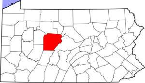
mapsize1 = 250x200px
map_caption1 = Map of Clearfield County, Pennsylvania
subdivision_type = Country
subdivision_name =United States
subdivision_type1 = State
subdivision_name1 =Pennsylvania
subdivision_type2 = County
subdivision_name2 = Clearfield
government_footnotes =
government_type =
leader_title =
leader_name =
leader_title1 =
leader_name1 =
leader_title2 =
leader_name2 =
established_title = Settled
established_date = 1812
established_title1 = Incorporated
established_date1 = 1878
unit_pref = Imperial
area_footnotes =
area_magnitude =
area_total_km2 = 136.7
area_land_km2 = 134.1
area_water_km2 = 1.6
area_total_sq_mi = 52.8
area_land_sq_mi = 51.8
area_water_sq_mi = 1.0
population_as_of = 2000
population_footnotes =
population_total = 11556
population_density_km2 = 86.2
population_density_sq_mi = 223.2
timezone = Eastern (EST)
utc_offset = -5
timezone_DST = EDT
utc_offset_DST = -4
postal_code_type =
postal_code =
area_code = 814
website =
footnotes =Sandy Township is a township in Clearfield County,
Pennsylvania ,United States . The population was 11,556 at the 2000 census.Geography
According to the
United States Census Bureau , the township has a total area of 52.8square mile s (136.7km² ), of which, 51.8 square miles (134.1 km²) of it is land and 1.0 square miles (2.6 km²) of it (1.88%) is water.The township surrounds DuBois, which is the postal address of township residents. Combined, they have a population of nearly 20,000. Several attempts have been made by city and township officials to incorporate the two entities as one, but these attempts have traditionally been met with resistance from residents.
Demographics
As of the
census GR|2 of 2000, there were 11,556 people, 4,387 households, and 3,299 families residing in the township. Thepopulation density was 223.2 people per square mile (86.2/km²). There were 5,028 housing units at an average density of 97.1/sq mi (37.5/km²). The racial makeup of the township was 98.58% White, 0.20% African American, 0.06% Native American, 0.61% Asian, 0.03% Pacific Islander, 0.07% from other races, and 0.46% from two or more races. Hispanic or Latino of any race were 0.45% of the population.There were 4,387 households out of which 31.2% had children under the age of 18 living with them, 65.3% were married couples living together, 6.8% had a female householder with no husband present, and 24.8% were non-families. 21.8% of all households were made up of individuals and 9.2% had someone living alone who was 65 years of age or older. The average household size was 2.50 and the average family size was 2.91.
In the township the population was spread out with 22.8% under the age of 18, 5.5% from 18 to 24, 27.2% from 25 to 44, 25.1% from 45 to 64, and 19.5% who were 65 years of age or older. The median age was 42 years. For every 100 females there were 93.4 males. For every 100 females age 18 and over, there were 89.9 males.
The median income for a household in the township was $42,450, and the median income for a family was $49,013. Males had a median income of $38,185 versus $24,042 for females. The
per capita income for the township was $20,420. About 5.0% of families and 7.2% of the population were below thepoverty line , including 9.3% of those under age 18 and 6.4% of those age 65 or over.chool Districts
DuBois Area School District
References
Wikimedia Foundation. 2010.