- Medicine Lodge Township, Barber County, Kansas
-
Medicine Lodge Township — Township — Location in Barber County
Coordinates: 37°18′50″N 098°33′56″W / 37.31389°N 98.56556°WCoordinates: 37°18′50″N 098°33′56″W / 37.31389°N 98.56556°W Country United States State Kansas County Barber Area – Total 119.75 sq mi (310.15 km2) – Land 119.36 sq mi (309.13 km2) – Water 0.39 sq mi (1.01 km2) 0.33% Elevation 1,512 ft (461 m) Population (2000) – Total 2,573 – Density 21.6/sq mi (8.3/km2) GNIS feature ID 0470490 Medicine Lodge Township is a township in Barber County, Kansas, USA. As of the 2000 census, its population was 2,573.
Contents
Geography
Medicine Lodge Township covers an area of 119.75 square miles (310.2 km2) and contains one incorporated settlement, Medicine Lodge (the county seat). According to the USGS, it contains one cemetery, Highland.
The streams of Albee Creek, Amber Creek, Antelope Creek, Cedar Creek, Elm Creek, Hackberry Creek, Short Creek, Threemile Creek, Walnut Creek and West Branch Little Sandy Creek run through this township.
Transportation
Medicine Lodge Township contains one airport or landing strip, Medicine Lodge Airport.
References
External links
Municipalities and communities of Barber County, Kansas Cities 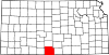
Townships Unincorporated
communitiesCategories:- Townships in Barber County, Kansas
- Kansas geography stubs


Wikimedia Foundation. 2010.