- Muel, Ille-et-Vilaine
-
Muel
Moel
 MuelLocation within Brittany region
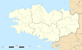 Muel
MuelAdministration Country France Region Brittany Department Ille-et-Vilaine Arrondissement Rennes Canton Saint-Méen-le-Grand Intercommunality Pays de Saint-Méen-le-Grand Mayor Marcel Minier
(2008—2014)Statistics Elevation 45–133 m (148–436 ft) Land area1 28.90 km2 (11.16 sq mi) Population2 648 (1999) - Density 22 /km2 (57 /sq mi) INSEE/Postal code 35201/ 35290 1 French Land Register data, which excludes lakes, ponds, glaciers > 1 km² (0.386 sq mi or 247 acres) and river estuaries. 2 Population without double counting: residents of multiple communes (e.g., students and military personnel) only counted once. Coordinates: 48°07′41″N 2°09′21″W / 48.1281°N 2.1558°W
Muel (Breton: Moel, Gallo: Muèu) is a commune in the Ille-et-Vilaine department of Brittany in north-western France.
Contents
Geography
The river Meu flows from west to east through the commune.
Demographics
Historical population of Muel, Ille-et-Vilaine
(Source : INSEE[1])1962 1968 1975 1982 1990 1999 773 928 803 709 653 648 From the year 1962 on: population without double counting—residents of multiple communes (e.g. students and military personnel) are counted only once. See also
References
External links
Categories:- Communes of Ille-et-Vilaine
- Ille-et-Vilaine geography stubs


Wikimedia Foundation. 2010.