- Shire of Bass
Infobox Australian Place | type = lga
name = Shire of Bass
state = vic
region =
area = 526
est = 1871
seat = Archies Creek
pop = 5170 (1992) [cite book|title=Victorian Year Book|author=Australian Bureau of Statistics, Victoria Office|year=1994|page=49-52|id=ISSN 0067-1223]
logosize =
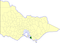
caption = Location in Victoria
county = Mornington
near-nw = "Western Port "
near-n = Cranbourne
near-ne = Korumburra
near-w = Phillip Island
near-e = Korumburra
near-sw = "Bass Strait "
near-s = "Bass Strait "
near-se = Wonthaggi (B) Woorayl
_noautocat = yesThe Shire of Bass was a Local Government Area located about convert|120|km|mi|0 south-southeast of
Melbourne , the state capital of Victoria,Australia . The shire covered an area of convert|526|km2|sqmi|1, and existed from 1871 until 1994. Its administrative centre was located in Archies Creek.History
Bass was first incorporated as the Phillip Island District on 8 September 1871, and became the Shire of Phillip Island and Woolamai on 24 December 1874. When the Phillip Island Riding was severed on 19 September 1928, its name changed to simply Shire of Woolamai, and finally Bass on 8 January 1929. It was reduced and redefined in 1977, including the loss of North Wonthaggi to the
Borough of Wonthaggi .cite book|title=Victorian Municipal Directory|year=1992|publisher=Arnall & Jackson|location=Brunswick|pages=592-593 Accessed atState Library of Victoria , La Trobe Reading Room.]The shire area covered the majority of the mainland of the currently existing
Bass Coast Shire except for the areas of Wonthaggi, Inverloch, some of the areas south of Korumburra and some of the coastline southwest of The Gurdies. The shire area spanned from the tiny township of The Gurdies (located approximately convert|90|km|mi|0 south of Melbourne on the Bass Highway) to Dalyston while the northern parts spanned to around Kernot, Almurta, Glen Forbes and other areas northwest of Inverloch.On 2 December 1994, the Shire was abolished, and merged with
Shire of Phillip Island ,Borough of Wonthaggi and parts of Cranbourne, Korumburra and Woorayl into theBass Coast Shire . [cite book|url=http://www.ausstats.abs.gov.au/ausstats/free.nsf/0/76E601D6DB55E88ACA25722500049195/$File/12570_1994-95.pdf|title=Victorian local government amalgamations 1994-1995: Changes to the Australian Standard Geographical Classification|author=Australian Bureau of Statistics |date=1 August 1995|publisher=Commonwealth of Australia|page=4|isbn=0-642-23117-6|accessdate=2008-01-05]Wards
Bass was divided into three ridings , each of which elected three councillors:
* Bass Valley Riding
* Powlett Riding
* Woolamai RidingTowns and Localities
*Almurta
*Anderson
*Archies Creek
*Bass
*Corinella
*Coronet Bay
*Dalyston
*Glen Alvie
*Glen Forbes
*Grantville
*Kernot
*Kilcunda
*San Remo
*WoolamaiPopulation
* Estimate in the 1958 Victorian Year Book.
References
Wikimedia Foundation. 2010.