- Chalford
-
Coordinates: 51°43′26″N 2°08′57″W / 51.72383°N 2.14907°W
Chalford 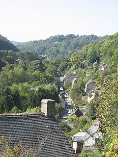
Frome valley showing Chalford High Street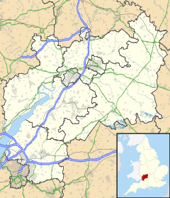
 Chalford
Chalford shown within GloucestershirePopulation 6,628 [1] OS grid reference SO898028 Parish Chalford District Stroud Shire county Gloucestershire Region South West Country England Sovereign state United Kingdom Police Gloucestershire Fire Gloucestershire Ambulance Great Western EU Parliament South West England List of places: UK • England • Gloucestershire Chalford is a village in the Frome Valley of the Cotswolds in Gloucestershire, England. It is about 8 km upstream (4 miles east) of Stroud. It gives its name to Chalford parish, which covers the villages of Chalford, Chalford Hill, France Lynch, Bussage and Brownshill, spread over 2 mi² (5 km²) of the Cotswold countryside. At this point the valley is also called the Golden Valley.[2]
Contents
History
The remains, and known sites, of many barrows indicate that the plateau area of Chalford Hill, France Lynch and Bussage has been an area of continuous settlement for probably at least 4,000 years.[3] Stone Age flints have been found in the area as well as the remains of a Roman Villa. Several of the place names in the area are also Saxon or Danish in origin.
The name Chalford may be derived from Calf (Way) Ford, or possibly from the Saxon cealj or Chalk and the Norman Ford: both possibilities have the same meaning. There were two ancient crossings at Chalford apart from the ford from which the village was named: Stoneford, recorded from the later 12th century, was the crossing-point of a track up Cowcombe hill on the line of the later Cirencester turnpike[4] and by 1413 another track crossed into Minchinhampton by Stephen's bridge at Valley Corner.[5]
Chalford Hill is a recent title for the western end of the hill: Its original name was Chalford Lynch. "Lynch" (lynchet in modern English)[6] means a cultivated terrace following the contours of a hill.
The settling of displaced Flemish Huguenot weavers in the 17th and 18th centuries brought quality silk and woollen cloth manufacturing to the valley. It is thought that they gave their name to the neighbouring village of France Lynch. At this point the Golden Valley is narrow and deep so many weavers' cottages were built clinging to the sides of the hills, giving the village an Alpine air. It is sometimes still referred to as the 'Alpine village'.[7] As the paths on the hillsides were too narrow for more conventional forms of transport donkeys were used to carry groceries and other goods to houses, this tradition continuing until as recently as the nineteen-fifties.[8] Chalford expanded rapidly with the opening of the Thames and Severn Canal in 1789 and the village became one of the centres for the manufacture of broadcloth. Its wealthy clothiers lived close to their mills and built many fine houses which survive to this day.
Architecture
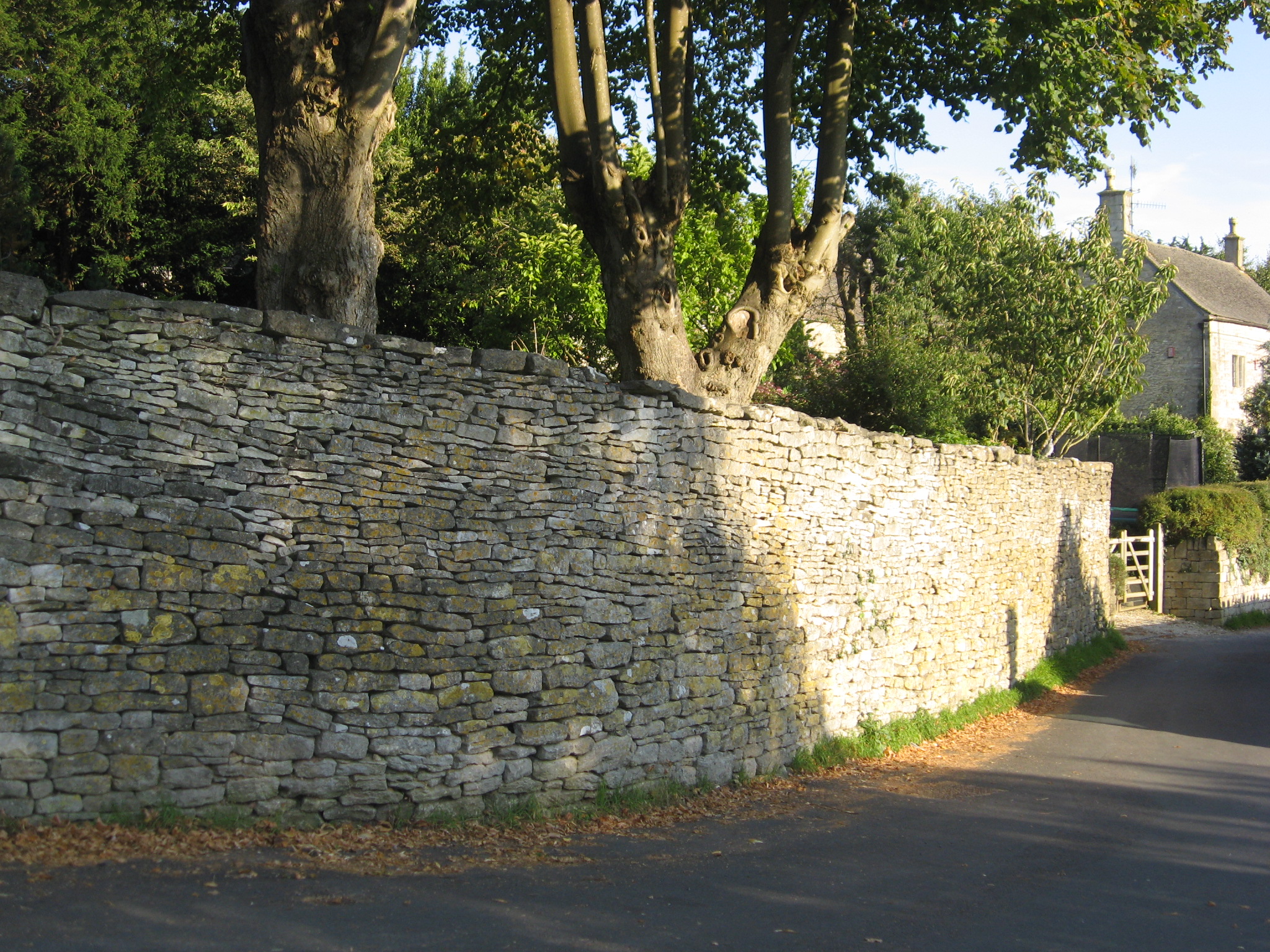
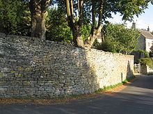 Dry stone wall in Chalford Hill
In common with other towns and villages in the area buildings are generally constructed of Cotswold stone, with local fields enclosed by dry stone walling. The area is designated as an Area of Outstanding Natural Beauty and the village itself is a designated conservation area.
Chalford is noted for two fine Arts and Crafts movement churches. Christ Church (Church of England) contains work by Norman Jewson, William Simmonds, Peter Waals, Edward Barnsley, Norman Bucknell, amongst other distinguished artists and craftsmen working in the Cotswold tradition. The Church of Our Lady of the Angels (Roman Catholic), Brownshill, by W. D. Caroe (1930), contains outstanding stained glass by Douglas Strachan.
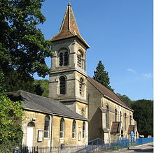 Christ Church, Chalford
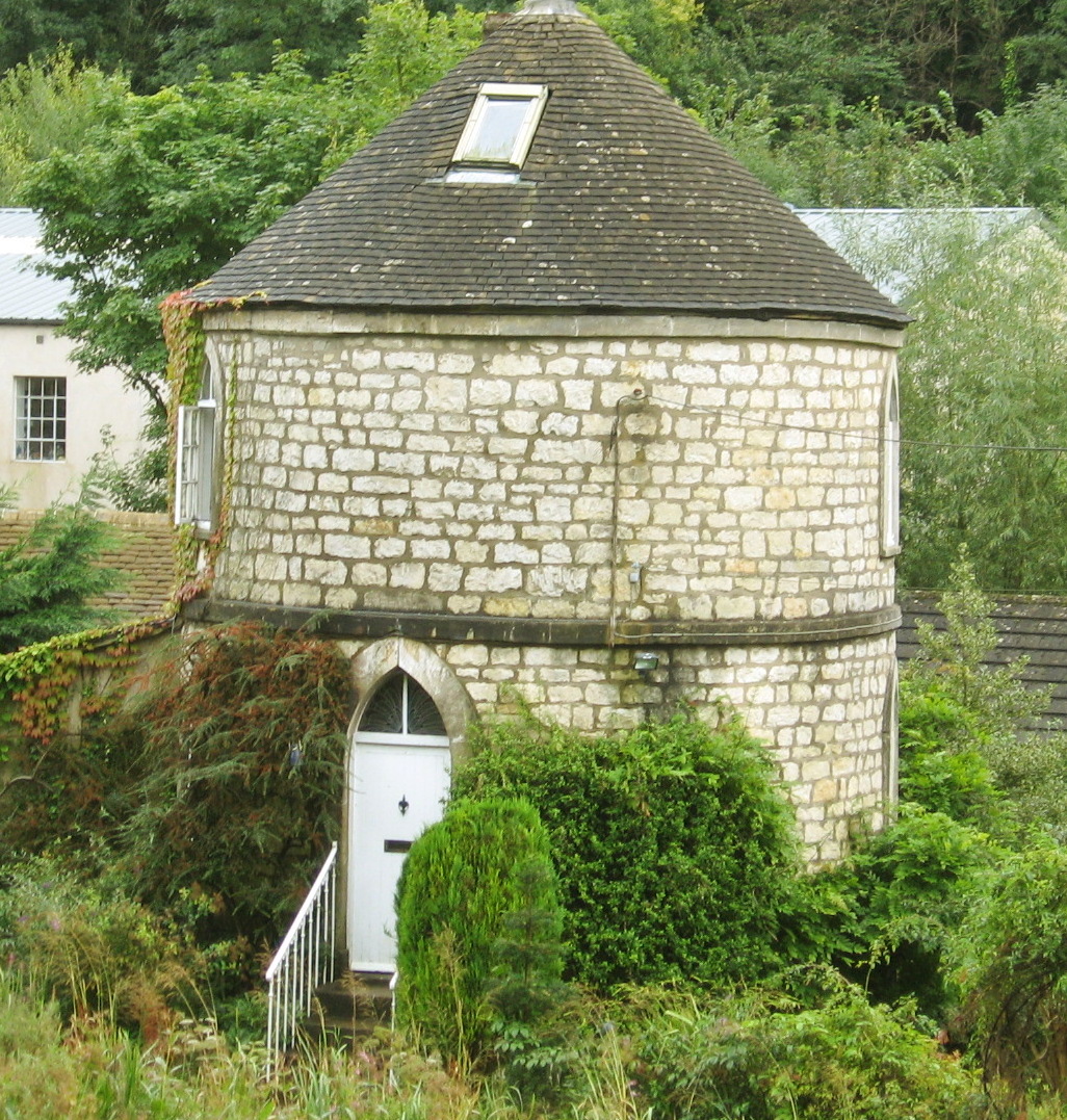
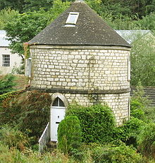 Round house at Chalford
One of the most distinctive, and most photographed, features of the village is the Round House. It was built by the Thames and Severn Canal Company as a lengthman's cottage and is one of five along the Thames and Severn Canal.[9] (The others are at Coates, Cerney Wick, Marston Meysey and Inglesham.) A notable feature is that access is by way of steps up to the first floor as the ground floor would have originally been stabling for a horse. Apart from a relatively short break in the nineteen fifties when it was a museum it has fulfilled its function as a private residence, which it continues to do to this day.
Directly opposite the Round House is Chalford Place, a Grade II* listed building built on the site of the original home of the de Chalkfordes who are mentioned in documents as early as 1240.[9] The house, formerly known as the Companys Arms, is one of the earlier houses in the valley. Built as a mill owner's house it became an inn in the nineteenth century. It owed its name Companys Arms to the East India Company for which the mills of Chalford supplied much of its cloth. It remained an inn until the nineteen sixties, when it reverted to its former name of Chalford Place.[10] The house lay derelict for many years until it was recently purchased and is now being restored by the artist Damien Hurst
Surviving mills in Chalford parish.
- St Mary's Mill
- Clayfields/Ballingers Mill
- Iles Mill
- Belvedere Mill
- Bliss Mills (Bliss, New , Mugmore, Spring and Wood.) Now form Chalford industrial estate.
- Woolings Mill (including Sevilles upper mill.)
- Smart Mill (formerly known as Stoneford, Bidmeads, Hoptons and Halliday Mill.)
- Valley or Morton's Mill
The mill race of Ashmeads Mill remains, mill demolished early 1900s.
Notable former mill owners' houses.
- Brookside
- Belvedere Mill House
- Chalford Place
- Chestnut House (Smarts Mill House)
- Green Court
- Old Valley Inn (formerly Clothier's Arms)
- Sevilles House
- Springfield House
- St Mary's Mill House
- Vale House
Listed buildings[11]
- Grade II* : Chalford Place, St John the Baptist, St Mary's House, Wing Cottage
- Grade II : Baptist Chapel, Church of St Michael and All Angels, Christ Church, France Congregational Church and Hall
Modern Chalford
In February 2008, Chalford hit the headlines when a community plan to reintroduce donkeys as a way of carrying shopping up the steep, narrow hills became public.[12][13][14]
On 5 September 2009 Chalford Community Stores allowed customers to purchase shares in the business. The store, which has been running with the aid of a volunteer workforce since 2003, is now affiliated with the independent organisation Co-operatives UK, making the share issue possible.[15]
Chalford is home to the national literacy charity Readathon.[5]
Residents
Notable residents include James Bradley, the third Astronomer Royal, who died in Chalford in 1762, and the 19th-century sculptor John Thomas. Sir Henry Cooper lived in the village as a child, after being evacuated here during the second world war.[16] The artist Damien Hirst has a studio in the village. Lord Janvrin, former Private Secretary to H.M. the Queen, maintains a house in the village and on his retirement was gazetted as Baron Janvrin of Chalford Hill, on 10 October 2007. The Public Relations guru Mark Borkowski lives at Oakridge.
See also
- Aston Down airfield across the Golden Valley from Chalford
References
- ^ UK 2001 census data, Key statistics for urban areas. Source: KS01 Usual resident population.
- ^ Information Britain
- ^ [1] The Vernacular Architecture and Buildings of Stroud and Chalford : Nigel McCullagh Paterson Pub. Trafford Publishing, 2006 ISBN 1-4120-9951-X,
- ^ http://www.british-history.ac.uk/report.aspx?compid=19016 British History Online
- ^ A History of the County of Gloucester: Volume 11: Bisley and Longtree Hundreds (1976)
- ^ Both forms derive from the Anglo-Saxon hlinc.
- ^ [2] Cotswolds Canal Trust
- ^ Donkey direct: Hilly hamlet brings back beast of burden to carry shopping after 50 years
- ^ a b Chalford Guide. Pub. Chalford Parish Council 1990
- ^ [3] The Vernacular Architecture and Buildings of Stroud and Chalford : Nigel McCullagh Paterson Pub. Trafford Publishing, 2006 ISBN 9781412099516
- ^ Stroud District Council
- ^ Independent newspaper
- ^ Daily Mail
- ^ BBC News
- ^ [4] Residents snap up hundreds of pounds of shares in village shop
- ^ Boxing legend Cooper's Stroud links
External links
Categories:- Villages in Gloucestershire
- Stroud (district)
- Civil parishes in Gloucestershire


Wikimedia Foundation. 2010.