- Rose, New York
-
Rose, New York — Town — Location within the state of New York
 Rose, New York
Coordinates: 43°9′47″N 76°53′13″W / 43.16306°N 76.88694°W Country United States State New York County Wayne Area – Total 33.9 sq mi (87.8 km2) – Land 33.9 sq mi (87.8 km2) – Water 0.0 sq mi (0.0 km2) Elevation 400 ft (122 m) Population (2000) – Total 2,442 – Density 72.1/sq mi (27.8/km2) Time zone Eastern (EST) (UTC-5) – Summer (DST) EDT (UTC-4) ZIP code 14542 Area code(s) 315 FIPS code 36-63605 GNIS feature ID 0979433 Rose is a town in Wayne County, New York, United States. The population was 2,442 at the 2000 census. The town was named after Robert S. Rose, an early landowner of the town.
The Town of Rose is an interior town of the county, located near the county center; it is west of Syracuse, New York.
Contents
History
The town was first settled around 1805. The Town of Rose was created in 1826 from the Town of Wolcott. About 1840 a mass delusion took over the local inhabitants, and they came to believe that a treasure of gold and jewels was buried within the town. In spite of many secret, nocturnal excavations, nothing was ever found.
Geography
According to the United States Census Bureau, the town has a total area of 33.9 square miles (88 km2), of which, 33.9 square miles (88 km2) of it is land and 0.03% is water.
New York State Route 414 is a north-south highway through the town.
Sodus Creek flows northward through the town to Sodus Bay.
Demographics
As of the census[1] of 2000, there were 2,442 people, 894 households, and 661 families residing in the town. The population density was 72.1 people per square mile (27.8/km²). There were 948 housing units at an average density of 28.0 per square mile (10.8/km²). The racial makeup of the town was 96.89% White, 0.61% African American, 0.20% Native American, 0.08% Asian, 0.70% from other races, and 1.52% from two or more races. Hispanic or Latino of any race were 1.43% of the population.
There were 894 households out of which 35.2% had children under the age of 18 living with them, 57.7% were married couples living together, 10.6% had a female householder with no husband present, and 26.0% were non-families. 20.1% of all households were made up of individuals and 9.8% had someone living alone who was 65 years of age or older. The average household size was 2.72 and the average family size was 3.11.
In the town the population was spread out with 28.1% under the age of 18, 7.7% from 18 to 24, 27.6% from 25 to 44, 24.7% from 45 to 64, and 11.9% who were 65 years of age or older. The median age was 37 years. For every 100 females there were 94.0 males. For every 100 females age 18 and over, there were 97.0 males.
The median income for a household in the town was $41,205, and the median income for a family was $46,000. Males had a median income of $34,028 versus $22,167 for females. The per capita income for the town was $16,645. About 4.3% of families and 5.7% of the population were below the poverty line, including 5.8% of those under age 18 and 6.5% of those age 65 or over.
Communities and locations in Rose
- Glenmark (formerly "Glenmark Falls") — A hamlet near the north town line and northwest of North Rose.
- Lockwood Corners — A location in the eastern part of the town, south of Stewart Corners on County Road 253.
- Maunders Corners — A location south of Rose village on NY-414.
- Rose (formerly "Valentine," "Albion," and "Rose Valley") — The hamlet of Rose on NY-414. It was first settled around 1811.
- Rose Center — A former location in the town.
- Stewart Corners — A location near the east town line on County Road 259.
- North Rose (formerly "Lambs Corners") — A hamlet north of Rose village on NY-414. It prospered to the detriment of Rose village because North Rose had a railroad station.
- Wayne Center — A hamlet near the west town line on County Road 251. The name is derived from it location near the center of the county.
References
- ^ "American FactFinder". United States Census Bureau. http://factfinder.census.gov. Retrieved 2008-01-31.
External links
- Early Town of Rose history
- Historical summary of Rose, NY
- Historical links for Rose, NY
- RW&O Railroad, North Rose, NY
Municipalities and communities of Wayne County, New York Towns 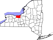
Villages Hamlets Alloway | Angells Corners | Bear Creek | Bonni Castle | Butler Center | Desbrough Park | East Bay Park | East Palmyra | East Williamson | Evans Corner | Fairville | Fairville Station | Fort Hill | Furnace Village | Furnaceville | Gananda | Glenmark | Huddle | Hydesville | Lake Bluff | Lakeside | Lincoln | Lock Berlin | Lummisville | Marbletown | Marengo | Mud Mills | Noble Corner | North Huron | North Macedon | North Wolcott | Ontario-on-the-Lake | Owls Nest | Pilgrimport | Pultneyville | Resort | Rice Mill | Shephards Corner | Sodus Center | South Butler | South Sodus | Sunset View | Thorntons Corner | Union Hill | Wallington | Wayne Center | Wayneport | West Butler | West Walworth | Westbury | Yellow Mills | York | Zurich
Coordinates: 43°09′13″N 76°52′43″W / 43.15361°N 76.87861°W
Categories:- Towns in New York
- Rochester, New York metropolitan area
- Populated places in Wayne County, New York


Wikimedia Foundation. 2010.