- Oakford, Indiana
-
Oakford — Unincorporated community — Approaching the railroad crossing in Oakford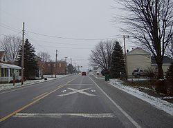

 Oakford
Coordinates: 40°25′09″N 86°06′15″W / 40.41917°N 86.10417°WCoordinates: 40°25′09″N 86°06′15″W / 40.41917°N 86.10417°W Country United States State Indiana County Howard Township Taylor Elevation 860 ft (262 m) ZIP code 46902 FIPS code 18-55584[1] GNIS feature ID 440462[2] Oakford (also called Fairfield[3]) is an unincorporated town in southwestern Taylor Township, Howard County, Indiana, United States. It lies at a railroad crossing of State Road 26, little more than 1 mile (about 2 km) east of State Road 26's intersection with U.S. Route 31.[4]
Oakford is part of the Kokomo, Indiana Metropolitan Statistical Area.
Geography
Oakford is located at 40°25′9″N 86°6′16″W / 40.41917°N 86.10444°W.
References
- ^ "American FactFinder". United States Census Bureau. http://factfinder.census.gov. Retrieved 2008-01-31.
- ^ "Oakford, Indiana". Geographic Names Information System, U.S. Geological Survey. http://geonames.usgs.gov/pls/gnispublic/f?p=gnispq:3:::NO::P3_FID:440462. Retrieved 2009-10-17.
- ^ Geographic Names Information System Feature Detail Report, Geographic Names Information System, 1979-02-14. Accessed 2008-01-07.
- ^ DeLorme. Indiana Atlas & Gazetteer. 3rd ed. Yarmouth: DeLorme, 2004, p. 33. ISBN 0-89933-319-2.
Municipalities and communities of Howard County, Indiana City 
Towns Townships Unincorporated
communitiesAlto | Cassville | Center | Darrough Chapel | Guy | Hemlock | Indian Heights | Jerome | Judson | Kappa Corner | New London | Oakford | Phlox | Plevna | Ridgeway | Shanghai | Sycamore | Vermont | West Liberty | West Middleton
Categories:- Northern Indiana geography stubs
- Populated places in Howard County, Indiana
- Unincorporated communities in Indiana
- Kokomo metropolitan area


Wikimedia Foundation. 2010.