- Shire of Rochester
Infobox Australian Place | type = lga
name = Shire of Rochester
state = vic
region =
area = 1934.25
est = 1864
seat = Rochester
pop = 7900 (1992) [cite book|title=Victorian Year Book|author=Australian Bureau of Statistics, Victoria Office|year=1994|page=49-52|id=ISSN 0067-1223]
logosize =
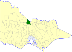
caption = Location in Victoria
county = Bendigo, Gunbower, Rodney
near-nw = Cohuna
near-n = "Murray (NSW)"
near-ne = "Murray (NSW)"
near-w = Gordon
near-e = Deakin
near-sw = East Loddon
near-s = Huntly
near-se = Waranga
_noautocat = yesThe Shire of Rochester was a Local Government Area of Victoria,
Australia , located about convert|190|km|mi|0 north ofMelbourne , the state capital, and immediately west and southwest of the town of Echuca. The shire covered an area of convert|1934.25|km2|sqmi|1, and existed from 1864 until 1994.History
Rochester was once part of the vast Echuca District, incorporated on 19 February 1864 and a Shire from 26 May 1871, which extended along the south bank of the
Murray River from Mount Hope Creek in the west to theOvens River in the east. Despite the name, the district never included Echuca itself, which was formed as a separate Borough in 1865 and became theCity of Echuca a century later.The Shire lost the eastern two-thirds of its area in 1878-1879 with the severances of the Shires of Shepparton and Yarrawonga, but on 10 October 1879 the Shire was added to when a large area was annexed from the
Shire of Waranga . The Moira Ward was annexed to theShire of Nathalia (then known as Numurkah) on 30 May 1892, fixing the boundary between Numurkah and Echuca at theGoulburn River . Following this, the Shire of Deakin, representing the eastern part of what remained, severed from Echuca and incorporated on 20 April 1893.cite book|title=Victorian Municipal Directory|year=1992|publisher=Arnall & Jackson|location=Brunswick|pages=784-785, 814-815, 881-882 Accessed atState Library of Victoria , La Trobe Reading Room.]The western part, still known as the Shire of Echuca, was renamed Rochester on 27 October 1909. On 1 January 1966 and again on 1 February 1976, the City of Echuca annexed land at Rochester's northeastern corner.
On 18 November 1994, the Shire was abolished, and merged with the
City of Echuca , theTown of Kyabram , the Shires of Deakin and Waranga and some neighbouring districts into theShire of Campaspe . [cite book|url=http://www.ausstats.abs.gov.au/ausstats/free.nsf/0/76E601D6DB55E88ACA25722500049195/$File/12570_1994-95.pdf|title=Victorian local government amalgamations 1994-1995: Changes to the Australian Standard Geographical Classification|author=Australian Bureau of Statistics |date=1 August 1995|publisher=Commonwealth of Australia|page=5|isbn=0-642-23117-6|accessdate=2008-01-05]Wards
Rochester was divided into three wards, each of which elected three councillors:
* North Ward
* South Ward
* Rochester WardTowns and Localities
Population
* Estimate in the 1958 Victorian Year Book.
References
Wikimedia Foundation. 2010.