- Shire of McIvor
Infobox Australian Place | type = lga
name = Shire of McIvor
state = vic
region =
area = 1295
est = 1863
seat = Heathcote
pop = 3450 (1992) [cite book|title=Victorian Year Book|author=Australian Bureau of Statistics, Victoria Office|year=1994|page=52|id=ISSN 0067-1223]
logosize =
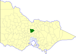
caption = Location in Victoria
county = Dalhousie, Rodney
near-nw = Huntly
near-n = Waranga
near-ne = Goulburn
near-w = Strathfieldsaye
near-e = Goulburn
near-sw = Metcalfe
near-s = Kyneton
near-se = Pyalong
_noautocat = yesThe Shire of McIvor was a Local Government Area located about convert|110|km|mi|0 north of
Melbourne , the state capital of Victoria,Australia . The shire covered an area of convert|1295|km2|sqmi|1, and existed from 1863 until 1994.History
McIvor was first incorporated as a district on 26 June 1863, and became a shire on 23 December 1864.
The Borough of Heathcote was created around the town of Heathcote in August 1869, but was reannexed as the Central Riding on 27 May 1892. Part of the East Riding was annexed to the
Shire of Goulburn on 16 May 1956.cite book|title=Victorian Municipal Directory|year=1992|publisher=Arnall & Jackson|location=Brunswick|pages=778-779 Accessed atState Library of Victoria , La Trobe Reading Room.]On 18 November 1994, the Shire was abolished, with most of its area, including Heathcote, being transferred into the
City of Greater Bendigo . The Graytown district was transferred to theShire of Strathbogie , while the Mia Mia and Tooborac districts became part of theShire of Mitchell . [cite book|url=http://www.ausstats.abs.gov.au/ausstats/free.nsf/0/76E601D6DB55E88ACA25722500049195/$File/12570_1994-95.pdf|title=Victorian local government amalgamations 1994-1995: Changes to the Australian Standard Geographical Classification|author=Australian Bureau of Statistics |date=1 August 1995|publisher=Commonwealth of Australia|page=6,9,11|isbn=0-642-23117-6|accessdate=2008-01-05]Wards
McIvor was divided into four ridings on 16 May 1956, each of which elected three councillors:
* Centre Riding
* East Riding
* North West Riding
* South West RidingTowns and Localities
* Argyle
* Costerfield
* Derrinal
* Glenhope
* Graytown
* Heathcote
* Knowsley
* Mia Mia
* Redcastle
* TooboracPopulation
* Estimate in the 1958 Victorian Year Book.
References
Wikimedia Foundation. 2010.