- Toronto streetcar system
Infobox Public transit
name = Toronto streetcar system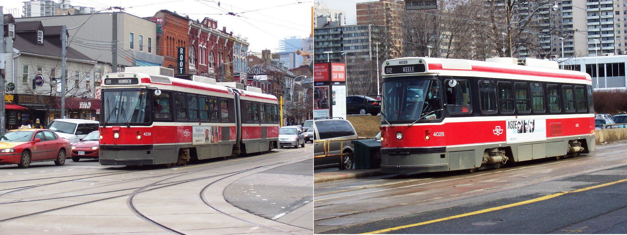
imagesize = 300px
locale =Toronto ,Ontario
transit_type =Streetcar
began_operation = 1861 (electric lines since 1891)
system_length = 305.8 km (190 miles)
lines = 11
stations = 1, plus 8 shared with the subway (all others are on-street stops)
ridership = 328,700
track_gauge = RailGauge|1495|al=on|lk=on
operator =Toronto Transit Commission The Toronto streetcar system comprises eleven streetcar (tram ) routes inToronto ,Ontario ,Canada operated by theToronto Transit Commission (TTC), the municipal public transit operator. Totalling 305.8 kilometres in length, the network is generally concentrated downtown and in proximity to the city's waterfront. Some of the TTC's streetcar routes date back to the 19th century. Unlike newer light rail transit (LRT) systems, most of Toronto's streetcar routes operate in the classic style on street trackage shared with car traffic, and streetcars stop on demand at frequent stops like buses rather than having fixed stations. However, some routes operate (totally or partially) within their own rights-of-way, though they still stop on demand at frequent stops.Before the TTC came into operation in 1921, there were seven distinct transit systems in the city. There were no transfers allowed between them, and so the free transfer has always been a sensitive issue for the TTC. The goal of ease in changing routes has affected the design of the system. There are underground connections between streetcars and the subway at Union, Spadina, and St. Clair West stations, and streetcars enter St. Clair, Bathurst, Broadview, Dundas West, and Main Street stations at street level. At these stations, no proof of payment is required to transfer between streetcars and the subway, as the streetcars have entered the paid area of the stations. Streetcars also pass by the entrances of St. Andrew, King, Osgoode, Queen, St. Patrick, Dundas, Queen's Park, and College - other downtown stations, although proof of payment is required to transfer between streetcars and the subway at these stops, as the streetcars stop outside of the stations themselves at these locations.
Despite the use of techniques long removed in the streetcar networks of other
North America n cities, Toronto’s streetcars are notheritage streetcar s run for tourism or nostalgic purposes; they provide most of the downtown core’s surface transit service, and four of the TTC's five most heavily travelled surface routes are streetcar routes.History
From 1921 as the Toronto Transportation Commission, the TTC began as solely a streetcar operator, with the bulk of the routes acquired from the private
Toronto Railway and merged with the publicly operatedToronto Civic Railways . In 1925, routes were operated on behalf of the Township of York (as Township of York Railway), but they were essentially TTC routes.After
World War II , the TTC began plans to eliminate all streetcar routes, in part because subway development was thought to eliminate the need for them. At the time of major curtailments in streetcar service in 1966 coinciding with the opening of the Bloor-Danforth subway, the TTC foresaw the end of streetcars by 1980. This policy of eliminating streetcar routes was dropped in 1972 in the face of widespread community opposition by citizens' groups who succeeded in persuading the TTC of the advantages of streetcars over buses on heavily travelled main routes.The TTC then maintained most of their existing network, purchasing new custom-designed CLRV and ALRV streetcars.The previous policy of eliminating streetcars and using buses for extensions built as the city developed northward account for the concentration of streetcar lines within five kilometres of the waterfront. The busiest north-south and east-west routes were replaced respectively by the Yonge-University-Spadina and Bloor-Danforth subway lines, and the northernmost streetcar lines, including the North Yonge and Oakwood routes, were replaced by trolley buses (and later by diesel buses).
Two other lines that operated north of
St. Clair Avenue were abandoned for other reasons: the Rogers Road route was abandoned to free up streetcars for expanded service on other routes, and the Mount Pleasant route was removed owing to complaints from drivers that streetcars slowed their cars down, and because the track was ageing and needed to be replaced.Recent Expansion
The TTC returned to building new streetcar routes in 1989, building first a short line from Union Station, travelling underneath Bay Street, and rising to a private centre median on Queen's Quay, running along the edge of
Lake Ontario to the base ofSpadina Avenue . This route was originally numbered 604, but was later renumbered 510 to fit with the numbering scheme of the other streetcar routes. This route was later lengthened northward alongSpadina Avenue , continuing to travel in a private right-of-way in the centre of the street, and ending in an underground terminal at Spadina Station. This new streetcar route replaced the former route 77 Spadina bus, and now provides the main north-south transit service through Toronto's Chinatown. The route along Queen's Quay was extended to Bathurst Street in 2000 to connect to the existing Bathurst route, and take advantage of the newly refurbished Exhibition Loop at the Exhibition grounds. The harbourfront route is now operated as the 509 Harbourfront.carborough RT
The Scarborough RT line was originally proposed to operate with streetcars on a private right-of-way, but the plans were changed when the Ontario government convinced the TTC and the borough of Scarborough to use its then-new Intermediate Capacity Transit System (ICTS) metro trains instead. Another proposed streetcar rapid transit line from Kipling station was abandoned, but the ghost platform at the bus level is a hint of a streetcar line.
Current and Future Expansion
Route 512 St. Clair is now being rebuilt to have a separated right-of-way similar to that of the route 510 on Spadina Avenue, to increase service reliability.
On
March 16 ,2007 , David Miller (the Mayor of Toronto) and the TTC announcedTransit City , a major proposal for a 120-kilometre, $6.1-billion network of new LRT lines that would provide rail transit to underserved suburban areas of the city. As of July 2008, environmental assessments are underway for LRTs on Sheppard Avenue East andDon Mills Road , and for the harbourfront route, including an extension of the route from Exhibition Place toQueen Street West at Roncesvalles Avenue.Routes
The TTC operates 305.8 kilometres or 190 miles of streetcar tracks throughout
Toronto .Route numbers
The TTC has used route numbers in the 500 series for streetcar routes since 1980; before then, streetcar routes were not numbered, but the destination signs on the new CLRVs were not large enough to display both the route name and destination, according to the TTC. The only exceptions today to this numbering scheme are the 301 Queen and 306 Carlton
Blue Night Network routes, which correspond to the regular 501 and 506 routes; there were similarly a 312 St. Clair and a 304 King streetcar, but the St. Clair Blue Night service is now a bus route, while the King service was removed and partially replaced with extensions of other night bus routes.The one other exception to the 500 series numbering was the Harbourfront LRT streetcar. When introduced in 1990, this route was numbered 604, which was intended to group it with the subway/RT routes (although these have no numbers in public use) instead of the other streetcars. In 1996 the TTC stopped trying to market the route as 'rapid transit' and changed the number to 510; the tracks were later extended in two directions to form the 510 Spadina and 509 Harbourfront routes. [cite web|url=http://www.transittoronto.org/streetcar/4107.shtml|publisher=Transit Toronto|first=James|last=Bow|title=Route 509 - The New Harbourfront Streetcar|accessdate=2007-07-21|date=2006-11-10]
During times when streetcar service on all or a portion of a route has been replaced temporarily by buses (e.g., for track reconstruction), the replacement bus service is typically identified by the same route number as the corresponding streetcar line. Shorter-term replacement or supplementary shuttle bus service (e.g., due to a track blockage or short-term street closure) is usually marked simply as 'SPECIAL' on the bus destination sign.
Private rights-of-way
The majority of streetcar routes operate in mixed traffic, generally reflecting the original track configurations dating from the late 19th and early 20th centuries. However, newer trackage has largely been established within private rights-of-way, in order to allow streetcars to operate with fewer disruptions due to delays caused by automobile traffic. Most of the system's private rights-of-way operate within the median of existing streets, separated from general traffic by raised curbs and controlled by specialized traffic signals at intersections. Queen and former Long Branch cars have operated on such a right-of-way along
the Queensway between Humber and Sunnyside loops since 1957. More recently, private rights-of-way have been opened downtown along Queen's Quay,Spadina Avenue , St. Clair Avenue West and Fleet Street.Short sections of track also operate in tunnel (to connect with Spadina, Union, and St. Clair West subway stations). The most significant section of underground streetcar trackage is a tunnel underneath Bay Street connecting Queens Quay with Union Station; this section, which is approximately 0.7 km long, includes one intermediate underground station at Bay Street and Queens Quay.
The TTC is reinstating a separated right-of-way — removed between 1928 and 1935 [http://transit.toronto.on.ca/streetcar/4110.shtml] — on
St. Clair Avenue , fromYonge Street to just pastKeele Street , to be completed by 2008. A court decision obtained by local merchants in October 2005 had brought construction to a halt and put the project in doubt; the judicial panel then recused themselves, and the delay for a new decision adversely affected the construction schedule. A new judicial panel decided in February 2006 in favour of the city, and construction resumed in summer 2006. One third of the St. Clair right-of-way was completed by the end of 2006 and streetcars began using it on February 18, 2007. The portion finished was from St. Clair Station (Yonge St.) toVaughan Road . The second phase started construction in the summer of 2007 from Vaughan Road to Caledonia Road. The third and final phase from Caledonia to Gunns Loop (just west of Keele St.) will be completed by the end of 2008.In 2008, the tracks on Fleet Street between
Bathurst Street and the Exhibition loop were converted to private ROW and opened for the 511 Bathurst and the 509 Harbourfront streetcars. Streetcar track and overhead power line were also installed at the Fleet loop, which is located at the lighthouse [http://transit.toronto.on.ca/streetcar/4155.shtml] .Current streetcar routes
There are currently 11 streetcar routes in
Toronto :
*501 Queen - 301 Queen (Blue Night Network)
*502 Downtowner
*503 Kingston Road
*504 King
*505 Dundas
*506 Carlton - 306 Carlton (Blue Night Network)
*508 Lake Shore
*509 Harbourfront
*510 Spadina
*511 Bathurst
*512 St. ClairThe 512 St. Clair line is currently under reconstruction, building a reserved right-of-way similar to the 510 Spadina. The 508 Lake Shore is a rush-hour only service.
Future expansion
Various plans for future routes include:
* Continuing a route along Kingston Road into Scarborough, then returning alongEglinton Avenue and stopping at Kennedy subway station
* A route eastward along Queen's Quay, into new developments on the port lands
* More coverage and line connections in southern Etobicoke
* Extending 512 St. Clair to Jane subway station
* Extending the Dundas streetcar fromDundas West (TTC) north to Runnymede Loop at Dundas and Runnymede to connect to a westward extended 512 St. Clair
* Converting the 25 Don Mills bus to streetcar operation
* Creating an LRT fromUnion (TTC) along Queens Quay East and Cherry Street to Parliament and possibly extending it toCastle Frank (TTC)
* Several ROW routes in Scarborough along Sheppard, Finch, Lawrence East, Eglinton, Danforth, McCowan, and Kingston Road.The City of Toronto's and the TTC’s
Transit City report [cite web|url=http://transitcity.ca/ |title=Transit City|accessdate=2007-07-21|publisher=City of Toronto] released on March 16, 2007, proposes creating new Light Rail Transit (LRT) lines and Rights-of-Way (ROW) including:
* Don Mills LRT (alongDon Mills Road fromSteeles Avenue to Overlea Boulevard, and continuing to Pape Station along a possible alignment of Overlea Boulevard from Don Mills Road to Millwood Road , continuing adjacent to the Leaside Bridge from Overlea Boulevard to Pape Avenue and along Pape Avenue from Millwood Road to Danforth Avenue)
* Eglinton Crosstown LRT (along Eglinton Avenue from near Renforth Drive to Kennedy Station, with underground operation from Keele Street to approximately Laird Drive)
* Etobicoke-Finch West LRT (alongFinch Avenue West from Yonge Street to Highway 27)
* Jane LRT (alongJane Street from Bloor Street to Steeles Avenue and continuing along Steeles Avenue from Jane Street to Steeles West on the Spadina extension. This line also includes a stub extension of the St. Clair ROW from Gunns Loop to Jane Street)
* Scarborough Malvern LRT (along Eglinton Avenue from Kennedy Station to Kingston Road, continuing along Kingston Road from Eglinton Avenue to Morningside Avenue and along Morningside Avenue from Kingston Road to Finch Avenue)
* Sheppard East LRT (along Sheppard Avenue from Don Mills station to Morningside Avenue, with a connection to an extended Scarborough RT nearMarkham Road )
* Waterfront West LRT (along Lakeshore Boulevard from Long Branch Loop to near the South Kingsway, continuing along the Queensway to King Street, and adjacent to theGardiner Expressway to Exhibition Loop; from Exhibition it will continue to Union station in either its own as yet to be determined alignment, or in the Harborfront West LRT alignment)The Ontario government has in itsMoveOntario 2020 plan, proposed funding approximately 2/3 of the $5.5 billion of the seven Transit City lines, with the expectation that the federal government would fund the remaining 1/3.Abandoned streetcar routes
*507 Long Branch (1928-1995 - merged with 501 Queen in 1996)
*512L Earlscourt (1954-1976)
*521 King Exhibition (1980-2000)
*522 Dundas Exhibition (1980-1986), also operated for a single year in 1995
*604 Harbourfront LRT (1990-2000 - forms part of the present 509 Harbourfront and 510 Spadina routes)
*Belt Line (1891-1923 - original and Tour Tram along Spadina and Sherbourne )
*Bloor, including Danforth Tripper (1890-1966) ("replaced by the Bloor-Danforth subway line")
*Coxwell (1921-1966)
*Dupont/Bay (single line 1926-1965)
*Fort (1931-1966 merged with 511 Bathurst)
*Harbord (1911-1966)
*Oakwood (1922-1960)
*Parliament (1910-1966); one small section forms part of the present 506 Carlton
*Winchester(1910-1924)
*Mount Pleasant (1954-1976)
*Rogers Road (1922-1974)
*Yonge (1873-1954) ("replaced by the Yonge subway line")Toronto Street Railway routes
*St Lawrence Hall-Yorkville (1873-1891)
*Yonge (1873-1891)
*Queen (1873-1891)
*Front (1873-1891)
*Sherbourne (1873-1891)
*Carlton (1873-1891)
*St Lawrence Market-Woodbine (1873-1891)
*Dovercourt-McCaul (1873-1891)
*North Toronto-Union Station (1873-1891)
*King (1873-1891)
*Bloor (1873-1891)
*Spadina (1873-1891)Toronto Railway routes
*Queen-High Park (1891-1921)
*Church (1891-1921)
*Carlton-College (1891-1921)
*Yonge (1891-1921)
*Belt Line (1891-1921)
*Bloor-McCaul (1891-1921)
*Avenue Road (1891-1921)
*Dundas (1891-1921)
*College-Yonge (1891-1921)
*Bathurst (1891-1921)
*Wincester (1891-1921)
*Parliament (1891-1921)
*Broadview (1891-1921)Toronto Civic Railway routes
*Danforth Division (1913-1921)
*Gerrard (1912-1921)
*Bloor West Division (1915-1921)
*St. Clair Division (1913-1921)
*Lansdowne (1917-1921)See also abandoned streetcar routes [http://transit.toronto.on.ca/streetcar/4100.shtml]
Vehicles
Note: Hundreds of cars were acquired from the TTCs predecessor companies, the
Toronto Railway , andToronto Civic Railways , among others. The current fleet operates with 248 vehicles.Work Cars
Lost carhouse
Source: [http://transit.toronto.on.ca/streetcar/4300.shtml The TTC's Active Carhouses]
During the construction of the St. Clair route, streetcars are being parked at three temporary locations:
* out of service cars along
St. Clair Avenue West betweenVaughan Road and Wychwood Avenue
* in service cars at St. Clair Station loop and St. Clair West station.Facilities
The TTC vehicles are serviced and stored at various location throughout the city:
Operator training
A mockup of a CLRV is used to train new streetcar operators is located at Hillcrest. The training simulator consist of an operator cab, front steps and part of the front of a streetcar.
Operators also train with a real streetcar. Front and rear rollsigns on the vehicle will identify it as a training car.
tatistics
* The TTC still has a blacksmith employed to make specialized parts for the overhead wires used by the streetcars.
* The lights, or bullseyes, over the route sign on today's CLRV and ALRV, are relics of the past streetcars in Toronto. Before lighted route signs, single green and red lights on the front and back of the cars allowed people waiting for streetcars at night to tell which direction a car in the distance was travelling.
* The streetcars (and subway trains) are powered with 600 volts DC.
* To reduce friction noise of wheels on tracks on curved sections of track, water is piped into the tracks; if oil were used for lubrication, it would destroy the tires of cars that drive over the tracks.
* Sand is used for the brakes for extra traction; a passenger might notice spilled sand on the streetcar floors near the front of the car.
* Eglinton West station features an artwork called "Summertime Streetcar" by Gerald Zeldinwith, which consists of two enamel murals depictingPCC streetcar s facing each other, although these streetcars never served this station.References
*cite news|first=Jeff|last=Gray|url=http://www.theglobeandmail.com/servlet/ArticleNews/TPStory/LAC/20050623/TTC23/TPNational/Toronto|title=TTC to shop for new streetcars|publisher=
The Globe and Mail |date=2005-06-23
*cite web|url=http://www.ttc.ca/postings/gso-comrpt/documents/report/f2473/_conv.htm|title=Future Streetcar Fleet Requirements and Plans|publisher=Toronto Transit Commission|date=2005-06-22
*cite web|first=Christopher|last=Livett|url=http://www.transit.toronto.on.ca/archives/maps/scroute.gif|title=Toronto's Streetcar System (schematic track map)|publisher=Transit Toronto
*cite web|format=PDF|url=http://www.toronto.ca/ttc/pdf/opportunities_for_new_streetcar_routes.pdf|title=Opportunities for New Streetcar Routes|publisher=Toronto Transit Commission|date=1997-01-21ee also
*
Toronto Transit Commission
*Toronto buses and trolley buses
*Toronto subway and RT
*Toronto PCCs
*Queen's Quay-Ferry Docks (TTC)
*Lower Queen
*Scarborough RT (TTC)
*Transit City External links
* [http://www.ttc.ca/ Toronto Transit Commission]
* [http://www.transitcity.ca/ TTC Transit City - LRT expansion proposals]
* [http://www.mynewstreetcar.ca TTC's web site for its new vehicle procurement programme]
* [http://www.combinoplus.ca Siemens's proposal for Toronto's new streetcar fleet]
* [http://transit.toronto.on.ca/streetcar/index.shtml Transit Toronto Streetcar Pages]
* [http://lrt.daxack.ca The Toronto LRT Information Page]
* [http://cfaj.freeshell.org/ttc/ TTC Schedules by Route Name]
* [http://www.pccmph.com/toronto.html Pictures of old Toronto streetcars, mostly from the 1960s and 1970s.]
Wikimedia Foundation. 2010.