- Dimbach, Austria
-
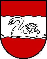
Dimbach 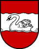
 Dimbach
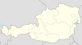
Country Austria State Upper Austria District Perg Mayor Josef Wiesinger (ÖVP) Area 31.4 km2 (12 sq mi) Elevation 680 m (2231 ft) Population 1,041 (1 January 2011)[1] - Density 33 /km² (86 /sq mi) Time zone CET/CEST (UTC+1/+2) Licence plate PE Postal code 4371 Area code 07260 Website www.dimbach.at Coordinates: 48°18′30″N 14°54′37″E / 48.30833°N 14.91028°E
Dimbach is a municipality in the district Perg in Upper Austria, Austria. It had a population of 1083 according to the 2005 census.
Contents
History
The precise date that Dimbach was founded, is entirely unknown, because there are no documents about it,[2] although it originally lay in the eastern part of the duchy of Bavaria. Dimbach has some late-Gothic church buildings and an old monastery, the Säbnich Monastery discovered in Waldhausen documents dated to the year 1147 in a parish which was a known place of pilgrimage.[2]
Between 1420 and 1436 murdering and robbing of the Hussites took place in the parish.[2] Since 1490 it has been part of the Principality of Austria. Under Emperor Maximilian I, Dimbach was awarded market rights in 1511.[2]
During the Napoleonic Wars the place was occupied several times. Since 1918 the town has belonged to the province of Upper Austria. After the Anschluss with the German Empire on 13 March 1938 the place belonged to the "Upper Danube Gau" but after 1945 was restored to Upper Austria.
Geography
Dimbach has an area of 31 km ². The town lies in northern Austria, in the east of Upper Austria. Dimbach lies east of the city of Linz and is located at an altitude of 680 metres. The extension is 6.5 kilometers from north to south, from west to east 8.4 kilometers. The total area is 31.3 km². 43.8% of the area is forested, 52.4% of the area is used for agriculture. Quarters include Dimbach, Dimbachreith, Großerlau, Hornberg, Klein Eger, Vorderdimbach and Angerweg.
Demographics
The population has declined slightly. In 1991 the town had 1118 inhabitants, and in 2001it had 1103 Inhabitants. The 2005 census recorded a population of 1,083.
Economy
The municipality has a number of carpentry and food retailing industries.[3]The main church is the Wallsfahrtskirche, a tall white building with a pointy grey roof.
References
Categories:- Cities and towns in Upper Austria

Wikimedia Foundation. 2010.