- Mustique Airport
-
Mustique Airport 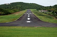
IATA: MQS – ICAO: TVSM Summary Airport type Public Owner Mustique Company Operator Mustique Company Location Mustique, Saint Vincent and the Grenadines Elevation AMSL 8 ft / 2 m Coordinates 12°53′17″N 061°10′49″W / 12.88806°N 61.18028°WCoordinates: 12°53′17″N 061°10′49″W / 12.88806°N 61.18028°W Map Location in Saint Vincent and the Grenadines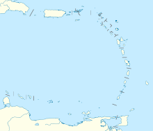
 TVSM
TVSMRunways Direction Length Surface m ft 09/27 992 3,255 Asphalt Source: DAFIF[1][2] Mustique Airport (IATA: MQS, ICAO: TVSM) is located on Mustique island in Saint Vincent and the Grenadines.
Airlines and destinations
Airlines Destinations Mustique Airways Saint Vincent SVG Air Saint Vincent References
- ^ Airport information for TVSM at World Aero Data. Data current as of October 2006.Source: DAFIF.
- ^ Airport information for TVSM at Great Circle Mapper. Source: DAFIF (effective Oct. 2006).
External links
Categories:- Airports in Saint Vincent and the Grenadines
- North American airport stubs


Wikimedia Foundation. 2010.