- Massillon Township, Cedar County, Iowa
-
Massillon Township, Cedar County — Township — 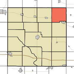
Coordinates: 41°54′05″N 090°58′01″W / 41.90139°N 90.96694°WCoordinates: 41°54′05″N 090°58′01″W / 41.90139°N 90.96694°W Country  United States
State  Iowa
IowaCounty Cedar Area – Total 35.08 sq mi (90.85 km2) – Land 35.08 sq mi (90.85 km2) – Water 0 sq mi (0 km2) Elevation[1] 778 ft (237 m) Population (2000) – Total 330 – Density 9.4/sq mi (3.6/km2) FIPS code 19-92895[2] GNIS feature ID 0468368 Massillon Township is one of seventeen townships in Cedar County, Iowa, USA. As of the 2000 census, its population was 330.
Geography
Massillon Township covers an area of 35.08 square miles (90.9 km2) and contains no incorporated settlements. According to the USGS, it contains three cemeteries: Brink, Center and Massillon. The township also contains the unincorporated settlement of Massillon, Iowa for which it is named.
References
- ^ "US Board on Geographic Names". United States Geological Survey. 2007-10-25. http://geonames.usgs.gov. Retrieved 2008-01-31.
- ^ "American FactFinder". United States Census Bureau. http://factfinder.census.gov. Retrieved 2008-01-31.
External links
Municipalities and communities of Cedar County, Iowa Cities Bennett | Clarence | Durant‡ | Lowden | Mechanicsville | Stanwood | Tipton | West Branch‡ | Wilton‡

Townships Cass | Center | Dayton | Fairfield | Farmington | Fremont | Gower | Inland | Iowa | Linn | Massillon | Pioneer | Red Oak | Rochester | Springdale | Springfield | Sugar Creek
Unincorporated
communitiesMassillon | Springdale | Sunbury
Footnotes ‡This populated place also has portions in an adjacent county or counties
Categories:- Townships in Cedar County, Iowa
- Iowa geography stubs

Wikimedia Foundation. 2010.