- Gaines Township, Kent County, Michigan
-
There is also Gaines Township, Genesee County, Michigan.
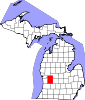
Gaines Charter Township, Michigan — Charter township — Location within the state of Michigan
 Gaines Charter Township, Michigan
Coordinates: 42°50′4″N 85°38′13″W / 42.83444°N 85.63694°WCoordinates: 42°50′4″N 85°38′13″W / 42.83444°N 85.63694°W Country United States State Michigan County Kent Area - Total 35.9 sq mi (93.1 km2) - Land 35.9 sq mi (93.0 km2) - Water 0.0 sq mi (0.1 km2) Elevation 817 ft (249 m) Population (2000) - Total 20,112 - Density 559.8/sq mi (216.1/km2) Time zone Eastern (EST) (UTC-5) - Summer (DST) EDT (UTC-4) FIPS code 26-31240[1] GNIS feature ID 1626329[2] Gaines Charter Township is a charter township of Kent County in the U.S. state of Michigan. The population was 20,112 at the 2000 census.
The township is about 13 miles south of downtown Grand Rapids. It is directly south of the city of Kentwood. The Charter Township of Caledonia and Village of Caledonia are to the east. Leighton Township in Allegan County is to the south and Byron Township to the west.
Contents
Communities
- Cutlerville is an unincorporated community and census-designated place in the northwest of the township, straddling the boundary with Byron Township.
- Corinth is an unincorporated community southwest part of the township at 42°46′58″N 85°39′49″W / 42.78278°N 85.66361°W[3] on the boundary with Byron Township. In 1866, three brothers named Cody built a steam grist mill and saw mills here and the place became known as "Cody's Mills". A village named "Corinth" was platted and recorded for Jacob and David Rosenberg by Robert S. Jackson on September 14, 1871. A post office named Cody's Mills was established in May 1867, was renamed Corinth in March 1871, and operated until December 1899.[4]
- Dutton is an unincorporated community located within the township, centered at the intersection of Dutton Ave and 68th St. It consists of two light industrial centers, planned residential areas, and a large trailer park.
Geography
According to the United States Census Bureau, the township has a total area of 36.0 square miles (93.1 km²), of which, 35.9 square miles (93.1 km²) of it is land and 0.04 square miles (0.1 km²) of it (0.06%) is water.
Demographics
As of the census[1] of 2000, there were 20,112 people, 7,501 households, and 5,318 families residing in the township. The population density was 559.8 per square mile (216.1/km²). There were 7,789 housing units at an average density of 216.8 per square mile (83.7/km²). The racial makeup of the township was 89.30% White, 5.26% African American, 0.50% Native American, 2.08% Asian, 0.02% Pacific Islander, 1.01% from other races, and 1.82% from two or more races. Hispanic or Latino of any race were 2.82% of the population.
There were 7,501 households out of which 37.1% had children under the age of 18 living with them, 57.2% were married couples living together, 10.5% had a female householder with no husband present, and 29.1% were non-families. 22.6% of all households were made up of individuals and 4.9% had someone living alone who was 65 years of age or older. The average household size was 2.64 and the average family size was 3.12.
In the township the population was spread out with 28.8% under the age of 18, 9.5% from 18 to 24, 31.7% from 25 to 44, 20.5% from 45 to 64, and 9.4% who were 65 years of age or older. The median age was 32 years. For every 100 females there were 96.5 males. For every 100 females age 18 and over, there were 94.5 males.
The median income for a household in the township was $48,482, and the median income for a family was $56,402. Males had a median income of $41,446 versus $27,333 for females. The per capita income for the township was $23,459. About 3.2% of families and 5.4% of the population were below the poverty line, including 4.6% of those under age 18 and 6.0% of those age 65 or over.
References
- ^ a b "American FactFinder". United States Census Bureau. http://factfinder.census.gov. Retrieved 2008-01-31.
- ^ U.S. Geological Survey Geographic Names Information System: Gaines Township, Kent County, Michigan
- ^ U.S. Geological Survey Geographic Names Information System: Corinth, Michigan
- ^ Romig, Walter (1986) [1973]. Michigan Place Names. Detroit, Michigan: Wayne State University Press. ISBN 0-8143-1838-X.
External links
Municipalities and communities of Kent County, Michigan County seat: Grand Rapids Cities Cedar Springs | East Grand Rapids | Grand Rapids | Grandville | Kentwood | Lowell | Rockford | Walker | Wyoming
Villages Charter
townshipsCaledonia | Cascade | Gaines | Grand Rapids | Lowell | Plainfield
General law
townshipsUnincorporated
communitiesAda | Alaska | Alto | Belmont | Byron Center | Cannonsburg | Cascade | Comstock Park | Cutlerville | Dutton | Forest Hills | Northview
Footnotes ‡This populated place also has portions in an adjacent county or counties
Categories:- Townships in Kent County, Michigan
- Charter townships in Michigan
- Grand Rapids – Wyoming metropolitan area


Wikimedia Foundation. 2010.